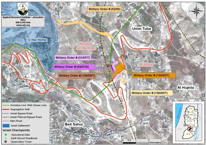
On September 1, 2007, two military orders were handed out to the Palestinian villages of Al Khas and Al Nu'man east of Beit Sahour by the Israeli army. The orders stated the confiscation of large sections of the villages' lands in order to fulfill the various Israeli purposes. The first order, which holds number, (07/31/T), stipulates the confiscation of 22 dunums of land for military purposes, mainly to expand Mazmuriya commercial terminal. The area mentioned in the order is located in parcel number 3 in the area of 'Ard Al Fasah and in parcel number 13 in Al Nu'man village. These lands were cut off from the villages by the construction of the Segregation Wall and the path adjoining it. ), stipulates the confiscation of 22 dunums of land for military purposes, mainly to expand Mazmuriya commercial terminal. The area mentioned in the order is located in parcel number 3 in the area of 'Ard Al Fasah and in parcel number 13 in Al Nu'man village. These lands were cut off from the villages by the construction of the Segregation Wall and the path adjoining it.
The second order, which holds number (07/02/S), identified that the area shaded in red as shown in the map attached to the military order, is a closed military area: no one has the right to enter or to live in this area unless they are authorized by the Israeli Army through a specially issued permit, otherwise anyone living there must leave immediately. [See map 1: Map of Military Orders]. In an analysis conducted by the Geo-Informatics department at the Applied Research Institute – Jerusalem (ARIJ), the area declared as 'closed' is estimated to be 2.7 dunums. ), identified that the area shaded in red as shown in the map attached to the military order, is a closed military area: no one has the right to enter or to live in this area unless they are authorized by the Israeli Army through a specially issued permit, otherwise anyone living there must leave immediately. . In an analysis conducted by the Geo-Informatics department at the Applied Research Institute – Jerusalem (ARIJ), the area declared as 'closed' is estimated to be 2.7 dunums.

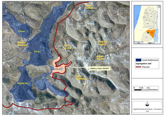
The new military orders come as an extension to a previously issued military order (155/05/T) on September 3, 2005. This order stated the confiscation of 30 dunums of land from Al Nu'man village for the purpose of constructing the Mazmuria commercial terminal. This terminal is one of the seven commercial terminals Israel announced during 2005, it would construct within the path of the Segregation Wall to control the movement of Palestinian goods between the West Bank and Israel. Table 1 shows the terminalsâ) on September 3, 2005. This order stated the confiscation of 30 dunums of land from Al Nu'man village for the purpose of constructing the Mazmuria commercial terminal. This terminal is one of the seven commercial terminals Israel announced during 2005, it would construct within the path of the Segregation Wall to control the movement of Palestinian goods between the West Bank and Israel. shows the terminalsâ�� plan set by the Israeli Army and its locations in the West Bank, along with the function and status of each.
|
Function and Status of the Terminals/ Crossing Points in the occupied West Bank Territory |
||||
|
West Bank Territory |
Name of Terminal/ Crossing Point |
Location |
Status |
Function |
|
|
Al-Jalameh |
Jenin |
Operational |
Commercial Terminal |
|
Sha'ar Ephraim |
Tulkarem |
Under Construction |
Commercial Terminal |
|
|
(Hasam Tzahub) |
Jordan Valley |
Under Construction |
Commercial Terminal |
|
|
Ramallah |
Operational |
Crossing Terminal |
||
|
Mechabim |
Ramallah |
Operational |
Crossing Point |
|
|
Betunia |
Ramallah |
Operational |
Commercial Terminal |
|
|
Center West Bank Territory |
Anata – Shu'fat (Hasidim) |
Jerusalem |
Under Construction |
Crossing Point |
|
Az-Ayyem |
Jerusalem |
Under Construction |
Crossing Point |
|
|
Jerusalem |
Under Construction |
Crossing Terminal |
||
|
South West Bank Territory |
Mazmuria |
Bethlehem |
Under Construction |
Commercial Terminal |
|
Bethlehem |
Operational |
Crossing Terminal |
||
|
Bethlehem |
Planned |
Commercial Terminal |
||
|
Bethlehem |
Under Construction |
Crossing Point |
||
|
Bethlehem |
Under Construction |
Crossing Point |
||
|
Al-Walajeh |
Bethlehem |
Planned |
Crossing Point |
|
|
Tarqumiya |
Hebron |
Operational |
Commercial Terminal |
|
|
Metar |
Hebron |
Operational |
Crossing Terminal |
|
Source: ARIJ GIS Database 2007
The Mazmuria commercial terminal: when, who and why?
The first time Israel announced about the construction of Mazmuria commercial terminal was in October 2003 when the Israeli Army handed out residents of An Nu'man community a map outlining the Israeli plans in the area. The map showed a sketch of a commercial terminal to be set in the area along with a military camp. Both, the terminal and the camp, as shown in the map, were to be constructed inside the area that will be segregated by the Wall. In addition, the map showed that the terminal would be connected with the northern and southern peripherals of the area through a Israeli bypass road that will cross through the lands of An Nu'man and Al Khas communities to connect with Bethlehem eastern part across an elevated bridge at the crossing point.
Additional Military Orders in Al Nu'man and Al Khas villages :
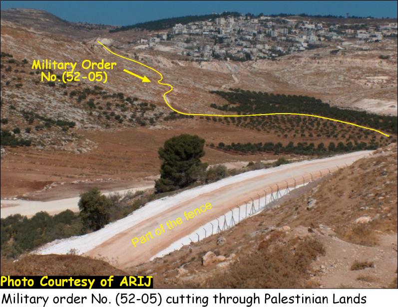
On August 17, 2005, the Israeli Army issued a military order number (52-05) to villagers of Al Nu'man to let them know that they will commence construction of a road at the north end of Al Nu'man village leading to the Har Homa (Abu Ghneim) settlement. ) to villagers of Al Nu'man to let them know that they will commence construction of a road at the north end of Al Nu'man village leading to the Har Homa (Abu Ghneim) settlement.

Later on September 3, 2005, the Israeli army issued two military orders (154-5-T and 156-5-T) regarding Al Nu'man village. The first (# 154-5-T) order was to confiscate 9 dunums of land belonging to Al Nu'man village residents to construct a road to the south of the village to connect the village's main road with the path of the Wall; while the second order (# 156-5-T), states the confiscation of 4 dunums of land to construct a road leading to the nine Palestinian houses trapped by the Wall. and ) regarding Al Nu'man village. The first (# 154-5-T) order was to confiscate 9 dunums of land belonging to Al Nu'man village residents to construct a road to the south of the village to connect the village's main road with the path of the Wall; while the second order (# ), states the confiscation of 4 dunums of land to construct a road leading to the nine Palestinian houses trapped by the Wall.
Location and Population
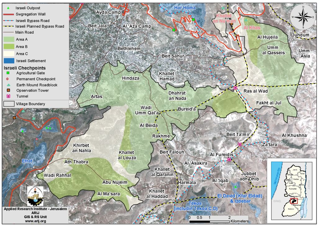
The villages of Al Khas and Al Nu'man are located at the northeastern part of the Bethlehem governorate. The two villages are considered part of the Beit Sahour village cluster along with 17 other Palestinian localities; all comprise a total area of 24,780 dunums. Combined, Al Nu'man and Al Khas have about 543 residents (PCBS- 2006) and sit on a total urban area of 55 dunums. See Map 2
Related Case Studies
-
Al-Khas and Al Nu'man villages suffocated by the Israeli colonization. October1, 2003.
-
New Military Orders in Al Khas and Al Nu'man for Constructing Mazmuriya Terminal and Two Roads. September 18, 2005.
-
The Village of Al Nu'man Turned into an Open Air Prison. June 15, 2006.
-
Four Houses Threatened with Demolition in the Village of Al Nu'man in the District of Bethlehem. June 20, 2000.
Prepared by
The Applied Research Institute – Jerusalem
ARIJ