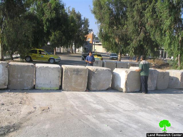
The Israeli occupation army continue to close all the agricultural roads that link the town of Deir Al Ghusun with its agricultural land, on one hand, and with the only rubbish dump site out side the town, on the other hand. The latest act of closure took place at the beginning of this month when the Israeli army bulldozers blocked with earth mounds and rocks the southern road in Bab As Sahl (plain gate) area which leads to the only rubbish dump site for the town of Deir Al Ghusun. This vicious act has caused a real problem in the town as there is no other available option for Deir Al Ghsusun municipality to get red of the rubbish, hence, leading to an accumulation of piles of rubbish in the streets of the town and spread of flies and mosquitoes, particularly, Culaneons Lrishmaniasis.


(Photo 1 & Photo 2: Deir Al Ghsusn, Tulkarme: two of the closed agricultural roads)
According to a recent report by the Palestinian ministry of health, Deir Al Ghusun has the biggest number of skin diseases in that particular area as result of the spread of Culaneons Lrishmaniasis and other flies caused by the accumulation of rubbish in the town.
On the other hand, the Bab As Sahl (plain gate) area has a main water line that provides the town with water at emergency time when other lines are cut off. The town's municipality and local people are afraid that the closure of the road will limit access to the this vital water source and/ or hinder any future repair and maintenance works in the area.
Deir Al Ghusun town
The town is located 8 km to the north of Tulkarem city in Tulkarem governorate. With its 11000 population the town is considered one of the biggest population centers in the Tulkarem district and it is part of a cluster named Ash Sha'rawiya which contains, amongst others, the following villages: Attil, Baqa ash Sharqiya, 'Alar, Saida, Qaffin and Zeita. See Map 1
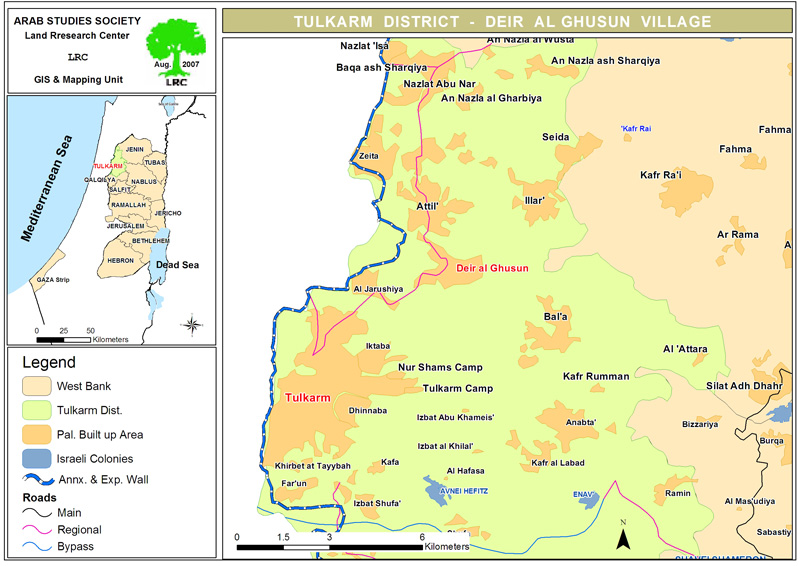
Deir Al Ghusun total land area before 1948 was 27000 dunums of which 14000 dunums ( 51% of the total ) was annexed by Israel in that year. The remaining 13000 dunums are divided as followed:
-
2868 dunums are built up zone;
-
2000 dunums are flat land cultivated with vegetable in green houses;
-
300 dunums are destroyed under the path of the Segregation Wall;
-
2400 dunums are separated behind the Wall;
-
5432 dunums are cultivated with olive and almond trees.
Deir Al Ghusun is a linking point between Tulakrem and Jenin, Tulkarem and Nablus and Tulkarem with its northern villages and towns. Amongst the people of the town there are about 900 individuals who are refugees. More than 60% of the population are dependent on agriculture as main income after loosing their jobs in Israel. According to the World Food Program there are at least 400 persons from the town who are totally dependent on international aid for livelihood and another 150 families are dependent on UNRWA.
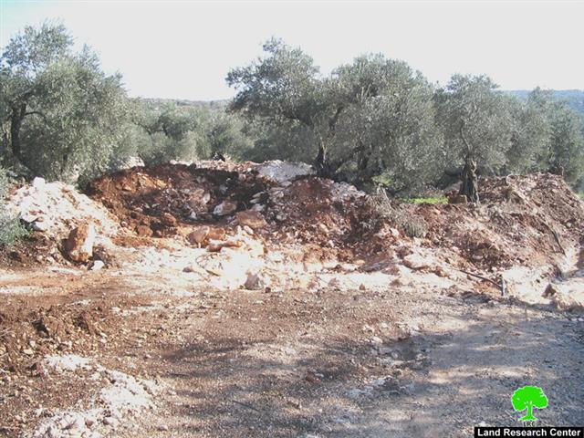
Dear Al Ghsusn and the Wall
As mentioned before, the Wall has destroyed or separated behind the total of 2700 dunums ( about 20% of the current remaining area). Three agricultural gates – Al Karak, Wadi ash Shami and Abthan- were established on the Wall for the use of Palestinian farmers and land owners, however, each gate is opened three times a day, one hour per time. To further complicate matters, the Israeli occupation authorities have been asking farmers and land owners to bring land ownership documents, such as taboos, land registration certificates and survey maps, not to mention the security clearances, as prerequisites for having the security passing permission renewed Because of this, only 150 permissions out of thousands of applications were given to farmers during the last olive harvesting season. Sometimes, soldiers manning the Wall gates confiscate or tear the passing permissions under the pretext that holders use them to go to Israel for work.
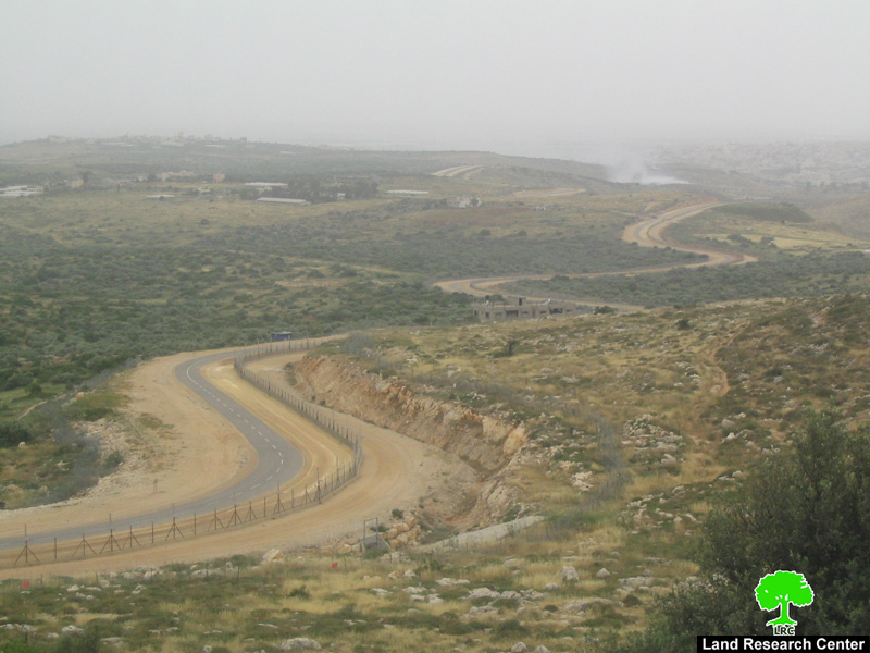
(Photo 3: Wall path to the west of Deir Al Ghusun town, Tulkarem)
The agricultural land surrounds the town from all sides, therefore, the municipality had opened more than 15 agricultural roads to facilitate access to these lands and to make linkages with other neighboring villages and towns. But, ever since the beginning of the current uprising in the year 2000, the Israeli occupation army has maintained the closure of these roads in the face of Palestinians under ' security' allegations.
More land grabbing
Last April, the Israeli occupation army circulated a new military decree as an amendment to a previous one carrying the number of T/21/02 ( issued in the year 2002) . The latest Wall amendment decree states the confiscation of an additional 158 dunums and 900 square meters ( about 1.2% of the current remaining land area) from the lands of Deir Al Ghusun located in basins 8664, 8668,8662 and 8663.
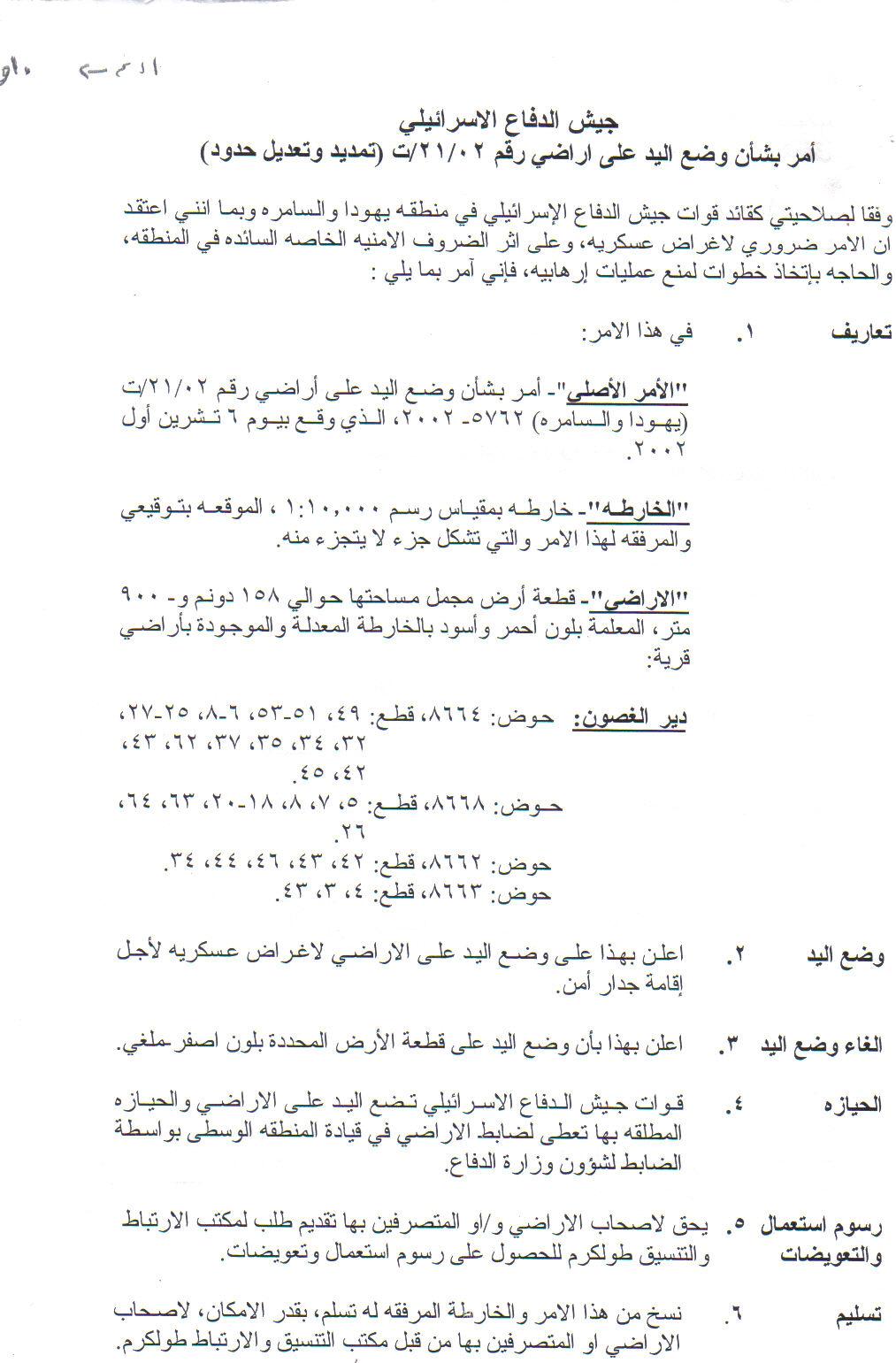

(Photo 4 & Photo 5 : A copy of military order number T/21/02 and attached map)
Related case studies:
1. Wall amendments: more land grabbing, Tulkarem governorate, May, 2007.
Prepared by
The Land Research Center
LRC