The policy of house demolition in the West Bank
House demolition is a systematic policy of the Israeli occupation that started early with the Israeli Army occupying the West bank and Gaza back in 1967. The demolishing campaigns started to take turn for the worse in 2002 when Israel started constructing the Segregation Wall. Thousands of Palestinian houses have been demolished by the Israeli Army either for being unlicensed, or due to their location close to the Segregation Wall path.
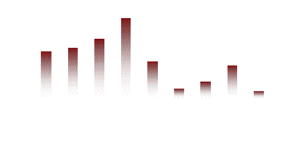
Since the eruption of the second Intifada, the Israeli forces demolished 2027 Palestinian houses throughout the Palestinian Territory and thousands of Palestinian families became homeless with no shelters. Chart one below shows number of houses demolished in the Occupied Palestinian Territory during the period of September 2000 and April 2007.

Chart 1: Number of houses demolished throughout the Palestinian Territory
New demolitions Warnings in Kafr Ad Dik Village
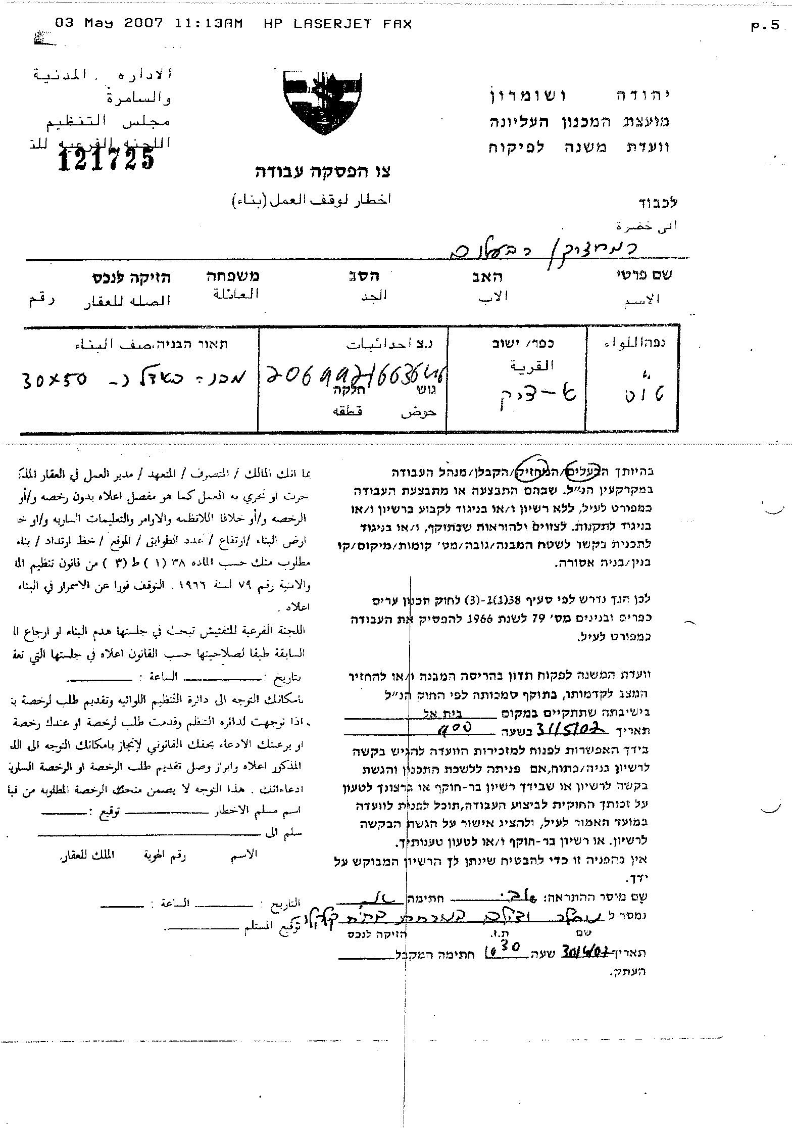
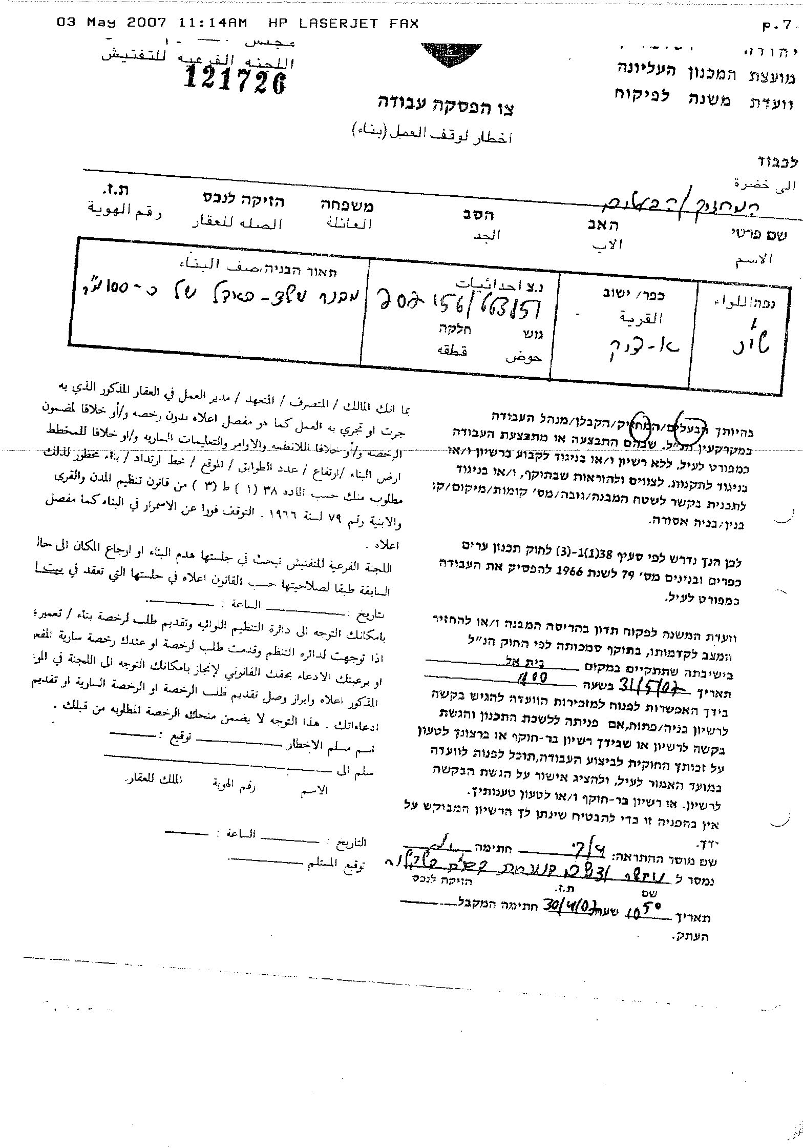
On April 15, 2007, the Israeli Occupation Army handed out military notices to several residents from Kfar Ad Dik: Siham Odeh Hasan Saleh, 'Abed El Hamid 'Ali Muhammad 'Ali Ahmad and Fatima Hussny Mustafa 'Ali Ahmad; informing them of the Army’s decision to demolish their two story houses under the pretext of being built without licenses.
Later on May 1, 2007, the Israeli Army issued an additional nine military notices to demolish more houses in the village under the same pretext. Among owners known were Firas Ibrahim Muhammad Habub, Muhammad Ibrahim Muhammad Habub and Mahmud 'Abed Al 'Atiq. See copy of house demolition warnings
The policy of demolition of civilian houses is an act of collective punishment, that breaches UN laws and Geneva conventions specifically article 53 of 1949 to which Israel is a High Contracting Party states: 'Any destruction by the occupying power of real or personal property belonging individually or collectively to private person, or to the State, or to other public authorities, or to social or co-operative organizations, is prohibited, except where such destruction is rendered absolutely necessary by military operations.'
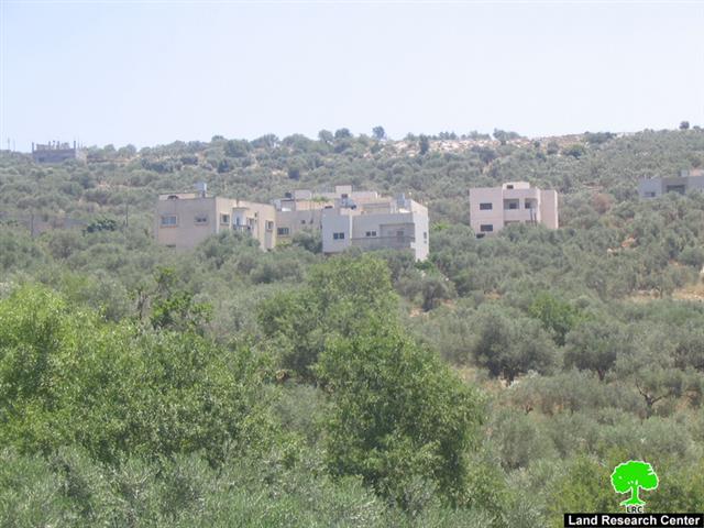
Kafr ad Dik village
Kafr ad Dik village lies 9.50 kilometers to the southwest of Salfit city and 8.08 kilometers away from the 1949 Armistice line (Green line). The village is the home of 5147 inhabitants (PCBS 2006) and has a total area of 15228 dunums; the built-up area comprises 578 dunums (of which 119 dunums lies outside Kafr ad Dik village boundary). The Israeli government has constructed 5 illegal Israeli settlements on an area of 1448 dunums of lands confiscated from the village's land with a total settlers’ population of 2062 Israeli settlers.
According to the Oslo II Interim Agreement signed in September 1995 between the Palestinian Liberation Organization (PLO) and Israel, 1953 dunums of the village area were classified as Area B (Areas under Palestinian civil administration but Israel continued to have an overriding control on security), while 13275 dunums were classified as Area C (Areas under full Israeli Control).
Kafr ad Dik village and the threats of the Segregation Wall
On November 20, 2006, the Israeli Army handed out the residents of Kfar ad Dik and Deir Ballut villages, military order # (82/06/T) to confiscate 538.7 dunums lands for the Segregation Wall, but the analysis done by the Geographical Information System (GIS) at ARIJ on the Israeli military order showed that the order will confiscate 578 dunums and will isolate 395 dunums of lands of Kafr ad Dik village.
Moreover, on February 7, 2007, the Israeli Army issued another military order holding # (07/01/T) to seize 404.6 dunums to construct additional sections of the Segregation Wall from the villages of Bruqin and Kfar ad Dik. See map of the Wall

Nearly 57.4% of Kfar Ad Dik lands will be isolated behind the Segregation Wall
According to the Segregation Wall route, 57.4% (8747 dunums) of Kfar Ad Dik's lands will be isolated, of which 21.4% of the Arable land that lies on the lands of Kfar Ad Dik will be entirely isolated behind the Wall and the local villagers will no longer be able to access it. Moreover, 49.7% of the open space and 66% of the shrub or herbaceous vegetation associations in the village will be isolated. Table one below shows the land classification inside the village boundary and the land that will be isolated behind the Wall.
Table 1: Land Use Land Cover of Kfar Ad Dik Village
|
Land Use Land Cover Classification |
LULC inside Kfar Ad Dik Village Boundary |
LULC of the area isolated by the Israeli Segregation Wall |
Percentage of Isolated lands from Total village area |
|
|
|||
|
|
|
||
| Agricultural Lands | 6844 | 3733 | 24.51% |
| Forests and Open Spaces | 6477 | 3563 | 23.40% |
|
Palestinian Built-up area |
459 |
3 |
0.02% |
|
Israeli settlement |
1448 |
1448 |
10% |
|
Total |
15228 |
8747 |
57.44% |
Source: ARIJ database- GIS, 2007
Prepared by
The Applied Research Institute – Jerusalem
ARIJ