The Israeli occupation authorities set up a permanent checkpoint at the main road linking between Nablus and Jenin at the distance of 250 meters from the evacuated colony of Sanur. The target land which is owned by Mrs. Nadiya Lutfi Abdul Karim Sulieman is located in basin 15, parcel 140 of 'Ajja village land. The owner who obtains all the necessary ownership and land registration documents, including the Turkish taboo received no documentation whatsoever from the Israeli side. Never the less, she presented an immediate objection through the Jenin municipality against the Israeli aggression on her land.
In her objection she mentioned the following: 'The target land is a private farm. 90% of it is cultivated land and the remaining 10% is an empty area located on the main road and serves as the main entrance to the farm. If this 10% is confiscated for the purpose of establishing a checkpoint there will be no access to the rest of the land. In addition, I have received no military order from the Israeli army stating the confiscation of my land which contradicts all the standing norms and regulations'.
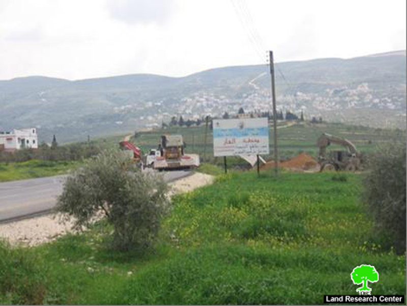
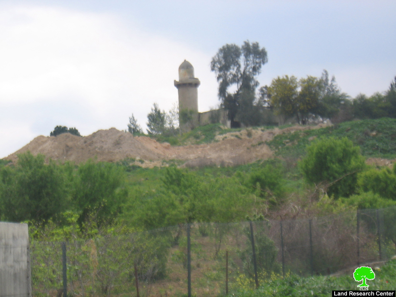
(Photo 1: Israeli army bulldozers preparing the land for the establishment of the
military checkpoint on the main Nablus- Jenin road
The colony of Sanur
It was established in 1982 over a Tel near the main Jenin – Nablus road number 60 over 50 dunums of land taken from Al Fandaqumiya Village.
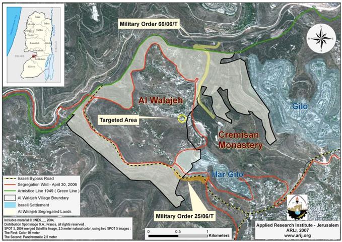
The site of Sanur was a British military garrison in 1936 which became a Jordanian police station in 1948 and an Israeli military base in 1967. It is located in basin number 1, parcel 59 of Al Fandaqumiya Village land adjacent to 'Ajja village land. At the beginning of the eighties of the last century the site came under expansion from south, west and east surrounded with a ring road at the expense of adjacent Palestinian land. Ten Israeli settler families were moved in at the beginning. The latest census showed that 112 settlers were living in it before the evacuation of August, 2005 ( Source- Foundation for Middle East Peace- Washington DC). See Map 1
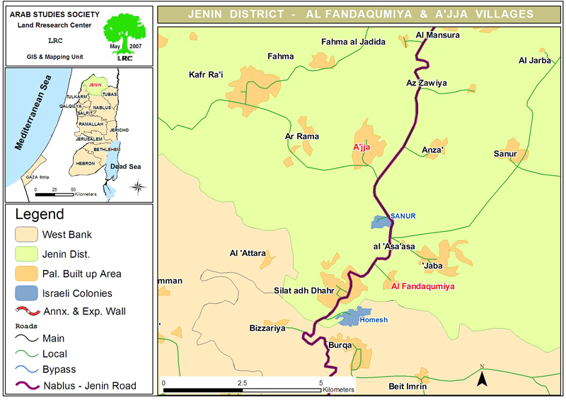
Al Fandaqumiya Village
Located on the main road between Jenin and Nablus. It has the population of 3500, while its total land area is estimated to be only 4500 dunums which is considered poor in land in compare to other villages in the area. The village is formed of the families of Azzam, Jarrar, Abbas, Dahon, Raba', Zu'bi and Hawarah. As main income the village depends on the local labor market and public services.
Continuous attacks and harassments
-
Through out the current Al- Aqsa uprising the Sanur settlers along with the Israeli army had terrorized the villagers and keep them off their lands and fields, specially during the olive harvest seasons.
-
A gas station belonging to Jarrar family from Jenin was completely destroyed and closed by the Sanur settlers at the beginning of the Intifada in the year 2000. The gas station is located near the evacuated colony.
-
Seven dunums of olive trees owned by Mr. Hasan Mohammed Azzam were, also, set to fire by the Israeli settlers.
-
During the unilateral withdrawal and evacuation of the colony, the main Jenin � Nablus road was closed for Palestinian traffic for the period of 40 days. After the evacuation Palestinian farmers and land owners began to rehabilitate and re-cultivate their land located in the vicinity of the colony.
-
In April, 2006, the Israeli settlers returned with the army and set up Jewish festivities at the Sanur site closing the main Jenin- Nablus road in the face 9of Palestinian traffic
-
On 19.3.2007, the army prepared the land inside the site for camping purposes during the Jewish holidays.
(Photos 2,3 & 4: land being prepared for camping purposes inside the evacuated colony.
Prepared by
The Land Research Center
LRC