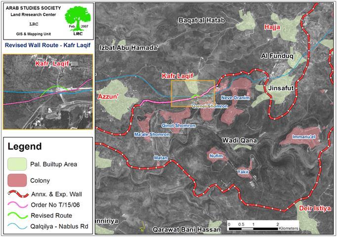
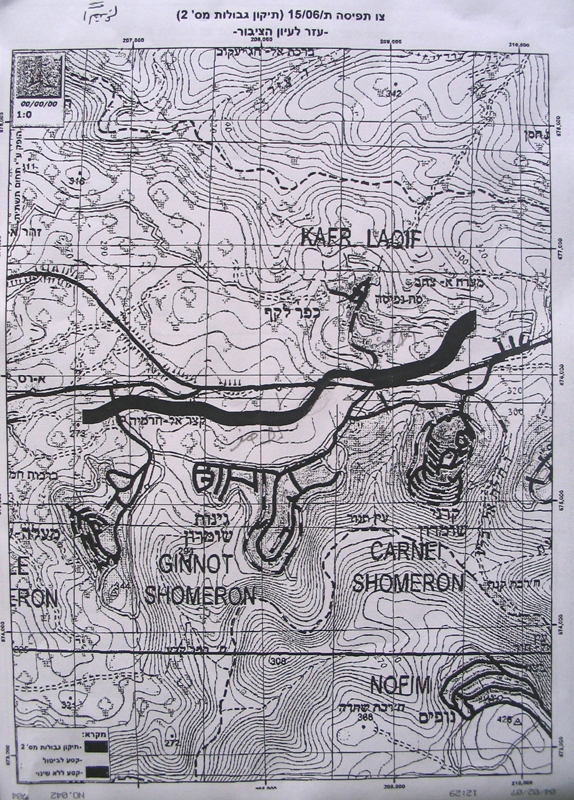
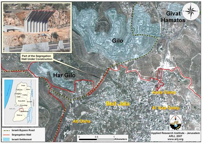
The Israeli occupation army issued an a amendment for the military order number T/15/06 stating the confiscation of an additional 24 dunums and 400 M2 for the purpose of revising the path of the Segregation Wall in the lands of Azzun Ashamaliay and Kafr Laqif, Qalqiliya governorate. The new amendment which was issued at the beginning of last January aims at cutting off the roads that link between Kafr Laqif and Azzun Ashamaliay villages and the main Qalqiliya – Nablus road (road No. 55) which will be annexed to Ma'ale Shomron colonial block and will be exclusively used by Israeli settlers living in this area. The Ma'ale Shomron block is, also, part of the biggest finger â��like corridor in the West Bank â�� Ariel corridor. See Map
Map prepared by LRC
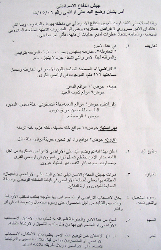
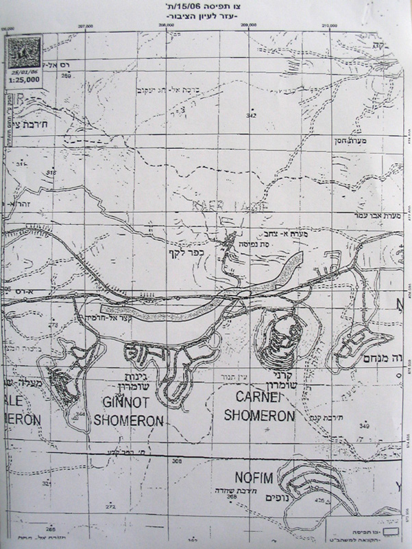
The initial plan Wall plan in this section was announced in February, 2006 stating the confiscation of 279 dunums from the lands of Hajja, Kafr Laqif, and Azzun Ashamaliay, Qalqiliay governorate and Deir Istiya village in Salfit governorate.
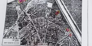
(Military photos No. 2 & 3: Copies of original military order No. T/15/06 and the attached map )
The planned route in this section is about 3000 meters long and between 80 to 100 meters wide. The above number doesn�t include the land that will be separated behind the Wall which is estimated at thousands of dunums.
The Wall route is planned to pass through the lands of these four Palestinian villages so as to complete the bordering of the biggest finger-like corridor in the West Bank which aims at ensuring the annexation into Israel of all Israeli colonies in the area. This finger- like corridor of Ariel settlement block includes15 colonies: Ariel, Yakir, Revava, Qiriyat Netafim, Neve Oranim, Carnei Shomron, Ginnot Shomron, Ma'ale Shomron, Immanuel, Nufim, Barqan, Alei Zahav ( Yo'ezer), Pedu'el, Beit Arie and Ofarim.
Since the commencement of the Wall works in this section last year, more than 2000 fruitful olive trees have been destroyed or uprooted as well as destroying 20 dunums of land used for seasonal ground crops. About 70 Palestinian family from the four above mentioned villages own the land that has been destroyed under or separated behind the Wall path.
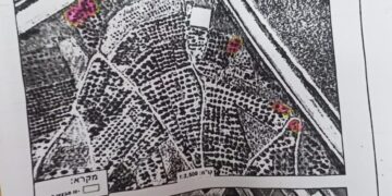
(Photos 4 & 5 : copies of the revised military order No. T/15/06 and the attached map)
Location, population and area
The following table provides information on the four Palestinian villages by Location, population and area:
|
No |
Village name |
Location |
Population |
Area in dunum |
|
|
|
|
|
|
Total |
Built up |
|
1 |
Hajja |
Qalqiliya |
2000 |
11717 |
932 |
|
2 |
Kafr Laqif |
Qalqiliya |
750 |
2579 |
298 |
|
3 |
Azzun |
Qalqiliya |
6500 |
9140 |
1525 |
|
4 |
Deir Istia |
Salfit |
3500 |
34000 |
900 |
|
Total |
12750 |
57436 |
3655 |
||
The Ariel finger like corridor will result in the annexation of thousands of dunums of Palestinian lands and dozens of underground water wells which, in effect, will cause disastrous impact on the very existence and welfare of Palestinian people in the area. From Azzun Ashamaliay alone, more than 1600 dunum of agricultural lands has been separated behind the Wall and are feared to be used for future colonial expansion of Ariel corridor.
Work in this biggest finger-like corridor in the West Bank started at the beginning of the year 2003 under a call by the former Israeli premier Ariel Sharon.
Impacts on Palestinians
1. Bulldozing thousands of dunums of olive orchards considered to be the only source of living for Palestinian families, particularly, after loosing jobs inside Israel;
2. The difficulty of accessing into agricultural lands which have been already separated behind the Wall;
3. Giving Israeli settlers in the area a wide scale space of land for expansion and development at the expense of Palestinian land and future development.
4. The above mentioned amendment will cut the main Qalqiliay-Nablus road forcing the citizens of Kafr Laqif, for instance, to travel 46 km instead of the ordinary 20 km long route to reach the city of Nablus.
5. The heirs of Late Mr. Rushdi Othman Shubaita, from Azzun, are mostly affected by the construction of the Wall in the eastern side of the village as they had lost about 44 dunums under its path, in addition to the destruction of at least 380 olive trees. Similarly, the heirs of Late Mr. Rashid Abdul Jawwad had lost about 21 dunums and more than 210 olive trees in the same location.
Legal action
Last march, the municipalities of Azzun and Kafr Laqif, along with the affected farmers and land owners had presented an objection to the Israeli legal advisor at Beit Eil ' civil Administration' against the aforementioned military order and its planned route. No response has been received yet.
Prepared by
The Land Research Center
LRC


