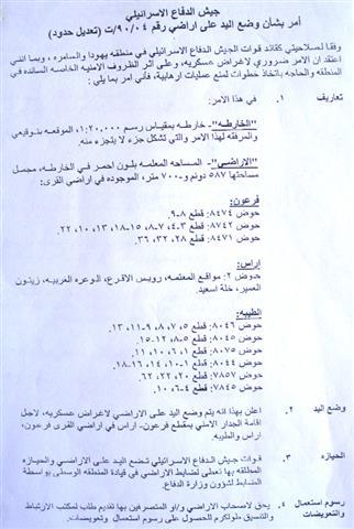
Finally, the Israeli occupation authorities decided to take Khirbet Jubara out of the Annexation and Expansion Wall, but only after destroying an additional 587.700 dunums of land belonging to the villages of Faro'un, Ar Ras and Atyybah in Tulkarem governorate. The Israeli occupation Forces (IOF) issued the modification for the military order number T/90/04 at the beginning of June, 2006, after a long and costly legal process that started in the year 2002.
(Photo 1: A copy of the military order)
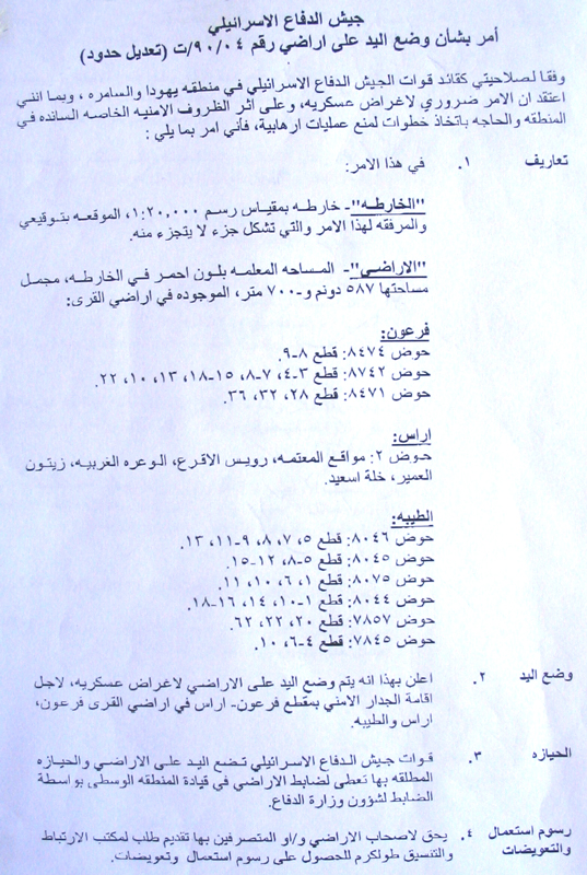
Location, population and area
Khirbet Jubara is located 5 km to the south west of Tulkarem city not far from the green line. It's population mounts to 350, 90 % of them belong to the nearby Ar Ras village and the remaining 10 % to Attayybah town inside the green line. Jubara'a total surface land is 3253 dunums of which 171 are built up area. 80 % of this area is registered in the name of Ar Ras village, 18% in the name of Faro'un village and 2% in the name of Attayybah town inside the green line. Out of the total, the following land areas are used as follows:
-
30 dunums plastic houses
-
200 dunums cultivated with citrus trees
-
100 dunums range land.
Map 1: Jubara Village – Tulkarem
Khirbet Jubara �¢?? along struggle against the Wall
The Wall tragedy in Khirbet Jubara started in April, 2002 when the IOF issued the first version of the military order number T/90/04 and started to bulldoze 500 dunums of land to set up the Wall around the Khirbet without including it inside the Wall. After destroying the 500 dunums mentioned above, the IOF changed their mind and decided to get the whole Khirbet inside the Wall. To do so, another 300 dunums were bulldozed and the older path dismantled inflicting heavy losses in lands and property which transformed the Khirbet into a disastrous one.
At the end of 2002, the Khirbet's local council levied a case to the Israeli high court demanding a removal of the Wall or a retreat to 1967 borders. Only in 2004 a response came from the Israeli side according to which a new Wall path was marked near the homes of the Khirbet separating behind almost all the lands of the Khirbet. This modification was objected again by the local council in front of the Israeli high court which decided to withdraw the Wall path towards the green line, but still, 70% of the Khirbet's land targeted for separation behind the Wall.
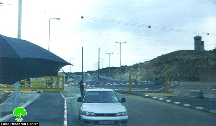
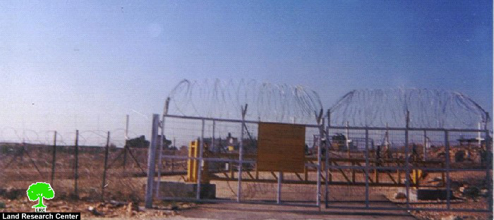
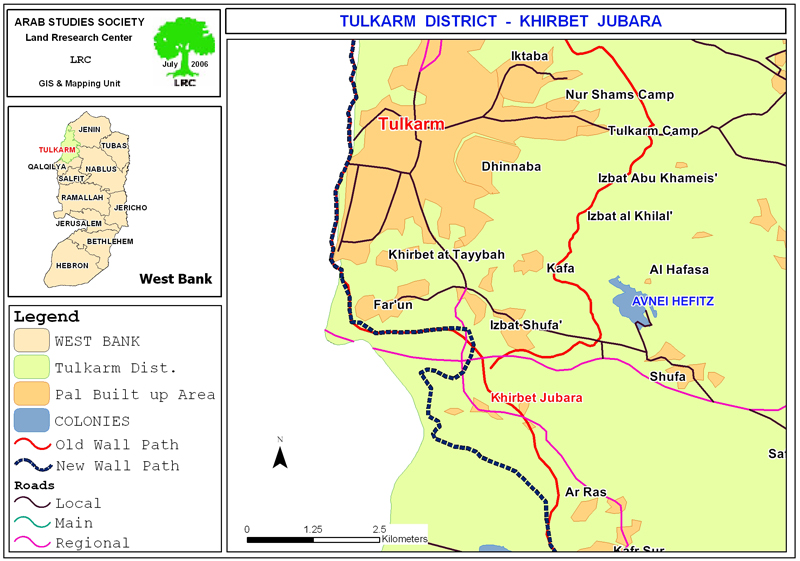
Photo 2 & Photo 3: the current entrances to Khirbet Jubara are only through the
Wall gates as the village is still inside the Wall)
A latest appeal was presented to the high court at the beginning of 2006 the result of which came in June, 2006, when the court decided to draw back the Wall path near the green line and to put back most of the Khirbet's land. However, the most recent Israeli high court's decision stated that the old road passing through the Khirbet's land towards the city of Tulkarem should remain under the control of the IOF.
To implement this decision, an extra 587.700 dunums of land are targeted for destruction under the path of the Wall, according to the attached military decree. This brings the number of dunums destroyed ever since the beginning of the Wall episode in Khirbet Jubara and the three other aforementioned villages to 1387 dunums, which is equal to 42.6 % of Khirbet Jubara'a total surface area.
Prepared by
The Land Research Center
LRC


