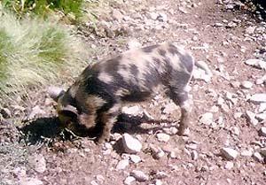
Israeli occupation authorities have released a large number of wild pigs in Deir Ballut which led to the spoilage of agricultural crops especially the newly-planted. This fact has caused a big problem for the residents of Deir Ballut; in addition to the ruining of the crops (which constituted the destruction of the main income sources for a large number of Palestinians), these wild pigs have caused panic and fear among the residents (especially children) as these pigs attack people ferociously.
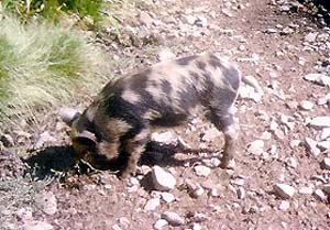
Photo 1: A wild pig grazing in Deir Ballut's land)
Photo courtesy of LRC
This Israeli action comes as a step in a campaign to fight the Palestinians in their livelihoods especially after they have lost their work inside the Israeli proper after the establishment of the Israeli Annexation and Expansion Wall on the lands of the village and other villages located on the proximity of the Green Line. This step is significantly damaging given the fact that the residents of the village depend largely on the valley associated with the village to secure the food supply and needs.
The Village Council has been continuously updating the International Committee for the Red Cross (ICRC) about the Israeli actions and violations in the valley. A study by both entities has been prepared about the feasibility of placing a fence around the plain to prevent the wild pigs from entering it. Yet, the problem still remains that Israeli authorities would not allow any Palestinian step in the area because it is classified as Area C according to Oslo agreements. These authorities would not create such a fence on its own while preventing the Palestinians from doing it themselves.
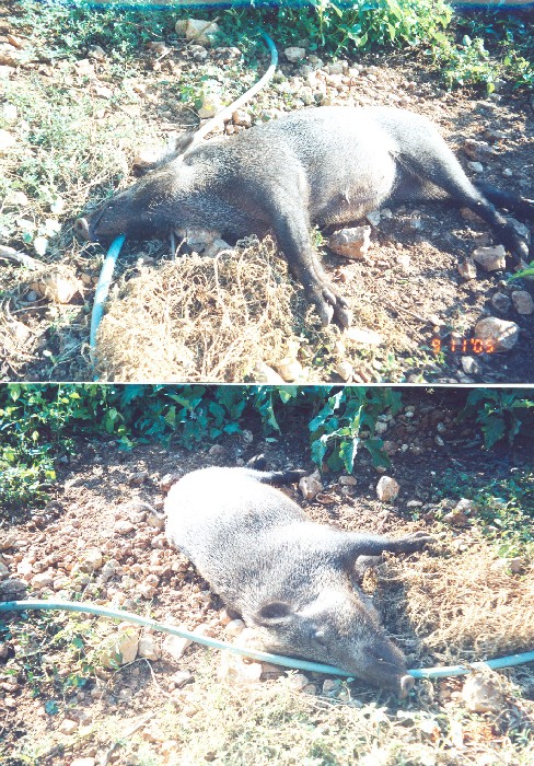
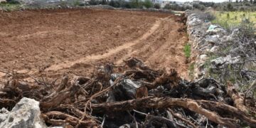
(Photo 2: two bodies of ferocious wild pigs in Deir Ballut plain)
The Village of Deir Ballut:
The village is located 20 kilometers to the west of the city of Salfit which makes it one of the frontline villages in the governorate as it is situated on the Green Line. The population of the villages is about 3,500 according to 2005 estimates. There are a number of clans in the village including the clans of AbduIlah, Odeh, Musa, Qasem, Mustafa and Sabra, in addition to a number of smaller refugee clans (constituting about 12% of the village’s population.)

The total area of the village is about 13.941 dunums, 10.000 dunums of which are located in the plains and is used to grow winter and summer crops. The built up area of the village is about 809 dumus and the remaining lands are used as range land and are located in the west of the village close to the Green Line, while the remaining area is planted with olive orchards mostly separated behind the Wall. The available data indicates that the village has lost more than 17,000 dunums of its fertile agricultural lands during the 1948 war.
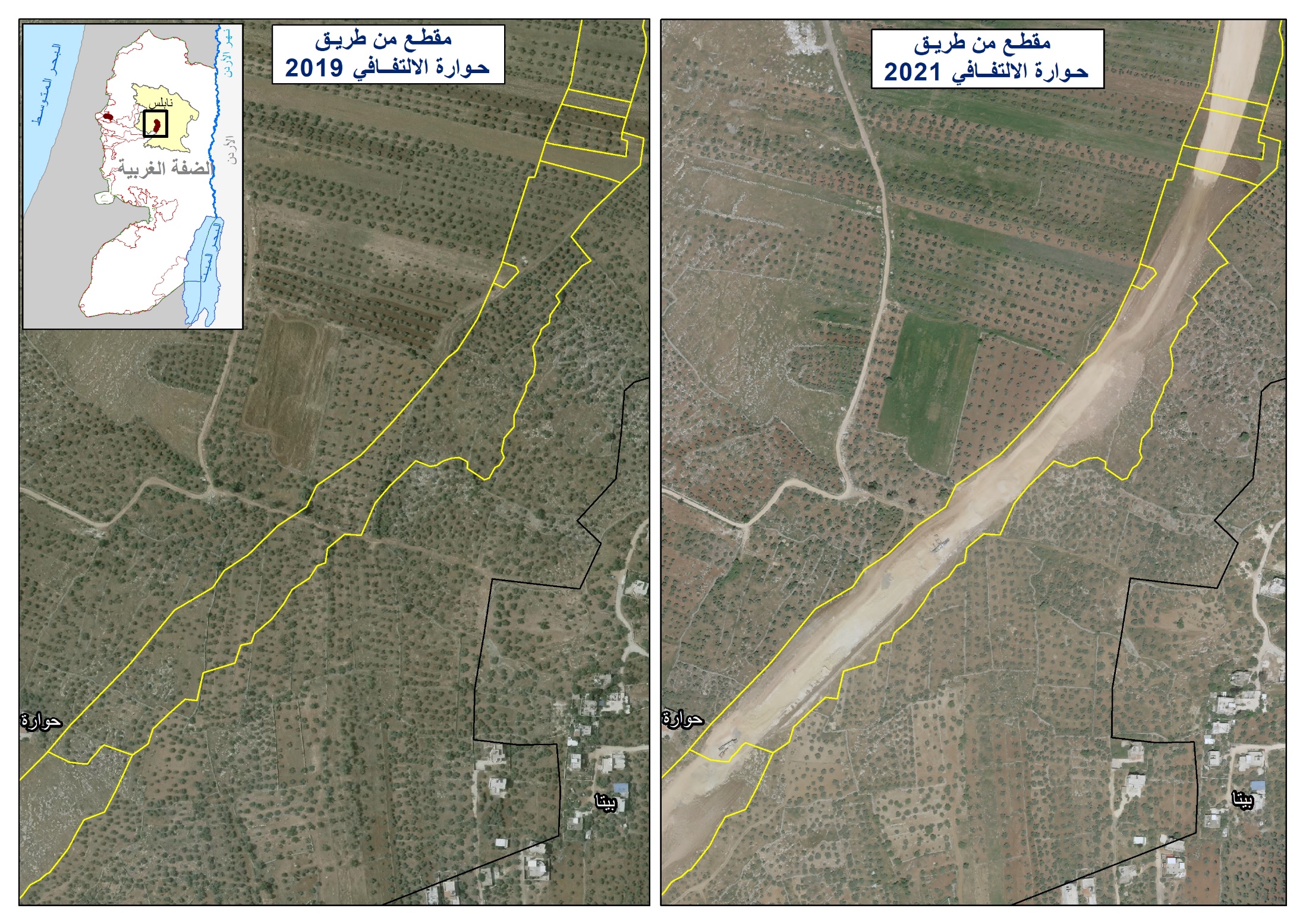
Deir Ballut’s Plain:
The plain is located in the east and northeastern direction of the village and it is considered to be the main source of income for more than 90% of the village residents. Its area is about 10,000 dunums and is usually used for agriculture year round due to its high fertility and the water availability. The plain was – and still is- a target for Israeli occupation authorities due to its strategic location as the village is situated on the Green Line and Tel Aviv is not far away from it. In addition, the village of Deir Ballut is considered to be the connection ring between the governorates of Salfit and Ramallah. All these factors made the village a target for Israeli expansion policies and steps have been taken to realize these policies including the attempt that was carried out in 1999 to move the Israeli military camp in Hawara, south of Nablus, to the plain of Deir Ballut. Yet, the circumstances created in the aftermath of the second Intifada of 2000 delayed the execution of this step. Such a delay does not mean that the danger has vanished because the plain is still under the threat of being confiscated at any given point under the pretext that it is classified as Area C according to the Oslo Accords.
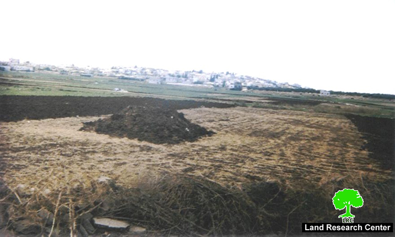
Photo 3:in the background is Deir Ballut village, in the foreground is Deir Ballut's plain)
Photo courtesy of LRC
Prepared by
The Land Research Center
LRC