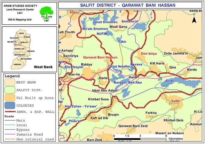
In 1986, the Israeli occupation authorities confiscated more than 54 dunums of olive orchard land from the villages of Qarawat Bani Hassan and Deir Istiya, Salfit district, for the purpose of opening a road that links between the settlements of Yakir and Revava to the north and east of Qarawat Bani Hassan. The Qiriat Netafim settlement to the east of Qarawat Bani Hassan was, also, connected to this road whose total length is 7 km and maximum width is 7 meters. The road which was only provided with base course has been used as a passage way for Israeli army's patrols and settlements' guard units. See Map 1 & Photo 1
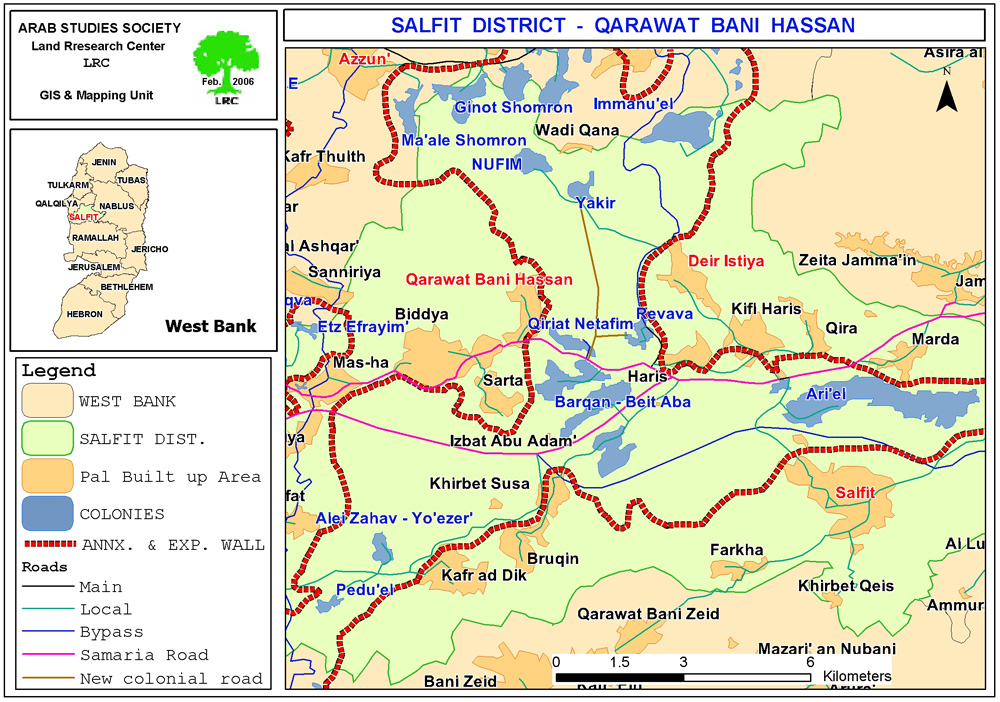

Photo courtesy of LRC
Since the beginning of 2004, the Israeli authorities started to provide the road with infrastructure such as water and electricity lines as well as asphalt. This has been viewed by Palestinians as part of the Israeli plans for further colonial expansion in the area at the expense of Palestinian land. See Photo 2
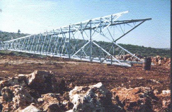
Photo 2: A high pressure electricity pole brought into the area
Photo courtesy of LRC
Introduction to the Israeli settlements in the area:
The following is information about the three aforementioned settlements:
1. Yakir: established in 1981 and had the population of 960 in the year 2004
2. Revava: established in 1991 and had the population 738 in the 2004
3. Qiriat Netafim: established in 1982 and had the population of 419 in the 2004 was.
The three settlements are located within a cluster of Israeli settlements forming the biggest finger-like corridor in the West Bank which is being surrounded with the Annexation and Expansion Wall prior to eventual annexation to Israel. This finger- like corridor of Ariel settlement block includes another 12 settlements: Ariel, Neve Oranim, Carnei Shomron, Ginnot Shomron, Ma'ale Shomron, Immanuel, Nufim, Barqan, Alei Zahav (Yo'ezer), Pedu'el, Beit Arie and Ofarim. See Photo 3
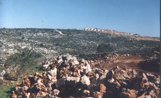
Photo 3: In the background is the settlement of Revava,
in the foreground is road work, Photo courtesy of LRC
New colonial post
Revava settlers recently occupied a hill top situated to the west of the settlement and setup 4 caravans (mobile homes) on top of it. Land owners were prevented from approaching the site and tending their fields planted with olive trees. This has been seen as another act of usurpation of Palestinian land with the aim of enlarging the Revava settlement and bringing more settlers into the area.
Qarawat Bani Hassan and the Israeli occupation
During the Palestinian exodus of 1948, a number of Palestinian citizens from the village of Kafr Bara (currently inside Israel) fled to their extended land to the east of the truce line (armistice line) and began to form a new community under the name of Qarawat Bani Hassan.
The post 1948 village is located 7 km to west of Salfit city and 6 km from the green line. Now, it has a total population of 3500, and a total surface area of 9387 dunums of which 875 dunums are built up area.
Ever since the military occupation of the West Bank in 1967, the land and people of Qarawat Bani Hassan has been under constant Israeli pressure affecting their social, economic and political life. In 1982, for example, more than 55 dunums of the village land were expropriated for the establishment of Qiriat Netafim settlement.
In addition, hundreds of dunums were also taken for the construction of the Trans Samaria highway over its southern land parts.
The humanitarian situation sharply deteriorated after the outbreak of the second uprising in the year 2000 where 60 % of population became jobless. At least 50 families are totally dependent on external support.
In an interview with LRC field worker, Mr. Subhi As'ad, farmer from the village, said that on January 25, 2006, he was surprised to see Israeli bulldozers devastating his olive groves located on the edge of the colonial road. He added that he spent about 30 years taking care of his trees before they were wiped out at a glance. See Photo 4
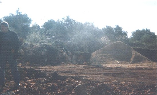
(Insert photo 4: Land devastation and tree uprooting as part of road works)
Photo courtesy of LRC
Prepared by
The Land Research Center
LRC


