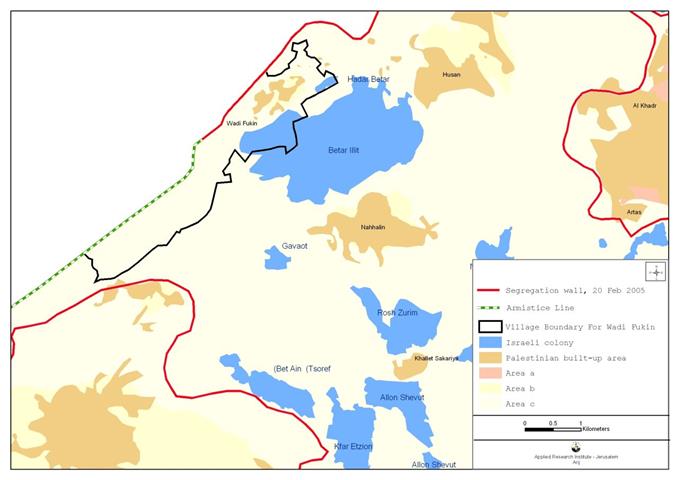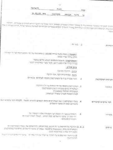
On April 6, 2005, the Israeli Occupation Forces handed out the village of Beit Surik new military order, numbered (05/81/T Judea & Samaria 2005), stating the confiscation of an additional 118 dunums of the agricultural lands for the construction of the Israeli Segregation Wall. The military order came after the Israeli Government's announcement of an updated plan of the Segregation Wall route on February 20, 2005. See copy of the military order and its translation.

|
Israel Defense Forces Order to Seize lands n0 05/81/T According to my authorities as a Military Chief Commander in the Region of Judea and Samaria, and as I believe that it is imperative for military reasons, and the special security situation in the region, I order the following:
1. The 'Map' signed in scale 1: 10,000 and attached to the order is an essential part of this order. The 'Lands': An area of land which is 118 dunums, and 400 meters, marked in red on the map: Beit Surik:
2. I announce that the above indicated lands are seized for military reasons 3. The IDF have absolute control over the indicated seized lands which is a responsibility given to the officer of the central command officer of lands who is part of the Ministry of Defense. 4. These copies are to be given by the District Co-ordination Office of Jerusalem 'The DCO' to the owners of lands. 5. Copies are found attached with maps for those who are concerned in locating the following places:
6. The owners of land have the right to get more information about their right of land use expenses and compensation from the DCO of Jerusalem. 7. The Validity of this order starts at the date signed till 31/12/2007. 8. The name of this order is: �¢??Order to seize lands n0 05/81/T (Judea & Samaria) 2005.
Yayer Neveah |
Military Order Analysis:-
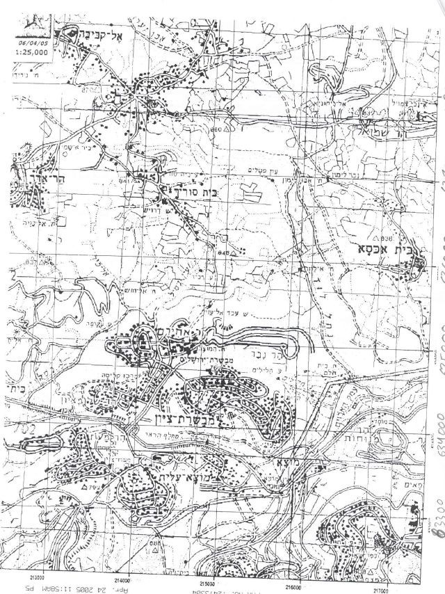
According to the military order handed out to residents of Beit Surik village, the section of the wall expected to be constructed on Beit Surik village lands will stretch a length of 1.45 km (from southeast to southwest) out of the wall's total length in the village (3.88 kilometers) as indicated in Israel's updated wall plan. See Map of military order..

The total Segregation Wall path will effectively isolate an area of 1.32 km2 out of Beit Surik's Village boundary (4.244 km2), 31% of the village's total land. This area is apart from the previously confiscated lands for building the settlements of Mevaseret Tsiyon, located to the southeast of the village and built over an area of 0.013 km2 (129.77 Dunums, confiscated during the 1948 War) and the settlement of Giv'at Har-Adar located to the northwest of the village, and built over an area of 0.23 km2 (230.78 dunums) of Beit Surik village's lands .
Concluding Remarks:res and curfews that are already restricting the movement of Palestinians throughout the West Bank Areas, the Segregation Wall has increased the pressure on the Palestinians as it fragmented their lands and put them in tiny Ghettos and cantons, and deprived them life resources; It is not a security tool as Israel claims, but rather to serve its land grab policy!!!
In addition to checkpoints, closu
Israel as an occupying power, must take into consideration the rights and obligations put on it by the international humanitarian law,(Under the title of ''Hostilities'' Article 23 (g) of the Hague Regulations 1907, which states that the destruction or seizure of property is ''especially forbidden'', unless imperatively demanded by the necessities of war. In the section addressing military occupation, Article 52 of the Hague Regulations allows for the requisitioning of property in occupied territories if it is for the needs of the occupying army. The requisitioning orders pertaining to land upon which the Security Wall is being built, fail to justify this need, which proves that the Israeli Segregation Wall is not built for the needs of the occupying army but rather to serve the broader 'Security' policy of the state of Israel.
Related Links:-
-
Israeli Occupying Forces flout High Court Ruling – March 9, 2005.
-
Israel to challenge High Court decision … !!! December 1, 2004.
References:-
-
ARIJ Geographical Information Systems (GIS) Database, 2005.
-
Palestinian Center Bureau of Statistics (PCBS 2005).
-
The International Humanitarian Law. Under the title of ''Hostilities''. Article 23 (g) of the Hague Regulations 1907.
Prepared by:
The Applied Research Institute – Jerusalem