Location and Population:-
The village of Sarta is located about 10 kilometers south of the city of Salfeet and 4 kilometers to the east of the Green Line. Its pre-1967 population reached 942, a number which declined to 760 as a result of the Six Day War. Currently the population is estimated to be 2,700. The village is composed of a large number of clans such as the Sarsour, Saleh, Musleh and Salah.
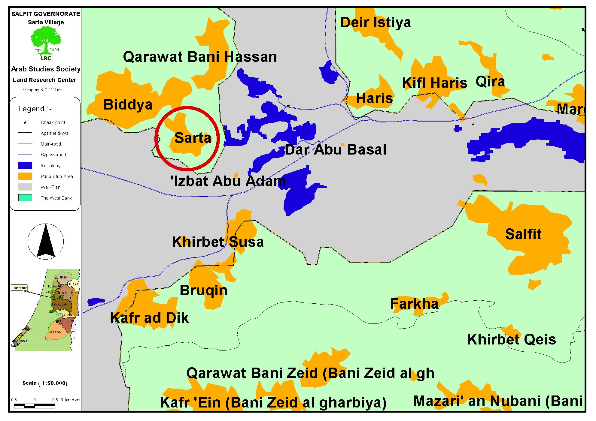
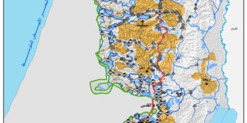
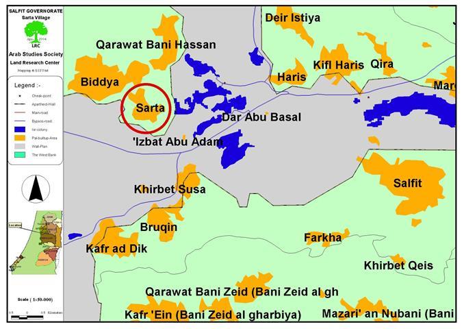
The village of Sarta ( in red square) to the north west of Slafit
Between the years 1967 and 2002, most of the population depended largely on working inside the Green Line as the main source of income. Yet, the establishment of the Israeli apartheid Separation Wall transformed more 60% of the working population into unemployment. The remaining percentage of the population included 12% working in public and private institutions, 5% working in the commercial field, while, the remaining 23% work in the agricultural and herd raising fields.
Surface Area:-
The current total surface area of the village is about 10,000 dunums distributed as follows:
-
600 dunums used for building purposes
-
4,800 filled with olive trees.
-
1,000 used for planting purposes
-
900 dunums used for grazing
-
2,500 confiscated lands used for by-pass roads and reserved for future colonial expansion.
-
200 dunums used as roads.
A profile of Israeli Violations against the Village and its inhabitants:-
Ever since the occupation of the village in 1967 it witnessed a large number of violations committed by the Israeli Army and settlers including the following events:
The confiscation of 77 dunums in 1981 by the Israeli Army in the eastern part of the village. Barkan settlement was established atop these lands. This settlement is basically an industrial zone that threatens the Palestinian environment as its industrial waste is usually buried in the surrounding Palestinian lands. The existence of this settlement, also, threatens to a large degree the underground water levels as it consumes, along with other neighboring settlements, more than 90% of the water deposit. Moreover, the Israeli Army prevents Palestinians accessing about 150 dunums surrounding the settlement as it declared it to be a ''Closed Military Area.''
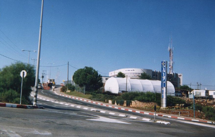
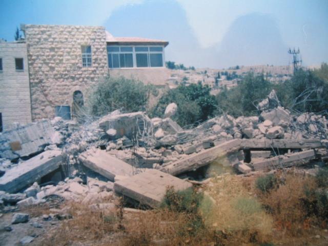
The entrance to Barkan settlement built on land confiscated from Sarta village, Photo courtesy of LRC
-
The confiscation of about 25 dunums in 1985 located to the east of the village and owned by Mr. Ahmad Mohammad Sarsour. An Israeli settlement called Ma'ale Israel was later established atop of this land as more than 200 olive trees were uprooted.
-
The confiscation of 30 dunums owned by Mr. Mohammad Sa'eed Omar Sa'eed Salah in a location called Khallet Jadida close to the above-mentioned settlement. The Israeli settlers burned in 2002 the 120 olive trees, in addition to the 40 citrus trees located in the land as they prevented the original landowners from accessing it.
-
The burning of 50 dunums owned by Mr. Ahmad Mohammad Sarsour which led to the ruining of 350 olive trees.
-
The plowing of 25 dunums owned by Mr. Ragheb Taher Sarsour and the uprooting of 200 olive trees in it. The reason behind this operation was to establish a road linking the settlement with the Trans-Samaria Highway.
-
The plowing of 23 dunums owned by Mr. Mohammad Ahmad Salah on the 17th of July 2004. The location of the targeted land is in Khallet Al Jadida as it was used for seasonal planting.
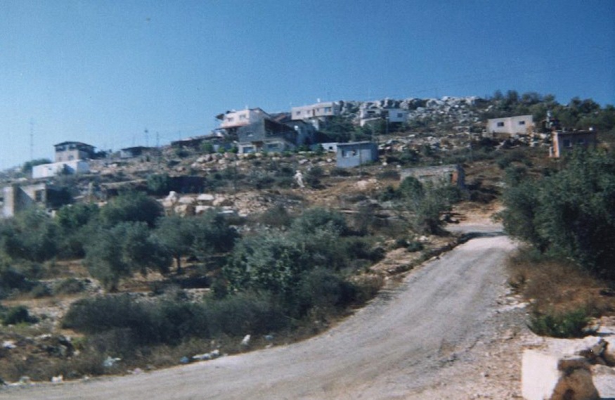
The remaining olive trees decorating the entrance to Sarta village, Photo courtesy of LRC
In the year 2000 the Israeli Army confiscated about 103 dunums for the purpose of establishing sections of the Trans-Samaria Highway. This fact has created a large number of problems for the residents of the village and other nearby villages as the occupation army won't allow any Palestinians from reaching the Highway. Moreover, the Israeli Army has transformed the lands surrounding the Highway to a Closed Military Area prohibited for Palestinian use.
Prepared by
The Land Research Center
LRC