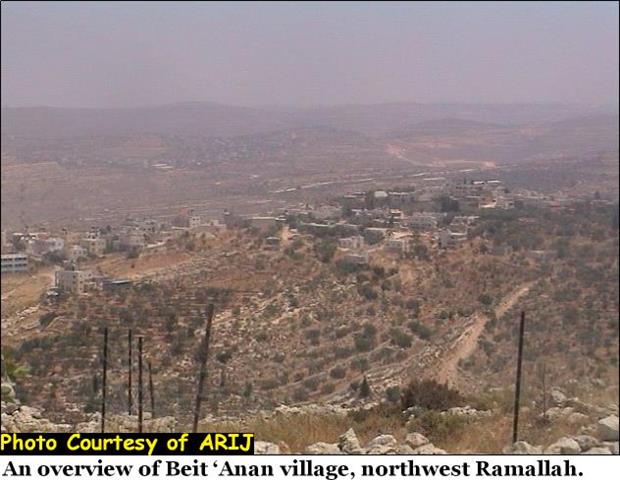
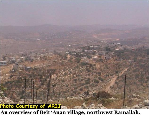
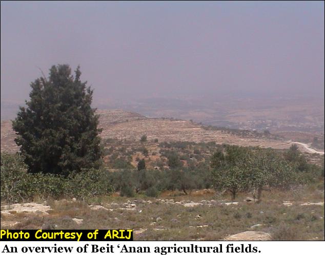
Beit Anan is a Palestinian village located to the northwest of Ramallah district. It houses a total population of 4018 inhabitant according to PCBS 2003 Statistics. Almost 50% of the total inhabitants are refugees who were expelled by the Israeli Occupation forces after the 1948 war. Between 2-3% of the inhabitants are Jerusalem ID holders while the rest hold a Palestinian ID cards. Click to see an overview of Beit 'Anan village. Most of Beit 'Anan residents depend totally on agriculture as their main source of living. Villagers used to reclaim their lands and plant it with different kinds of vegetables and fruitful trees. The village is a rich with olive trees and Grapes where 90% of Beit 'Anan's land are used for cultivation. See photo 1
A number of social infrastructure facilities exist in Beit 'Anan, following is a summary of these facilities:
|
1-Schools |
A-Female UNRWA school(students560) |
B-Elementary school(students300) |
C-Beit Anan School(students440) |
|
2-Kinder Garden |
Three kinder gardens. |
|
|
|
3-Sports Clubs |
A- Beit Anan Club |
B- Beit Anan Club for women's |
|
|
4-Mosques |
Abo Ayob Al Ansary mosque |
|
|
|
5-Health Clinics |
2 clinics |
|
|
|
6-Committees charities |
1 |
|
|
|
7- Bus station |
1 |
|
|
Chronology of Events:-
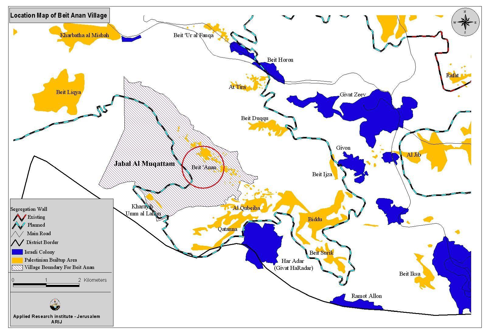
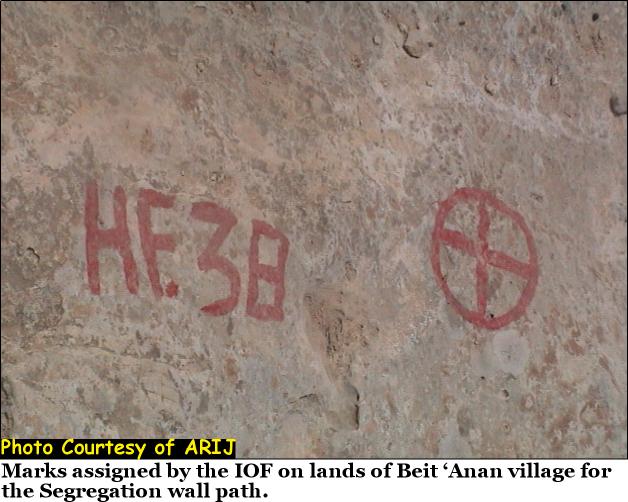
On the 24th of September, 2002, Israel launched its segregation plan and declared vast areas of Palestinian lands of Beit 'Anan as closed military areas and started to mark off territory preparing for the Segregation Wall path in the area. See map of Beit 'Anan and photo 2 below and below
On 17 July 2003, The Israeli Occupation forces distributed military orders in Beit 'Anan village declaring the confiscation of more lands in the area.
On 19 December 2003, the Israeli occupation forces handed Beit 'Anan villagers military order number (03/103/T Judea& Samaria 2003) stating the confiscation of 607 dunums of their agricultural land for the construction of the Segregation wall. ARIJ filed workers were able to get a copy of the order. Click on page 1 & page 2 to read the Israeli military order & to read the Israeli military order

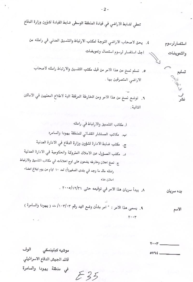
A translation of the military order to the English language is stated below:-
Israel Defense Forces
Order to Seize lands n0 03/103/T
According to my authorities as a Military Chief Commander in the Region of Judea and Samaria, and as I believe that it is imperative for military reasons due to the special security situation in the region, I order the following:
1. The ''Map'' signed in scale 1: 20000 and attached to the order is an essential part of this order. The ''Lands'' : An area of land which is 607 dunums(9000 meter long and 55-230 meters wide) marked in red in the map :
- Block 1:Parcel :43,41-40,29-25
- Block 3:Parcel:62,55-54,52-49,44-42,34-2531-19,17-15
- Block 5:Parcel:55,52-50,48-46,43,42
- Block 9:Parcel:30,29,26-14,5-4
- Block12:Parcel:69,62-60,58,49-46,38,33,25-21,16,13-9,7-6
- Block13:Parcel:33-31,29-28,26-25,19
- Block 14:Parcel:53,26,43-30,26-25
2. I announce by that the above mentioned lands are seized for military reasons
3. The IDF seize the lands and have an absolute control over it that is given to the officer of the central command officer of lands who is responsible in the ministry of defense.
4. These copies are to be given by the District Co-ordination Office ''The DCO'' of Ramallah to the owners of land.
As regard to compensation issue, people of Beit 'Anan think that their land is worth more than being compensated an amount of money afforded by the Israeli government. They will always see the significance of the land value on a personal level since it represents their history and culture and a reason to exist.
The Israeli authorities endorsed a compensation for land according to its geographical nature, location, type of agriculture cultivated in it, and the area. See paper 1 & paper 2 of compensation papers. of compensation papers.
5. Copies are found with maps for those who are interested in the following places:
· DCO of Ramallah.
· Offices of the Juridical advisor in the region
· The office of commander responsible in the ministry of defense in the civil administration.
· Office responsible of absentee and public lands in the civil administration.
6. The owners of land have the right to go to the DCO in Ramallah in order to get more information about their right of land use expenses and compensation.
7. The Validity of this order starts at the date signed till 31/12/2005
8. The name of this order is: '' Order to seize lands n0 03/103/T (Judea & Samaria ) 2003
Mosheh Kaplenski
Chief Commander of the Israel Defense Forces in Judea & Samaria
9/2/2003 -Signature
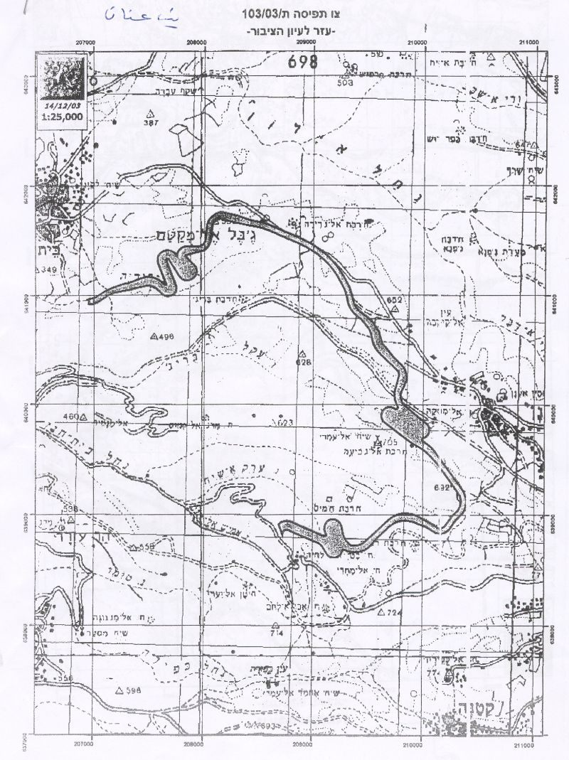
See map of military order as provided by the IOF
In reference to the military order, an area called Jabal Al Muqattam (Al Muqattam is mostly threatened by the construction of the wall. Jabal Al Muqattam (Al Muqattam mountain), lies on extensions of the northwestern parts of the village and is 2450 meters away from the Green Line. This mountain links four Palestinian villages housing 20000 inhabitants together. It is a private property distributed on more than 300 people from Beit 'Anan who have documents of ownership of this mountain.
Land Classification of Beit 'Anan village:-
Beit 'Anan total built up area including areas A, B, and C (classified according to Oslo Pease accords in 1993) is 12.000 dunums. Out of these lands, 1400 dunums are classified as area ''A'' on which the 4018 residents currently live.
Beit 'Anan and the Israeli settlements:-
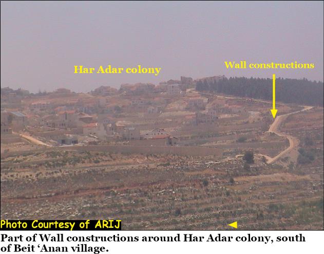
Beit 'Anan village is located far from any Israeli settlement. The only settlements that exist are located in the north and the south of the village and are kilometers away from the borders of the village. Besides, Beit 'Anan is not surrounded by any Israeli bypass roads or military bases. According to the village council leader; there is no threat or danger typified by the location of the village to the Israeli settlements mentioned below:
1. Har Adar (4 km2) (South of Beit 'Anan). See Photo 3
2. Beit Horon (4 km2) (North of Beit 'Anan).
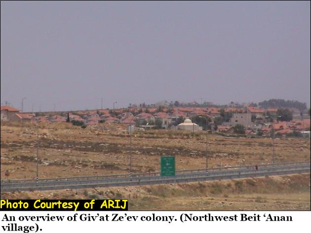
3. Giv'at Ze'ev (7 km2) (Northeast of Beit 'Anan). See Photo 4
The above Israeli military order was handed to 143 Palestinian families living in Beit 'Anan where the Wall is to penetrate their lands. The total land area designated for the Segregation Wall according to the military order is 607 dunums and states the seizure of lands for military purposes mainly for the construction of the Segregation Wall.
The route of the Wall is planned to begin from the southern side of the village, on borders of Kerbat Um Al Lahem lands to extend to Beit Leqia northwest of Beit 'Anan. Item number 1 of the military order (03/103/T Judea& Samaria 2003) states that the width of the wall is planned to range between 55 to 230 meters width and to penetrate the lands of Beit 'Anan village with a length of 9km.
Facts from Beit 'Anan village:-
According to Beit 'Anan village council leader:-
1. Most of the lands that the Wall is planned to penetrate have Tabo (papers of ownership) and are owned by almost 1000 residents, and 300 families currently depend on land cultivation to earn a living.
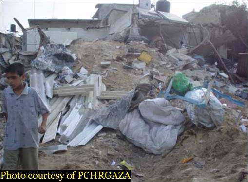
2. The planned wall route is very close to some Palestinian houses in Beit 'Anan and in some areas, the wall plan threatens the existence of those houses.
3. The land area designated for agriculture in Beit 'Anan forms 90% of the total lands of Beit 'Anan and are cultivated with Olive tress and Vines.
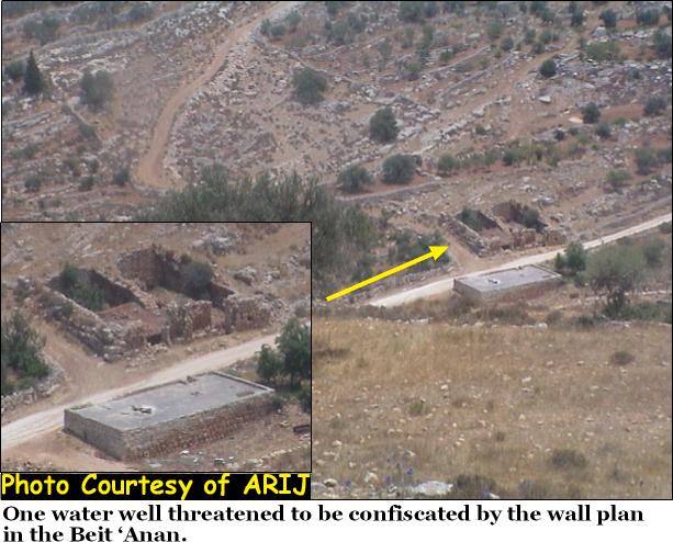
4. The construction of the Wall will result in confiscating ten water wells (Al Mesqa), out of which, 2 are dry but were originally historical sites. See Photo 5
5. The Segregation Wall, as provided by the IDF commander, Moshe Kaplenski, is expected to be built 1200 meters away from the Green Line, on lands located on the southern side of the village. See Photo 6

Lands located behind the wall:-
-
Vast areas of lands (32000 dunums) located to the south of Beit 'Anan village like Al Manateer, Al Sahayel, and Al 'Aurud and a nature reserve were confiscated in 1948.
-
An area of 6120 dunums is lands located within and behind the Segregation zone area. This increases the total area of confiscated lands to 9320 dunums. Following is a summary of the impact of the Wall on the villagers:
1. The Wall prevents farmers from using the water wells and springs, which became cut- off by the wall.
2. The Wall prevents the Palestinian families of Beit 'Anan from visiting the holy and historical sites exist in the village like Kherbat Al Misqah, Al Sheikh Al Omary, Kherbat Al Juderia ,Kherbat Al Buraij and many others. ). See photo 7
Impacts of the Segregation Wall on Beit 'Anan village:-
1- Economical impacts:-
1. There are 18,000 old Roman Olive trees in the lands that the Segregation Wall will pass.
2. There are 5507 dunums continuing more than 70,000 trees that will lie behind the Wall.
3. The grazing lands will be no longer accessible to shepherds and their cattle.
4. Unemployment rate reached 75% as a result of the current political situation, where most of the workers lost their jobs inside Israel and turned to work in agriculture. Therefore, the construction of the Segregation Wall will hinder families form earning their living.
2- Social Impacts:-
1. The Wall cuts off the villagers of Beit 'Anan from their relatives who live in the nearby villagers.
2. The Wall hinders the natural territorial expansion of the village according to the village's master plan.
3. The Segregation Wall will affect the educational system in the village and many students will lose their right to get a proper education.
4. Staff and workers will not be able to head to their destinations if the Wall plan is implemented.
5. Farmers and villagers of Beit 'Anan feel desperate since their lands are forcibly confiscated for the construction of the Segregation Wall.
6. The Israeli Occupation aims at dispelling Palestinians from their homeland.
3- Environmental and Health impacts:-
1. The Segregation Wall will hinder Palestinians of Beit 'Anan from having access to hospital and medical centers situated in the nearby cities and villages mainly Ramallah.
2. The construction of the Wall will hinder Municipality cars from reaching solid waste sites which are threatened to be segregated behind the Wall borders.
3. The Construction of the Wall will hinder Waste water vehicles from reaching the western areas located within the wall borders as provided in the plan; thus causing an environmental problem in the village since the village lack sewage networks.
4. Suspension for project funded by the UNDP (United Nations development Program) to build a 'Solid Waste dumping site' for Beit 'Anan village and the nearby Palestinian communities.
4- Agricultural impacts:-
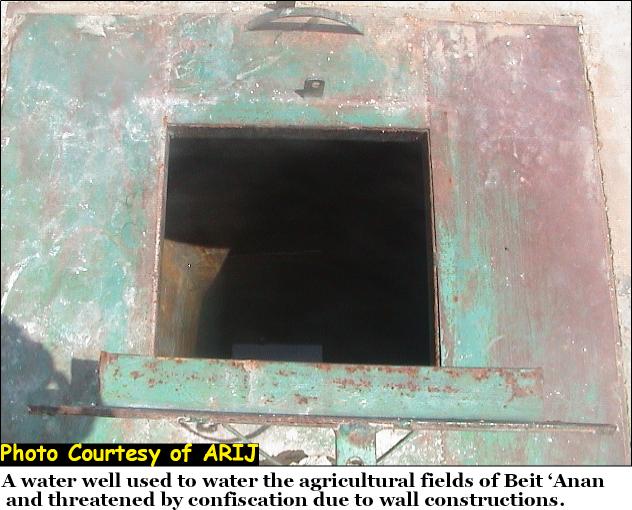
In addition to land confiscation, the planned wall route threatens the water sources of the village. Ten water wells and four springs are expected to be confiscated. The following wells were known: Al Masqa, Mizrab, Ahmash, Hann, Wad Skman. Villagers of Beit 'Anan expressed that, if the wall is implemented, a huge agricultural loss would occur. Villagers would no longer be able to water their fields which in turn would lead to aridity. See Photo 8 & Photo 9 &

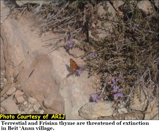
Moreover, many terrestrial herbs are threatened of extinction like terrestrial Frisian thyme if lands are confiscated for the wall construction. See Photo 10
5- Educational impacts:-
The Isolation expected to be caused by the construction of the Segregation Wall will affect many Palestinian teachers who come from the nearby villages to work in schools of Beit 'Anan. Not forgetting to mention the daily humiliation and harassments they face in order to get to the village.
The UNDP leased 80 dunums of lands of Beit 'Anan to build a new a University in the area that will serve students from 20 nearby Palestinian villages. The project was halted by the Israeli authority due to Israeli claims that the area where the university to be built is close to the Green line and is located on lands classified as Area ''C'' (Israeli controlled areas), while the main reason behind such action was the construction of the Segregation Wall which, according to the military order, is going to penetrate these areas.
Beit 'Anan and the Israeli High Court Order:-
On the 29th of June 2004, the Israeli high court orders a halt in construction of 30 Kilometers section of the Segregation Wall in the northern and northwestern areas of Jerusalem city. The order came as many Palestinian communities appealed to the court in an attempt to preserve their rights of living and protect their communities from becoming isolated. According to the Israeli court, the wall's route is to be redrawn along the 1967 borders as declared by the International law following the occupation of the West Bank in 1967.
Despite court's decision to halt the construction of 30 Kilometers wall section, the court still considers that legality of the Wall in the Palestinian territories by declaring the redraw of the wall route rather than the canceling the idea of the Wall itself which still affects all aspects of Palestinian life.
The Israeli High Court expressed its rejection of the military order n0 03/103/T which states the construction of a segment of the Wall on lands of Jabal Al Muqattam. The planned wall route in this area was redrawn by three kilometers south and adjacent to the Green Line as provided by the Israeli High Court. Yet, the Israeli high court did not prescribe a new wall course but the order was left for Israeli officers for reconsideration.
If the wall construction is justified by securing Israeli settlers in the West Bank as claimed by the Israeli Government, then the wall course should be redrawn to make a balance between Israeli security claims and the needs of the Palestinian people living in these areas. The erection of wall is one of a long- termed Israeli plans and land grab Policies to control the Palestinian Territories. The Segregation wall should have been constructed alongside the Armistice Line (the separation line of the Occupied Palestinian Territories from Israel.
Israel, as an occupying power, is required to ensure the welfare of Palestinians in the Occupied Territories as regard to Hague Regulations, Art. 43. The construction of the Segregation Wall is a blatant violation of International law and UN resolutions which do not permit annexation of land by force as stated by Geneva Conventions, article 47: ''Protected persons who are in occupied territory shall not be deprived, in any case or in any manner whatsoever, of the benefits of the present Convention by any change introduced, as the result of the occupation of a territory, into the institutions or government of the said territory, nor by any agreement concluded between the authorities of the occupied territories and the Occupying Power, nor by any annexation by the latter of the whole or part of the occupied territory''.
Prepared by:
The Applied Research Institute – Jerusalem