On February 2002, the Israeli army commenced the construction of a new ''bypass road'' southeast of Bethlehem. The road, according to the military order number 02/02/C which was issued by Yitshak Etan, the IDF commander in the occupied territories, will be constructed over Palestinian farmers' land of Beit Sahour and Bethlehem; as well as Za'atra, Ras-El Wad, Tekoa, Al-Shwawreh and Al-Fureidis villages and stated the seizure of land for military use.
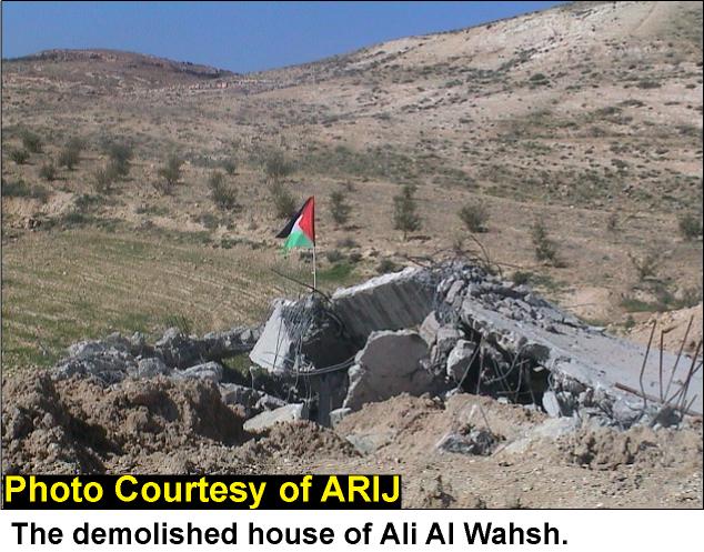
On June 3, 2002, the Israeli army commenced the second stage of constructing the Israeli bypass road according to the aforementioned military order southeast Bethlehem district. The second stage led to the confiscation of vast areas of agricultural land that belong to Palestinian farmers form Ras Al-wad, Za'atra and Beit Sahour in addition to 500 olive and almond trees that have been uprooted.
During the last two years, the work was halted for budget problems and was again resumed to achieve the construction of this huge bypass road. The main fact about the road is that it will link with the Eastern ring road project. The road also intersects with the portion of the wall constructed along Beit Sahour city borders and is identified by the Israelis as the ''Jerusalem Envelope''. See Map 1 project. The road also intersects with the portion of the wall constructed along Beit Sahour city borders and is identified by the Israelis as the ''''.

The construction of various Israeli bypass roads has contributed in slicing and strangulating Bethlehem district.
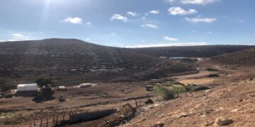
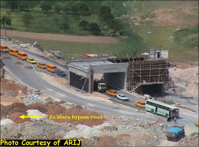
Today the work continues to accomplish the planned road. See photo 1
The road confiscates more lands from Bethlehem, Beit sahour, Za'tara, Ras El wad, Teqo'a, Al Shawawra and Al Fureidis localities to achieve the plan of connecting the southeastern settlements of Bethlehem district mainly Nekodim and Tekoa settlements. The seven Palestinian villages constitute a total population of 57815 which will be severly affected by the completion of the Israeli bypass road.
|
City/Village |
Population |
|
Beit Sahour |
14465 |
|
BethLehem |
28132 |
|
Za'tara |
5053 |
|
Ras El Wad |
740 |
|
Tekoa |
6269 |
|
Al Shawareh |
2483 |
|
Al Furdeidis |
673 |
|
Total |
57815 |
Source: PCBS 2003
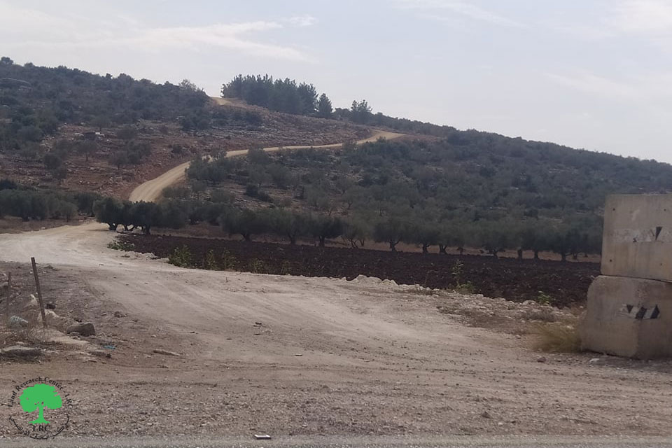
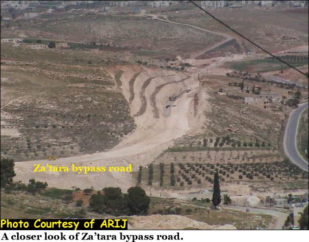
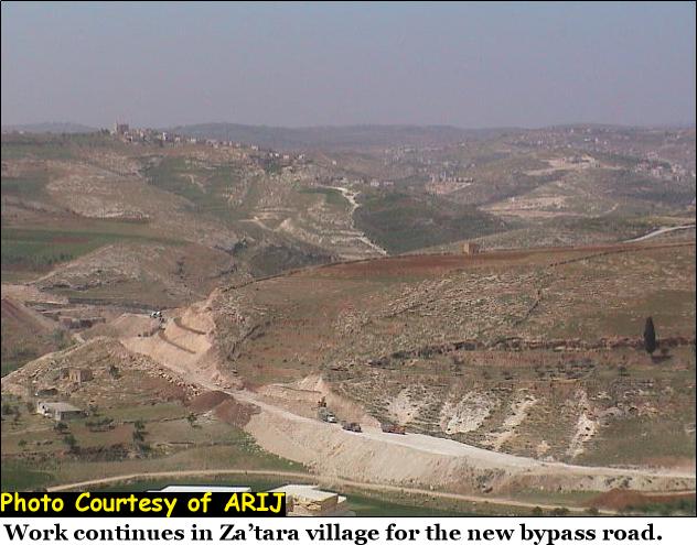
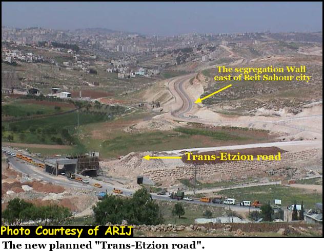
Another road is planned and waiting for approval by the Israeli government to be constructed. The road is supposed to be similar to the Trans Samaria road in the north. See Photo 2 & Photo 3

The 'Trans-Etzion road', the new planned road, if completed, will connect Betar Illit settlement (northwest Bethlehem city) with Efrat settlement (southwest bethlehem city) extending to Tekoa (south east Bethlehem city) and then eastward to the Dead Sea. This 'Trans Etzion Road' will be connected with the planned route # 80 known also as the Allon road, which was named after the former Israeli labor minister Yigal Allon. See map of plan
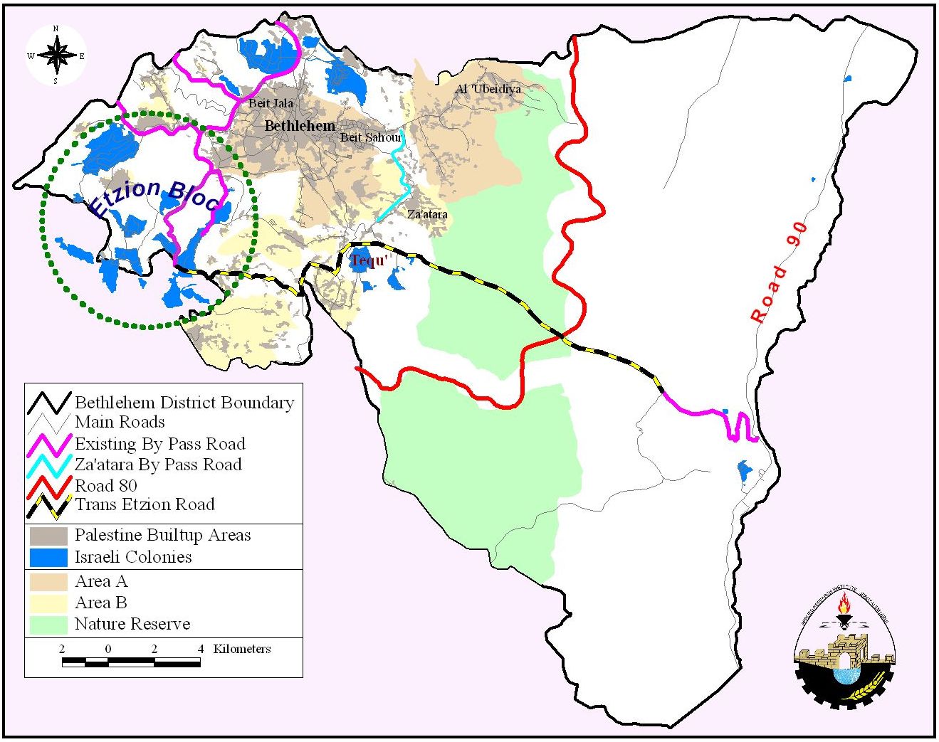
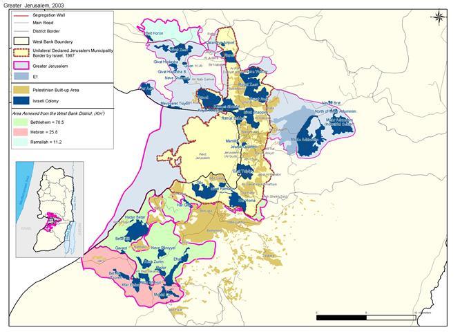
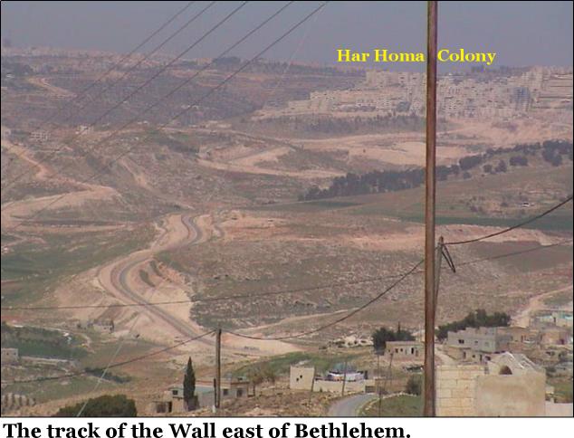
The segregation process in the Occupied Palestinian Territories is achieved not only by erecting the Segregation Wall, but also by building a matrix of bypass roads that are slicing the West Bank and making the Palestinian localities geographically limited. Bethlehem governorate will be reduced and limited in area by the aforementioned plans as both its eastern and western rural areas will be divided if not isolated from their urban center. See Photo 6 & Photo 7
Even if the Israeli government decided not to build an eastern Segregation Wall, the control of land is achieved through the construction of those Israeli controlled bypass roads. The construction of the 'Trans Etzion Road' and route # 80 will keep the southeastern settlements of Bethlehem, Tekoa and Nekodim of great importance to Israel, at the same time it will retain them for future plans.
Furthermore, the Za'tara bypass road will help in the creation of a colonial circular belt when Tekoa settlement (south east Bethlehem city) is linked to Har Homa and Gilo settlements ( east and west of Bethlehem city). See photo 8
The circle will be completed will be completed when road # 60 is finally linked to Gilo settlement; thus, it becomes possible to reach the other parts of the Gush Etzion block through 'Betar to Efrat' road belt.
Therefore, the connection among Israeli settlements surrounding Bethlehem which will disconnect the eastern and western rural Palestinian localities from the city center of Bethlehem.
Prepared by:
The Applied Research Institute – Jerusalem