Governorate: Salfit
Village: Kifl Haris
Location: The village of Kafl Haris is located 6 kilometers to the west of the city of Salfitt and about 18 kilometers to the south of the city of Nablus.
Population: The estimated number of the population of the village is about 3,000 most of which work in agriculture.
Area: The total area of the village is about 10,000 dunums
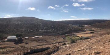
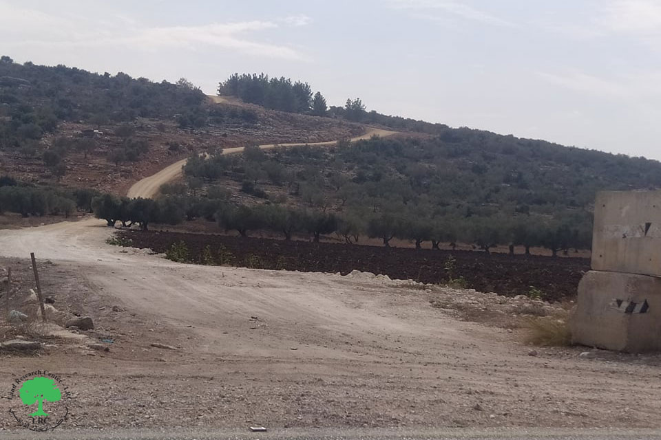
Targeted Location: the area of Al Marj
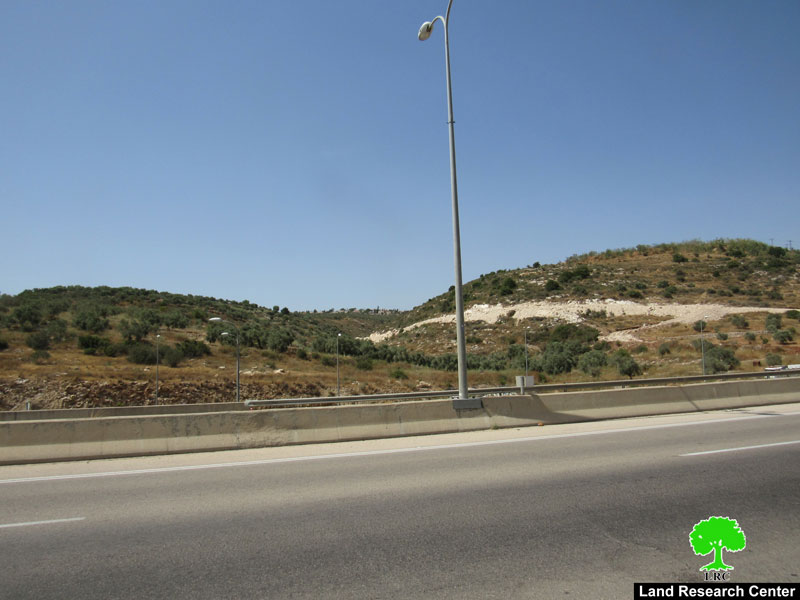
Violation: The uprooting of olive trees as deep as 30 meters along a distance of 1,500 meters along the sides of the Trans Samaria Highway.
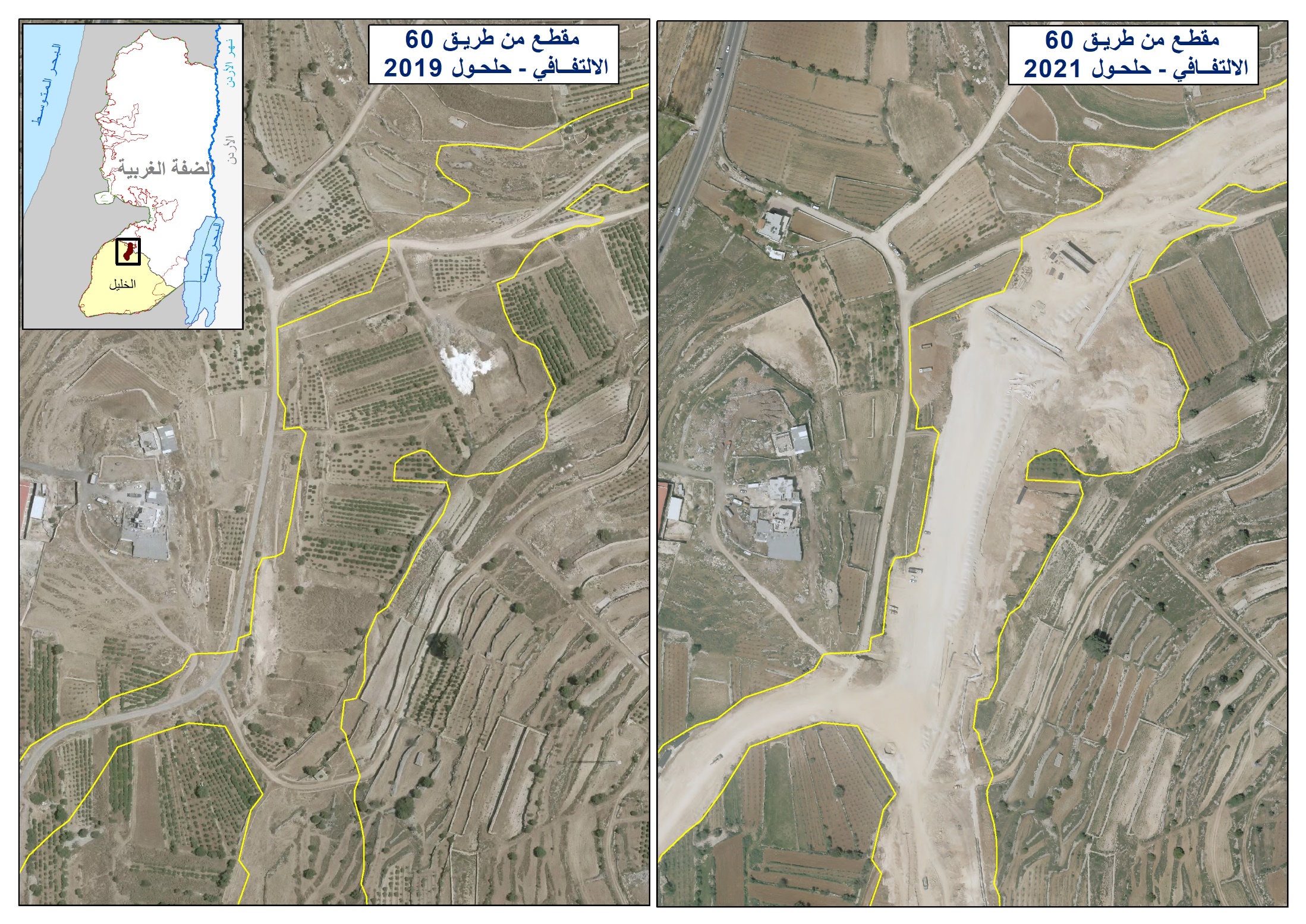
The Highway: The practical implementation of the Trans – Samaria Highway started in 1992 from the town of Kufr Qasem inside the green line up to the village of Mardah. The length of this first phase was 18 kilometers with a width of 180 meters. Villages affected by this first phase included Al Zawiyah, Masha, Sartah, Bedya, Haris, Kafl Haris, in addition to Mardah. This phase caused the uprooting of thousands of trees before it had been frozen for Israeli reasons. Further smaller steps were taken throughout the nineties until it reached the Bruqin crossroad and the village of Haris which is close to the village of Kafl Haris. Some 14 kilometers of the Highway were constructed before the year 2000. In October 2003, Israeli relevant bodies started its work again where it left of in the village of Kafl Haris.
A large number of protests and demonstrations sprouted when work on the Highway was initiated in the nineties by land owners as well as by local and international organizations due to the fact that the new Highway runs parallel to the old Highway. The distances separating between the two Highways ranged between 30 and 500 meters. Moreover, the condition of the old Highway was sufficiently good that it would have served for a long time without needing a new Highway to replace it. Palestinians foresaw that one of the main goals of establishing the Highway was to suffocate Palestinian agriculture which what really happened. See Map

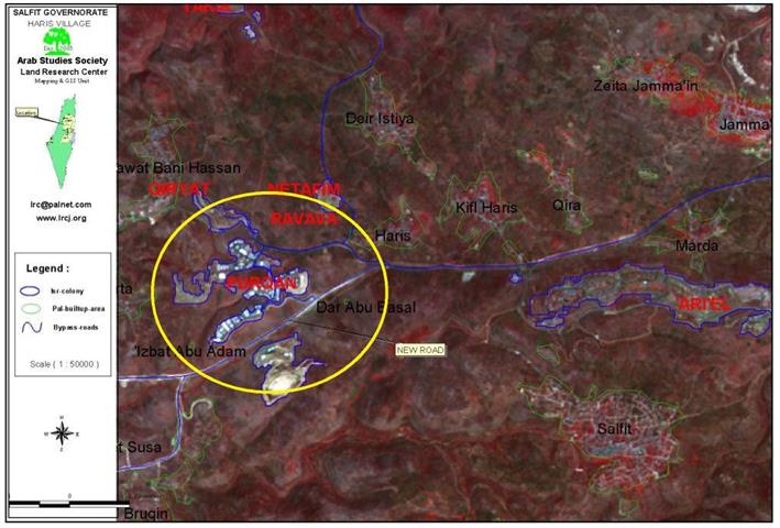
The village of Kifl Haris ( in green circle) and the Trans Samaria bypass road ( in blue color)
Area of Targeted Lands: about 50 dunums.
Number of Uprooted Trees: about 500 olive trees.
Number of Affected Palestinian Farmers: 46 farmers.
Date of commence of violation: 20/9/2003
Current Situation: Recently, Israeli bulldozers and heavy equipment have taken the necessary initial steps to enlarge the above-mentioned section of the Highway.
Tree Uprooting: According to the Palestinian farmers and the Kafl Haris Municipality, tree uprooting takes place on intervals fearing an outburst of Palestinian anger if trees were uprooted all at once. The above-mentioned 500 uprooted trees were dug up over a period of three months.
The Effects of the Violation:
A) Political and Security Arena: The Israeli goal is to leave as little land as possible for Palestinians. However, the Israelis claim that the Highway is being enlarged to prevent stones from reaching Israeli cars. This pretext is false as the width of the Highway is 180 meters.
B) Economical Arena: Palestinian families in this village depend to a large extent on agriculture for their livelihood. The expansion of the Highway as planned would damage their livelihood to a great extent.
C) Agricultural Arena: On the long run, and due to the Israeli war against olive trees, it is expected that Palestinian farmers would stop planting olive trees (and other trees in that matter) causing, in the process, negative effects on the environment as well as on the social well-being of Palestinian farmer families.
Prepared by
The Land Research Center
LRC