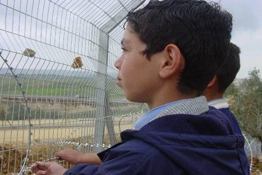

Two Palestinian children look through apartheid wall
LRC
Background
Qalqiliya is located in the northern western part of West Bank. It is the smallest Palestinian governorate and the mostly affected by the Israeli occupation. It suffers from continuous Israeli expropriation of land for the exclusive use of Israeli settlements, bypass roads, military checkpoints and the most recently the apartheid wall along the green line.
Since the occupation of 1967, ehe governorate of Qalqiliya has been very much targeted by Israel because of its closeness to the green line and to Palestinian coast. The inhabitants of the city of Qalqiliya total about 40 000, while the inhabitants of the whole gevernorate total about 82000 with an area of 163 square kilometers. Therefore, it is considered one of the mostly populated areas in compare to its area of 163 2km.
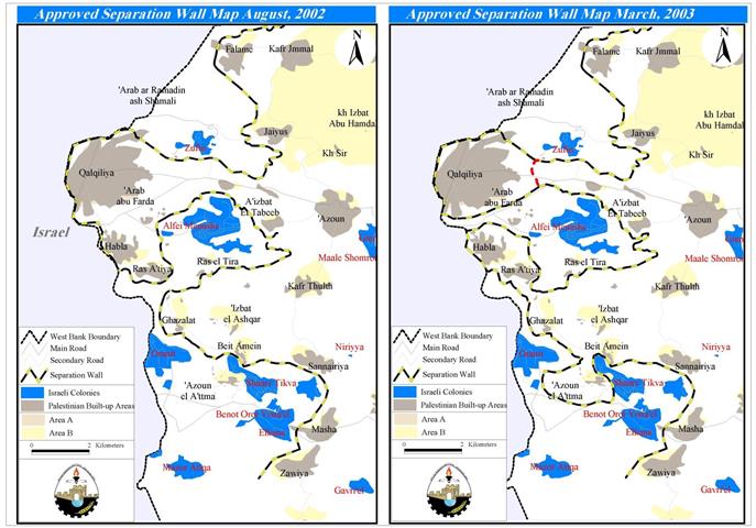
Israeli Wall activities in Qalqilia
Once Israeli occupied the West Bank in 1967, it started to encircle Qalqiliya from all sides with the aim of halting Palestinian housing expansion as much as possible. Along with the many building restrictions imposed on Palestinian construction, Israel gave full momentum for the establishment of at least 17 settlements in the area which constitute a segregation line between the city and villages, on one hand, and between the governorate and the rest of governorates within West Bank, on the other hand. The closest settlements to the city center are Alfeh Menashe, Tsofim, Tsuregal, Yirhav and the biggest settlement in the West Bank, Areil.
Related studies and researches indicate that during the first years of 1967 occupation, Israel confiscated more than 30 000 dunums of fertile Palestinian land which was considered a great loss for local farmers in the area. Israel, also, continued to confiscate the hilly areas in the south, north and east of Qalqiliya to build settlements and bypass roads for exclusive Jewish use.
By so doing, Israel managed to besiege the governorate of Qalqiliya with settlements and bypass roads from the east, south and north, and with the already existed green line in the west. Consequently, Qalqiliya lives now in a closed enclave with only one passway ( bottle neck) through the village of Nabi Elias on the road to Nablus to the east ( see attached aerial photograph). It is worth mentioning that the area of land confiscated so far for the building of Israeli settlements and bypass roads exceeds the total area of Palestinian built up zones in the whole governorate.
The Apartheid Wall
After the construction of the apartheid wall Qalqiliya, as mentioned before, has become an enclosed enclave with only one passageway through the village of Nabi Elias between Nablus and Qalqiliya. Residents who intend to leave or enter the city should pass through the Israeli Badoq military checkpoint located in this passageway, thereby becoming under the mercy of individual Israeli soldiers. See Map
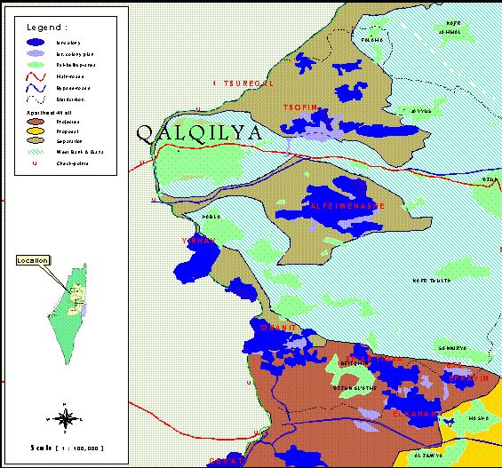
Qalqiliya looks surrounded with apartheid wall from all directions except the eastern bottleneck
The Qalqiliya governorate is the mostly affected one by the construction of the apartheid wall where large areas of agricultural land have been cut and annexed to Israel proper. However, the annexed areas only include four settlements out of 17 ( see attached aerial photograph.). The reason behind the annexation of this land is not a security one as claimed by the Israeli occupation authorities, rather, it is aimed at confiscating as much Palestinian land as possible introductory to dismissing Palestinian inhabitants eastward. See Photo
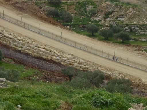
Part of the apartheid wall once finished- LRC
An active commercial center
Due to its proximity to the Palestinian communities inside the green line, especially those located in the triangle, Qalqiliya served as an active commercial and agricultural center which put it in the center of the attention of Israeli occupation who sought to make it otherwise.
In order to destroy this center, the Israeli occupation authorities intensified their destructive campaigns during the past two years of Intifada against agricultural and commercial infrastructure, including artisan wells, irrigation systems, green houses, orange groves and nurseries, as well as electricity, sewage and road networks. These practices have been accompanied by continuous and systematic military closure aiming at forcing inhabitants to leave their homes and properties.
Prepared by
The Land Research Center
LRC