Situated at 15 kilometers west of Ramallah city, the ''Modi'in Block'' is a group of Jewish settlements on the western edge of the West Bank. In fact, they lie on and beyond the 1949 Armistice Line that defines the boundaries of the West Bank. Successive Israeli governments have encouraged the development of those specific settlements so as to make the return to the 1967 borders practically impossible. Table 1: Settlements that make up the Modi'in block
|
Name |
Date |
Area in dunums |
Population |
Growth 1997-98 |
||
|
1997 |
1998 |
Absolute |
% |
|||
|
Kfar Rut |
1977 |
909 |
n.a. |
n.a. |
– |
– |
|
Shilta |
1977 |
761 |
n.a. |
n.a. |
– |
– |
|
Mattityahu |
1979 |
648 |
n.a. |
n.a. |
– |
– |
|
Makkabim |
1982 |
1707 |
n.a. |
n.a. |
– |
– |
|
Hashmonaim |
1985 |
1047 |
1,410 |
1,530 |
120 |
10 % |
|
Modin Illit (Qiryat Sefer) |
1991 |
2477 |
8,090 |
10,500 |
2,410 |
30 % |
|
Lapid |
1996 |
436 |
995 |
1,580 |
585 |
60 % |
|
Menora |
1998 |
671 |
– |
132 |
132 |
– |
Source: ARIJ database 1999 and Peace Now Settlement Watch report.
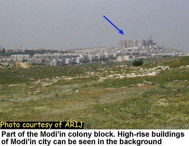
The Israelis envisage transforming these settlements into suburbs of Modi'in (population 15,700) which is the Israeli town on the other side of the 1949 Armistice Line; hence the name ''Modi'in block''; see photo. .
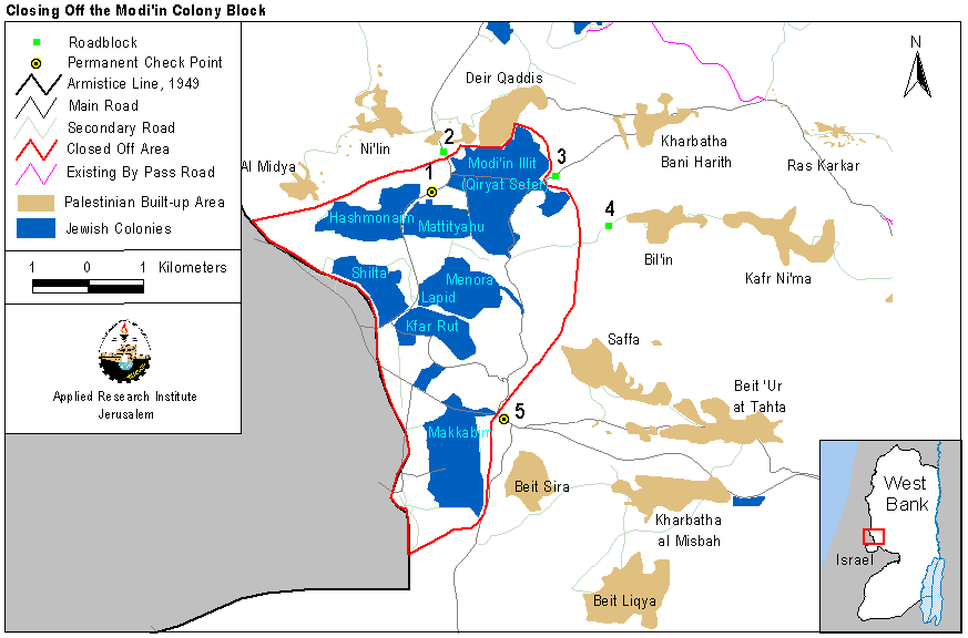
This new metropolis would then serve as the midway between Tel Aviv and Jerusalem. And when one knows that the Modi'in block lies less than 30 kilometers from each of these two cities, it becomes very clear why such a metropolis is so attractive to Jewish settlers; see map. .
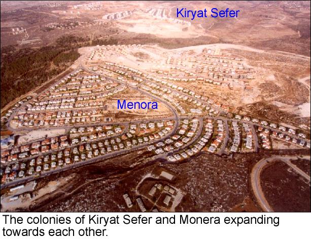
As a matter of fact, they have shown the highest population growth in the period 1997-98. A comparison of the rate of growth in the settlements of the West Bank and Gaza shows that the settlements of Lapid and Modi'in Illit ranked in the top five; Lapid ranked 1st at 60% growth rate, while Modi'in Illit ranked 4th at 30% growth rate, see photo 1, photo 2 .
Table 2: Population of the largest two settlements in the Modi'in block
|
Settlement |
1998 |
1997 |
1995 |
|
Modi'in Illit |
10500 |
8100 |
5500 |
|
Makkabim-Re'ut |
10500 |
10400 |
10200 |
Source: Statistical Abstract of Israel 2000, No. 51, pp-2-42
Table 3: Population growth in the largest two settlements of the Modi'in block
|
settlement |
Growth 1997-98 |
Growth 1995-98 |
||
|
Absolute |
% |
Absolute |
% |
|
|
Modi'in Illit |
2400 |
30 % |
5000 |
91 % |
|
Makkabim-Re'ut |
100 |
1 % |
300 |
3 % |
Source: Calculated from table 2.14 in Statistical Abstract of Israel 2000, No. 51, pp-2-42.
Recently, the Israeli government took a precarious step toward realizing the ''Modi'in metropolis''. Through a series of roadblocks and checkpoints Israel closed-off the Modi'in settlement block from the rest of the West Bank thus enforcing a de facto annexation of the area; see map. .
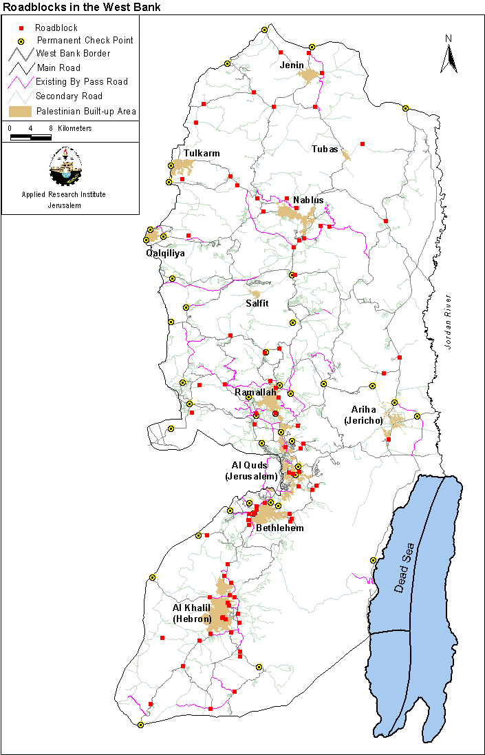
The choice of roadblocks was not random but pre-planned. First, the Israeli authorities fixed two checkpoints in the area to screen vehicles moving in and out of Israel; see checkpoints 1 and 5 on the map. Then, during the Al Aqsa Intifada, several roadblocks were placed around villages and towns in the Ramallah district (see map), as well as elsewhere in the West Bank and Gaza (see map); click for more. These roadblocks closed the roads leading to Bil'in and Kharbatha Bani Harith villages; roadblocks 3 and 4 on the map. Finally, and in the first week of December 2000, the Israeli authorities moved the checkpoint near Modi'in Illit (Qiryat Sefer) settlement (checkpoint 1 on the map) several meters north (roadblock 2 on the map). This move completed the encirclement of the Modi'in settlement block and implied a unilateral annexation by Israel of occupied Arab land. The area of the closed-off block is 21 square kilometers and is another attempt at redrawing the 1949 Armistice Line; click for related topic .
Prepared by:
The Applied Research Institute – Jerusalem


