Abu Ghnaim used to be a forested mountain north of Bethlehem city. It was forested during the Jordanian administration and when Israel occupied the West Bank in the 1967 war it included the mountain into the unilaterally expanded borders of Jerusalem's Municipality. At the time, the Israeli authorities designated the mountain as ''green area'' or ''open space'', which meant that no construction was allowed on it. However this only seemed to apply to Palestinian development. For when the Israeli agencies came up with projects for constructing residential buildings for Jews, the mountain stopped being a ''green area.''
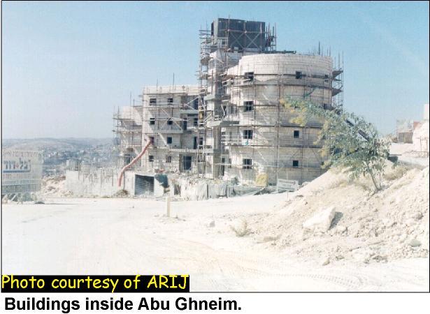
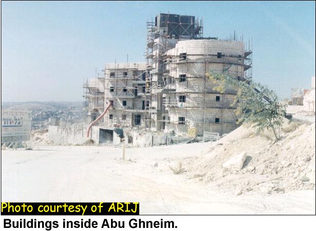
The Israeli planning scheme of Har Homa settlement covers approximately 2148 dunums of the land on and around the mountain. Most of this land is owned by Palestinian families from Bethlehem, Beit Sahour, Sur Bahir and Umm Tuba. Today, construction is well underway for at least 6,500 housing units and the infrastructure for the settlement has already been completed. The built-up area has reached 1048 dunums and there are more than 53 buildings built or in various stages of construction with between 4 and 7 floors each (see photo 1, photo 2). housing units and the infrastructure for the settlement has already been completed. The built-up area has reached 1048 dunums and there are more than 53 buildings built or in various stages of construction with between 4 and 7 floors each (see , ).
The construction on Abu Ghnaim Mountain has not only destroyed most of its trees, removing many endemic wild plants and animals but also leaves the surrounding Palestinian villages with little land to accommodate natural population growth and future developments. The Har Homa settlement and the fenced military by-pass road is creating a physical barrier disconnecting Bethlehem from Jerusalem, depriving the Palestinians of Bethlehem of their main source of income and tourist visitors.
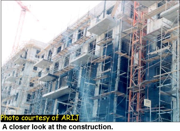
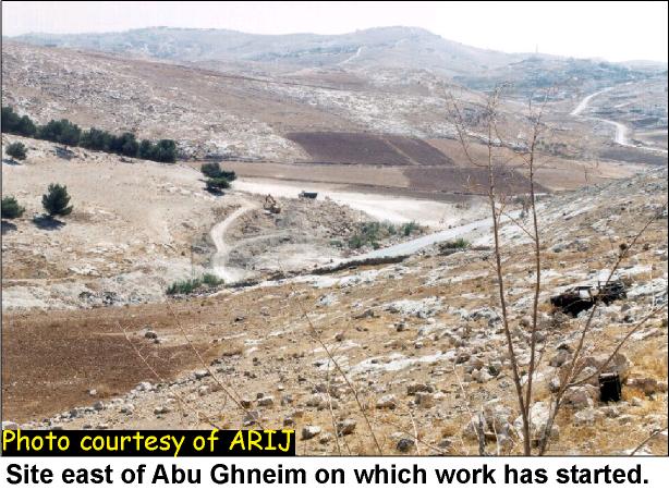
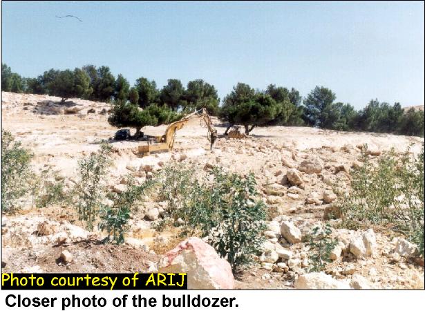
The latest work on Abu Ghnaim has involved the preparing of ground on the south side of the mountain (see photo 3, photo 4)). The diggers can be seen clearing land near olive trees, irreparably altering the local environment. This new development pushes the extent of the settlement right up to the edge of the Israeli unilaterally declared municipal boundary of Jerusalem.
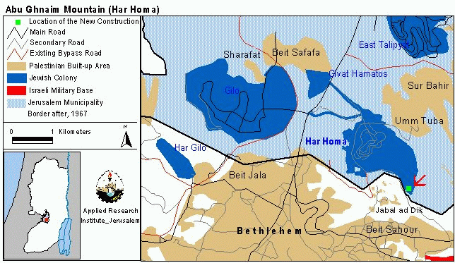
The new site is very close to two Palestinian housing developments on Jabal al Dik, in Beit Sahour. This new work highlights the continuing pattern of developing the settlement towards Palestinian areas, in order to prevent their future extension (see map). Such moves further exacerbate an already very difficult situation. Residents of Beit Sahour remain powerless to halt or alter the development in their own backyards.). Such moves further exacerbate an already very difficult situation. Residents of Beit Sahour remain powerless to halt or alter the development in their own backyards.
Prepared by:
The Applied Research Institute – Jerusalem