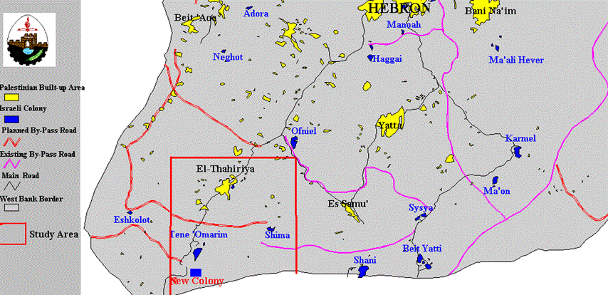
In a feverish attempt to create more facts on the ground, Jewish settlers in Hebron District launched a new West Bank hilltop grab. El Thahiriya, a Palestinian town of about 20,000 residents , is located 18 kilometers away from Hebron, bordering the 'Green-Line' (the 1967 border-line) (Figure 1).).
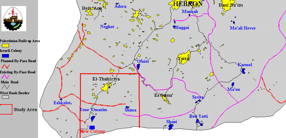
Figure 1: Location map of El Thahiriya town and the new settlement.
The Israeli colonization activities in the El- Thahiriya area started as early as 1984. Presently, two Israeli settlements, namely Tene (Ma'ale Omarim) and Shima have been created in the southern parts of El Thahiriya.
|
Table 1: Israeli Settlements South of El Thahiriya |
|||||
|
Israeli Settlement |
Number of Families |
Population |
Founding Date |
Population Type |
Built-up Area (dunums) |
|
Tene |
140 |
463 |
Jan-1984 |
Secular |
221 |
|
Shima |
60 |
200 |
Jul-1988 |
Secular |
183 |
On March 6th 1999, in a bid to grab more West Bank land, Jewish settlers occupied a hilltop about 2 kilometers away from Tene, south of El- Thahiriya (Figure 2). They bulldozed an access road to the hilltop and set up seven caravans and a water tank; thus, creating a new settlement outpost .). They bulldozed an access road to the hilltop and set up seven caravans and a water tank; thus, creating a new settlement outpost .
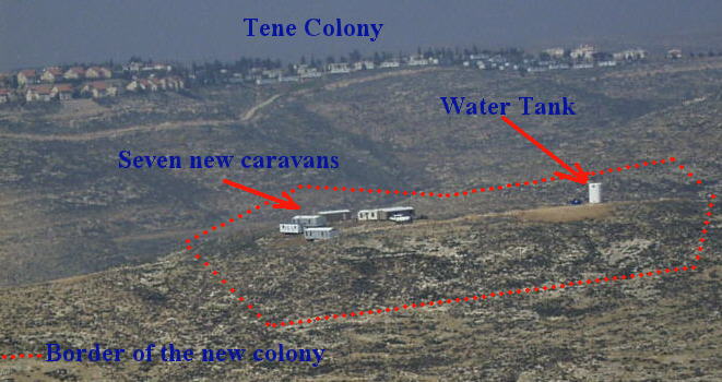
Figure 2: The Israeli new settlement South of El-Thaharyia town
The caravans were erected illegally on land classified as Area C (under complete Israeli control), and owned by El Qisiyeh family who have documents for their land dating back to the Ottoman period. Over years of occupation, up to-date, Palestinian families are not allowed to build on or cultivate their land located in 'Area C '.
An examination of the Israeli colonizing activities in the southern part of the West Bank reveals the gradual application of the Israel's broad 'master plans' which has been deliberately endorsed by Israel (Figure 3).).
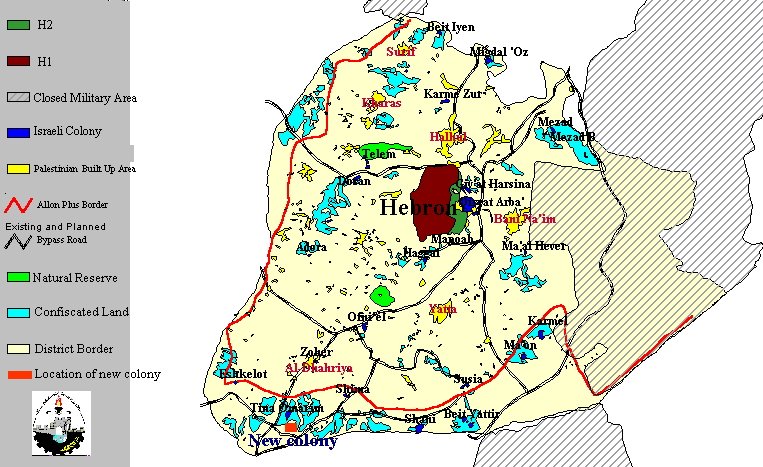
Figure 3: Map showing recently confiscated land in Hebron
The expansion of the southern Jewish settlements of Eshkolot, Shani, Shima, Susya, Tene, and the newly created settlement will lead to the construction of a belt of settlements which erases the 'Green-Line', dragging it to the north, according to Allon Plus plan, of about 2-3 kilometers; thus, unilaterally delineates the Israeli-Palestinian borders.
The completion of the southerly extension of the belt of settlements would place at least ten Palestinian Khirbats (small Palestinian communities) at risk. They would be either exterminated or annexed to Israel.
To conclude, the redemarcation of Israeli-Palestinian border would result in hindering the geographical contiguity of the Palestinian territories, and eliminating the continuity and development opportunities of the Palestinian communities. Thus, creating de facto realities on the ground. These de facto realities are clearly affecting the outcome of the negotiations on the final status of the Palestinian territories, in Israel's favor, impairing the possibility of declaring a future independent Palestinian state.
Prepared by:
The Applied Research Institute – Jerusalem


