Bethlehem is historically an area of religious importance, especially to the Christian faith. It is most famously known as the birthplace of Jesus Christ. The rich history has attracted pilgrims from around the world throughout the millennia. It is estimated that during the upcoming Bethlehem 2000 celebrations, the city will be host to 3-4 million pilgrims and tourists.
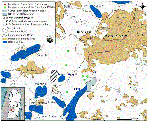
The Bethlehem District is located eight kilometers south of Jerusalem City, in the southern part of the West Bank. It is bounded by the Hebron District to the south and southwest, the Dead Sea to the east, and Israel to the west (Figure 1).
Figure 1 Location map showing the location of Bethlehem District.
The Bethlehem District has a total area of 605 square kilometers, and includes the major municipalities of Bethlehem, Beit Jala, and Beit Sahur, and 27 Jewish colonies. According to the 1997 Palestinian census, the district's total population is 136,517, including 4,905 refugees, as well as around 50,000 Jewish colonists.
Approaching the millenium, the Jerusalem Municipality has committed itself to finishing construction on a military checkpoint between Bethlehem and Jerusalem despite the fact that the new checkpoint admittedly does not have the proper permits. The plan includes the construction of a checkpoint parallel to the existing one, and is meant to be used by Palestinians only so that tourists will be able to use the existing checkpoint without ever encountering the indigenous population.
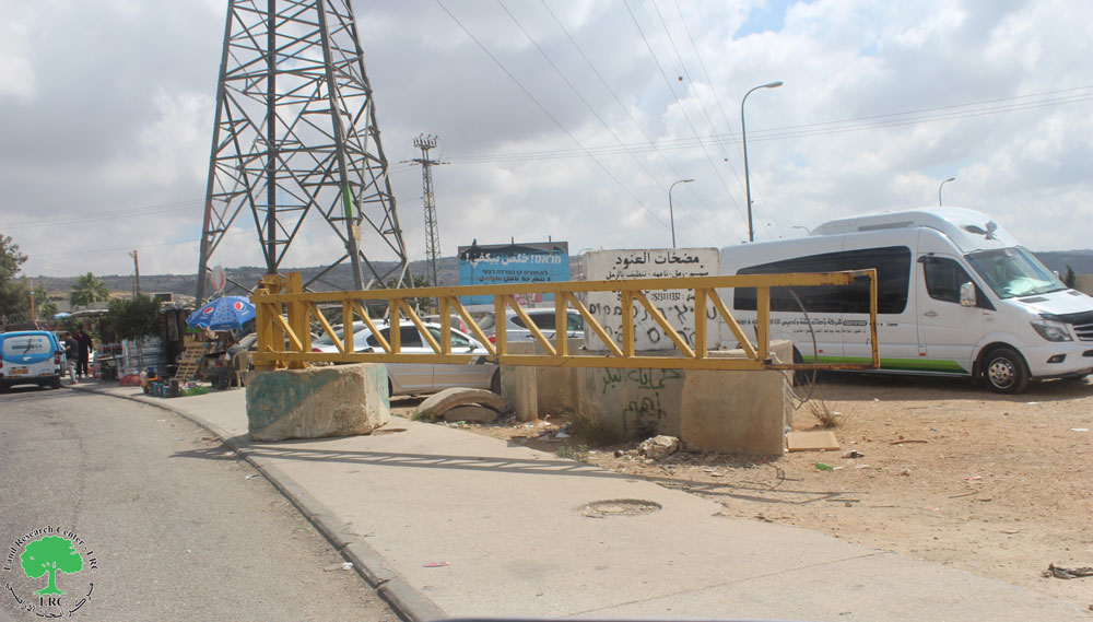
The new checkpoint is modeled to resemble the Erez checkpoint in Gaza, with a 650 meter fenced walking path and a lateral road that will be used to transport Palestinians with valid permits to Jerusalem (Figure 2 —map). Palestinians have to park their cars in a parking lot on the Bethlehem side (Figure 3,4,5-parking), walk the 650 meter distance (Figure 6,7 —–650), and then undergo inspection by Israeli officers before getting on commuter vans taking them to Jerusalem.

Figure 2: The new Israeli scheme for the northern entrance of Bethlehem.
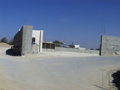

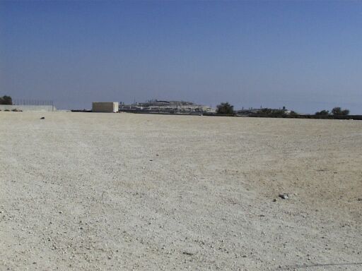
Figure 3,4,5: Scenes from the new Palestinian parking lot
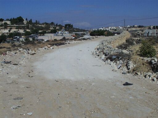

Figure 6,7 The 650 meters walking path.
On October 12, 1999, several Israeli bulldozers prepared the foundation for the new checkpoint and fresh cement was being poured to build a wall around the existing checkpoint (Figure 8). The 650-meter walking path from the parking lot to the new checking point was also opened.
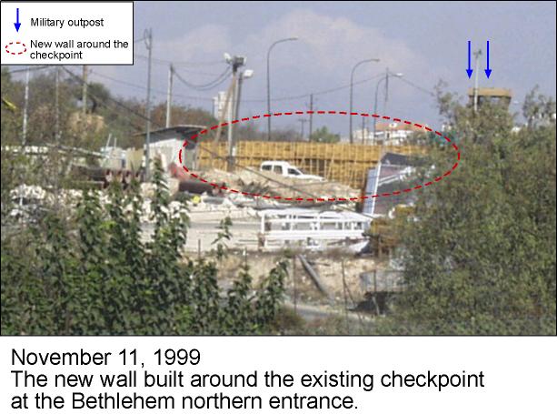
Figure 8: The new wall around the existing checkpoint
In fact, the Bethlehem Municipality owns 27 dunums of property adjacent to the existing checkpoint. Some of the property has already been leveled to make way for the new checkpoint.
It is also of important weight to mention that the construction on Rachel's Tomb, located at the northern entrance of Bethlehem City, is also rapidly continuing. According to the Israeli Civil Administration, the construction on Rachel's Tomb will include a reinforced concrete wall around the holy site (Figure 9, 10) as well as a bridge (Figure 11) to connect the guarded parking lot and military outpost with Rachel's Tomb.


Figure 9, 10 Rachel's Tomb, past & present.
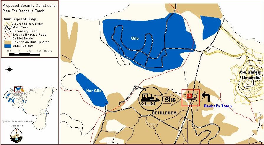
Figure 11: Location of the proposed bridge
This new construction is in addition to the existing military installments (Figure 12) including a security wall and seven guard towers. Once the plan is implemented, the Jerusalem boundary will expand to reach Rachel's Tomb under the auspices of a security zone. The Israeli designs will suffocate Bethlehem and harass the 4000 Palestinians living in the one-kilometer area to be confiscated by Israel. These acts contradict the spirit of agreements acknowledging the Site's special status and the need to maintain special arrangements for the area around it in the final status settlement.
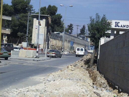
Figure 12: New security wall around Rachel's Tomb
Furthermore, the Israeli violations perpetrated against the nearby Muslim cemetery desecrated the sanctity of that Muslim holy site (Figure 13). On July 19, 1999 Jewish contractors demolished the northern part of the cemetery and its wall near Rachel's Tomb military installation. On August 28, 1999, the Israeli authorities narrowed the entrance of Bethlehem City, through erecting cement constructions beside the wall of the cemetery adjacent to Bilal Ibn Rabah mosque (Figure 14).
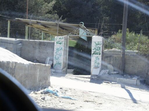
Figure 13: Muslim Cemetry

Figure 14: Israeli construction next to the cemetry
To cut the long short, the execution of the new Israeli plan is provocative and a violation of Palestinian rights. The new checkpoint will incite the confiscation of more Palestinian land and strengthen the policy of Israeli military closure around Jerusalem, which has besieged the Palestinian community. Moreover, the military closure undermines Palestinian national rights to Jerusalem by creating de facto borders before a final status settlement is reached.
Prepared by:
The Applied Research Institute – Jerusalem