Abu Dis: A Palestinian Town Tarred by the Israeli Wall
To the southeast of Jerusalem is where the Palestinian Town Abu Dis is located, a home for more ...
To the southeast of Jerusalem is where the Palestinian Town Abu Dis is located, a home for more ...
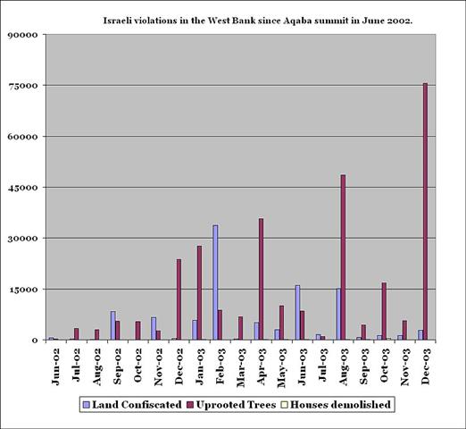
Israel's confiscation of land and properties belonging to the Palestinians in different parts of the Palestinian territories is a dominant ...
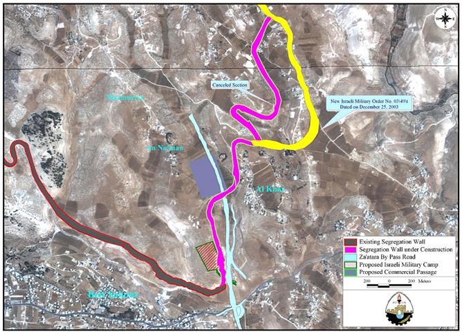
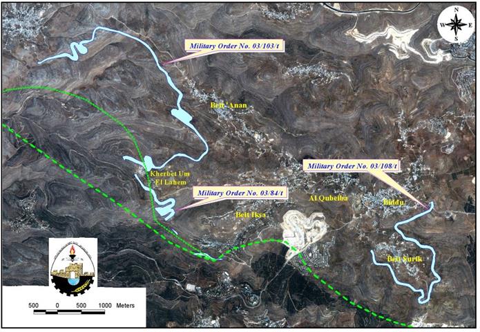
On December 25, 2003, the Israeli Offense Army (IOA) issued a seize order # 03/49T (Judea & Samaria) ...
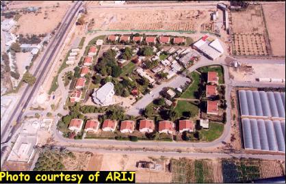
Referring to our report ''New Qiryat Arba' at the northern entrance of Bethlehem city'' published on September 2003, ...
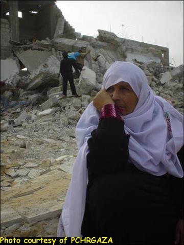
In cooperation with PCHRGAZA ( The Palestinian Center for Human Rights) ( The Palestinian Center for Human Rights) Gaza ...
Welcome to the State of Israel ... under this statement/ announcement Israel is adding yet another obstruction to prohibit foreigners from ...
Following the 1967 war when Israel captured the West Bank, Israel declared vast areas of the West Bank as 'State ...
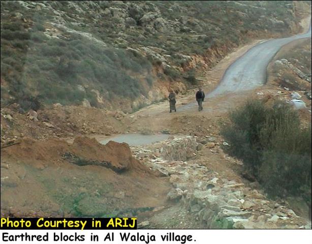
Besides being victims of the Israeli occupation, Palestinians are daily facing the Israeli threat of confiscating their land especially after ...
After launching the Israeli segregation plan to construct the so-called Segregation Wall, Israel has been issuing military orders to annex ...
On January 12, 2004 at approximately 11:30 Am, two of ARIJ Staff were placed in custody during a ...
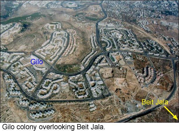
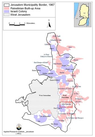
It has always been the case that Jerusalem was, and still is, a dilemma in any vision for a possible ...
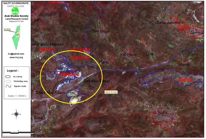
Governorate: Salfit Village: Kifl Haris Location: The village of Kafl Haris is located 6 kilometers to the west of the ...
October - December 2003 This report highlights the chronology of events concerning colonizing activities in the West Bank, Jerusalem ...
Prepared by Jad Isaac, Nael Salman, Nader Hrimat, Khaldoun Rishmawi, Majed Abu Kubi, Iyad Abu Rdeineh, Issa Zboun, Roubina ...
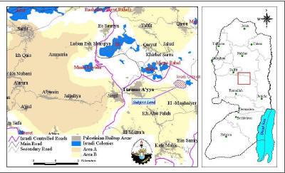
Location: Turmus 'Aya village is located 15.7 km to the northeast of Ramallah district and a built -up area of ...
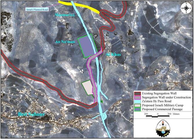
Location and historical background Mazmuria is a small village located on a hill to the south of Jerusalem. It ...
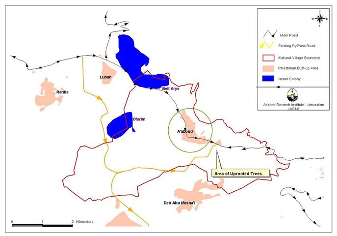
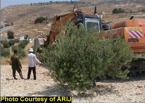
Throughout the years of the Israeli occupation and the day-after-day Israeli colonization activities in the West Bank, fruitful trees ...
The Israeli forces are planning to begin a new Settlement project in Jabal al-Mukabbir to the southeast of Jerusalem. Jabal ...
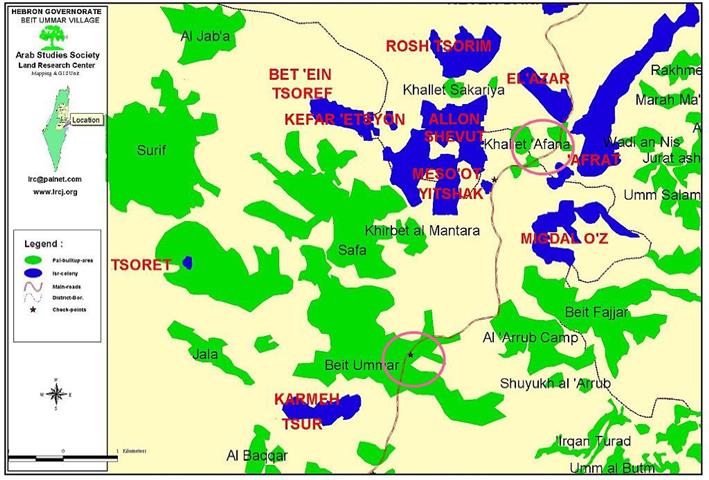
Location: Beit Ummer village is located 12 km to the north of Hebron city. It has a population of 12000 ...
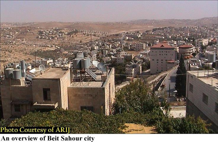
The town of Beit Sahour,''the house of vigilanc'' lies on the northern edge of Bethlehem. It has 14.465 inhabitants, Christians ...
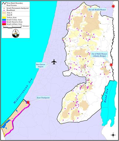
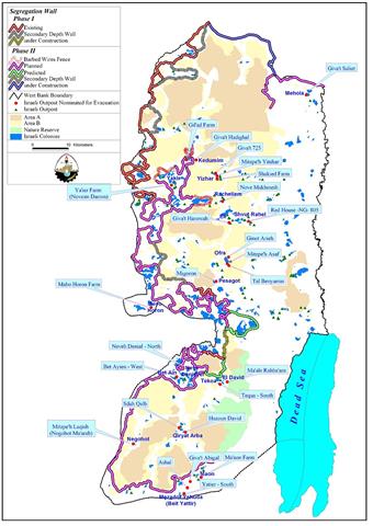
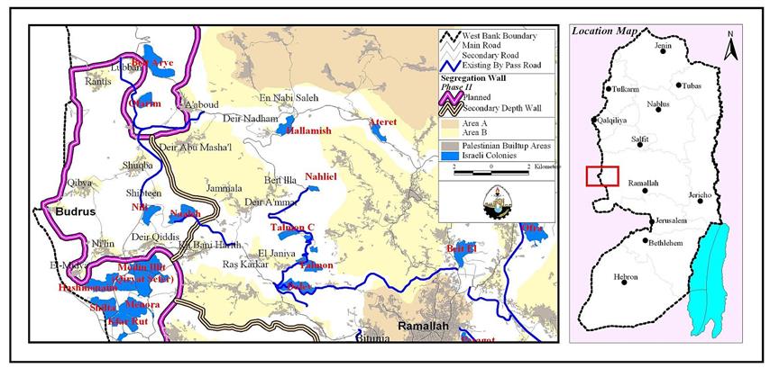
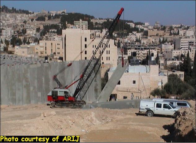
The Segregation Wall which Israel claims necessary to stop Palestinians from entering Israel, runs along the Artimistic line (Green line) ...
On the 23 June 2002, the Israeli government endorsed a plan to build the so-called 'Security wall' running into the ...
This report highlights the chronology of events concerning colonizing activities in the West Bank, Jerusalem and the Gaza ...
Prepared by Jad Isaac, Nael Salman, Nader Hrimat, Khaldoun Rishmawi, Majed Abu Kubi, Iyad Abu Rdeineh, Issa Zboun, Roubina ...
'And the dove came in to him in the evening; and, lo, in her mouth was an olive leaf ...

........................................................

........................................................

........................................................

........................................................

This website and its content were initiated in 1993 by the Applied Research Institute – Jerusalem (ARIJ) and the Land Research Center (LRC) with the support from the European Union up until 2023. Since then, the Applied Research Institute – Jerusalem (ARIJ) has taken over the continued development and maintenance of the website. The views expressed remain solely those of ARIJ) and do not necessarily reflect those of the European Union.