Historic buildings are targeted in Hebron’s Old city
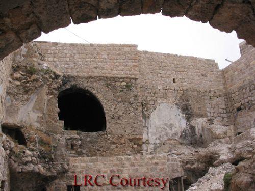
Hebron- Old city- Part of the residential compound threatened with demolition, Photo courtesy of LRC The Israeli occupation forces ...
Hebron- Old city- Part of the residential compound threatened with demolition, Photo courtesy of LRC The Israeli occupation forces ...
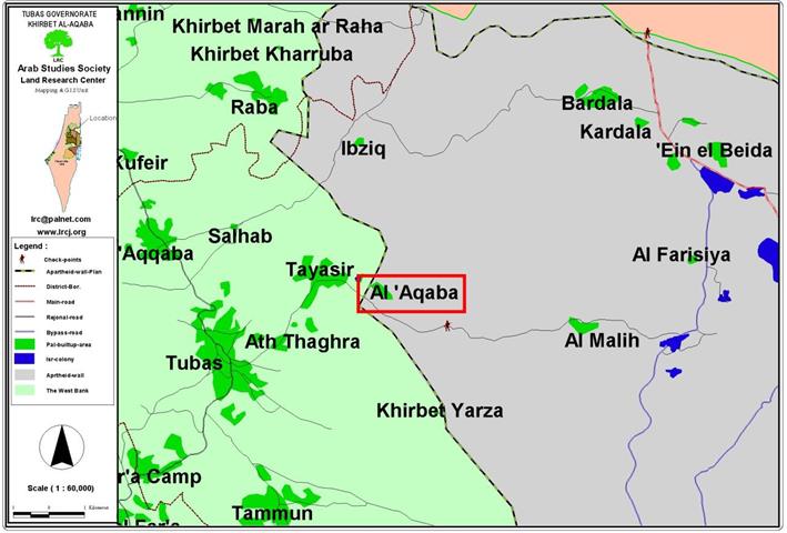
Location and Population: The village of Al Aqaba is located 7 kilometers east of the city of Tubas. ...
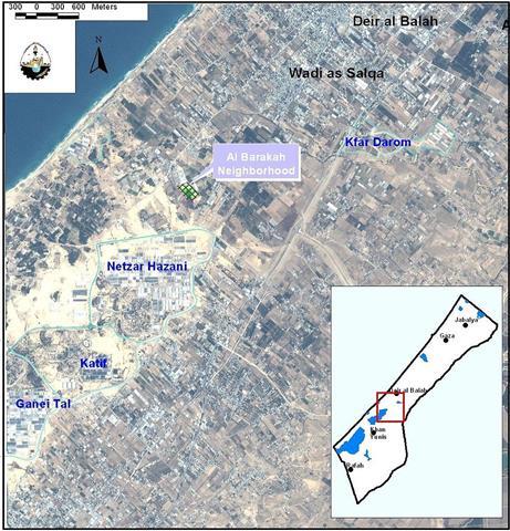
Location: Deir El Balah is a Palestinian city located in the Gaza Strip 14.6km southwest of Gaza city; it has ...
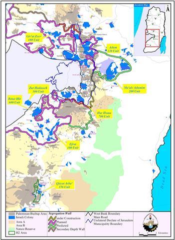
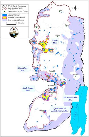
Following the 1967, War, Israel occupied the West Bank including East Jerusalem and Gaza Strip. Israel also started its progressive ...
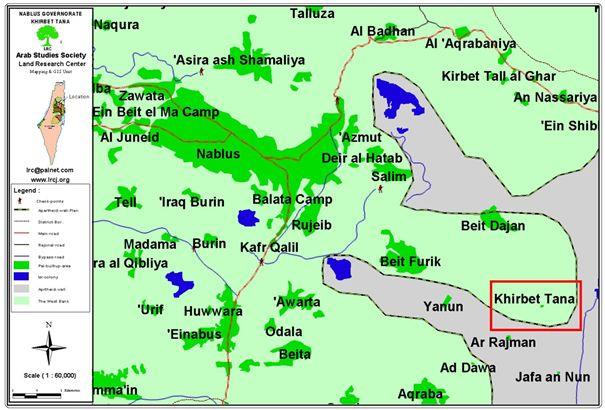
Location and Population Tanna Hamlet is located 7 kilometers to the east of the town of Beit Furik, Nablus. ...
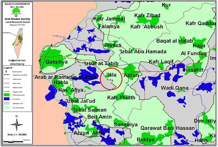
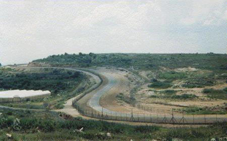
'Eighty percent of the land of Isla village has been confiscated or separated by the Wall construction' Location ...
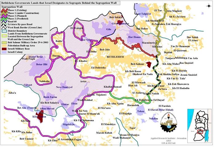
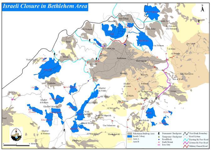
Israeli Show of Force in Bethlehem city For the fourth day in a row, a complete 24-hour curfew is ...
Location and Population: The town of Kafr Thuluth is located 6 kilometers away from the Green Line. Its lands ...
Curfew Continues in Bethlehem Esatern Towns Until yesterday, the Israeli Army had not entered the city center of Bethlehem ...
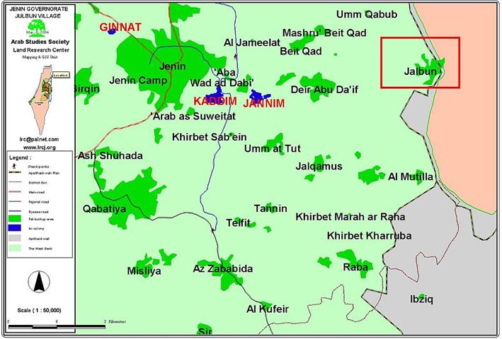
Location and Population: The village of Jalbun is located 12 kilometers to the east Jenin city. It houses a ...
Israeli Prime Minister Ariel Sharon's policy of disengagement and separation is being put into effect in an ever accelerating pace. ...
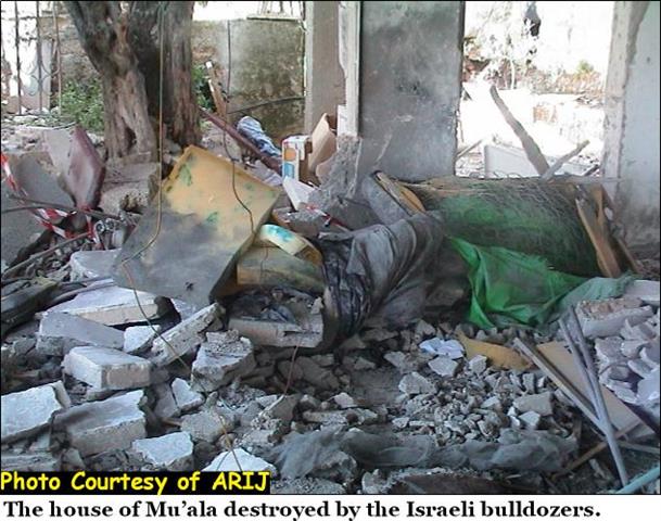
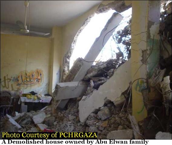
The Israeli Army carried-out early Thursday, April 15, 2004 on 1:00 Am, yet another operation against Palestinian civilians as a ...
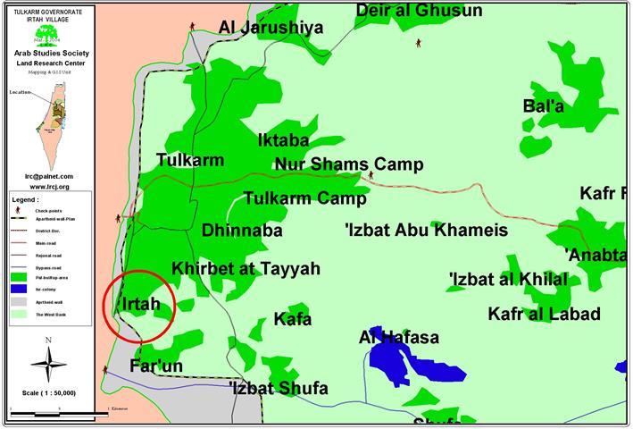
Location and Population: The Tulkarem Neighborhood of Irtah is located exactly at the Green Line which qualified it ...
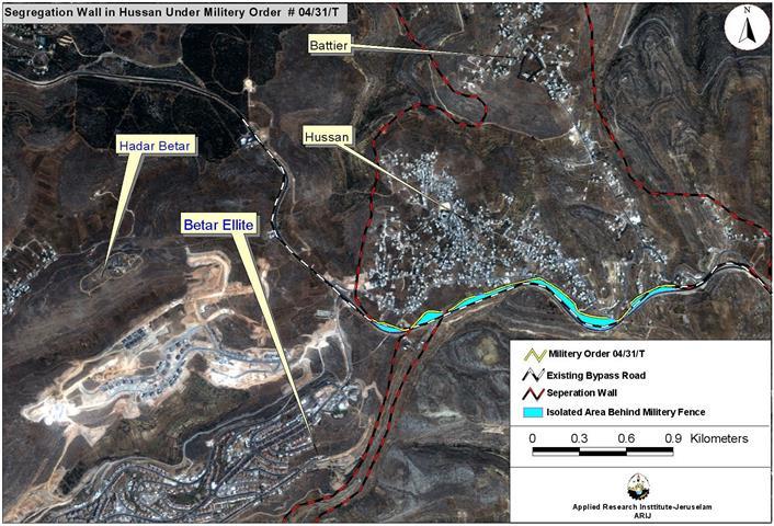
On the dawn of Thursdays April 15, 2004, residents of Husan village were awakening by the thunderous blast of ...
Click to read the article in German Bethlehem is one of the most celebrated cities in the world due to ...
Click to read the article in English Bethlehem ist eine der berühmtesten Städte der Welt, dank der Auszeichnung, die ...
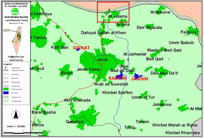
Location and population: The village of Al Jalama is located 6 kilometers to the north of Jenin city, in Jenin ...
In preparing for his trip to Washington to discuss the disengagement plan from the West Bank with the US administration, ...
The town of Beit Jala is located to the west of Bethlehem city and to the southwest Jerusalem district borders. ...
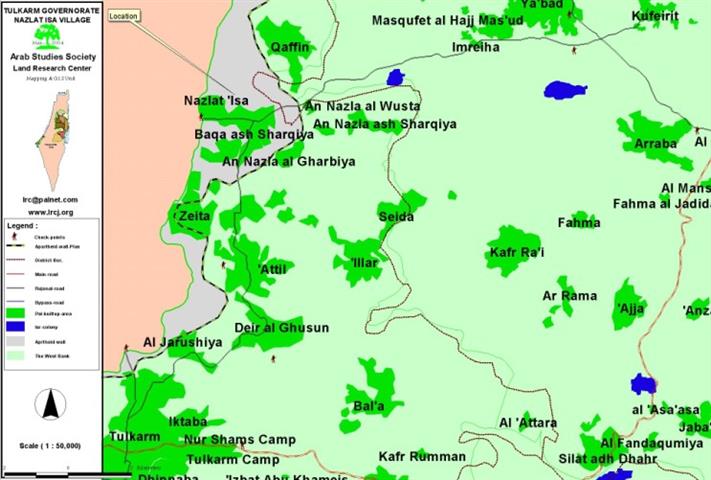
Location and Population The village of Nazlat Isa, which borders the Green Line, is located 18 kilometers to ...
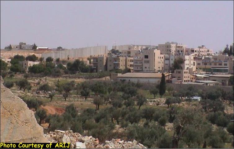
Husan, a rural Palestinian village (population: 5300) located about 7 Km west of Bethlehem district and recently was forcefully enlisted ...
This report highlights the chronology of events concerning colonizing activities in the West Bank, Jerusalem and the Gaza Strip ...
July 2004 - September 2004 This report highlights the chronology of events concerning colonizing activities in the West Bank, ...
Camp and Location Khan Yunis camp is located west of Khan Yunis town, at the southern part of the ...
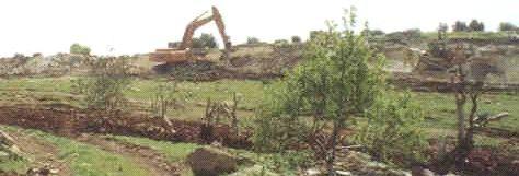
Photo 1: Wadi Shubash-Metulla- Jenin: Israeli large hammers and bulldozers leveling the land and uprooting trees for Wall construction ...

........................................................

........................................................

........................................................

........................................................

This website and its content were initiated in 1993 by the Applied Research Institute – Jerusalem (ARIJ) and the Land Research Center (LRC) with the support from the European Union up until 2023. Since then, the Applied Research Institute – Jerusalem (ARIJ) has taken over the continued development and maintenance of the website. The views expressed remain solely those of ARIJ) and do not necessarily reflect those of the European Union.