Wadi Qana polluted by Israeli settlements
( Photo 1: in the background is the settlement of Emmanuel, in the foreground is the swage water canal coming from ...
( Photo 1: in the background is the settlement of Emmanuel, in the foreground is the swage water canal coming from ...
( Photo 1: in the background is the settlement of Emmanuel, in the foreground is the swage water canal coming from ...
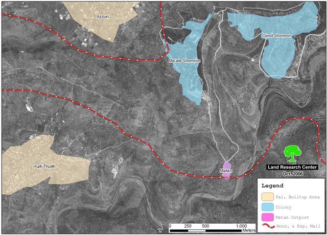
Israeli settlers from Matan colonial outpost started to bulldoze Palestinian land in Wadi Al Qari' site, basin number 7 of ...
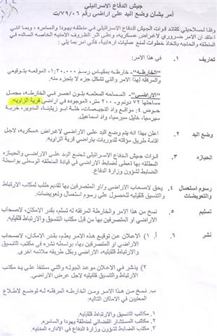
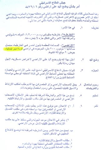
The Israeli occupation army in the West Bank issued last month military decree number T/79/06 stating the confiscation of 72 ...
As a result of the ongoing colonial program against the lands of Deir Istiay village, Salfit governorate, about 20% of the ...
Even-though the consecutive Israeli governments were well aware that settlements establishment and expansion stands as a greave breach and violation ...
The Israeli hunger for Palestinian lands has no limits. It is rarely that a day passes with the occupation carrying ...
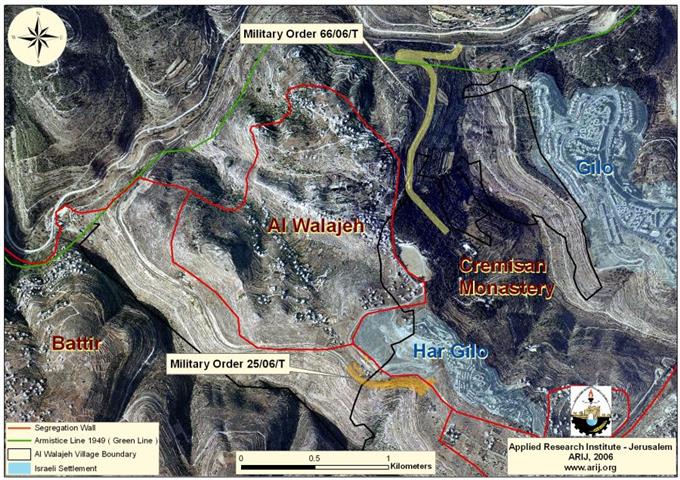
Al Walajeh village lies about 9 kilometers to the southwest of Jerusalem city with a total of 1695 inhabitants (PCBS ...
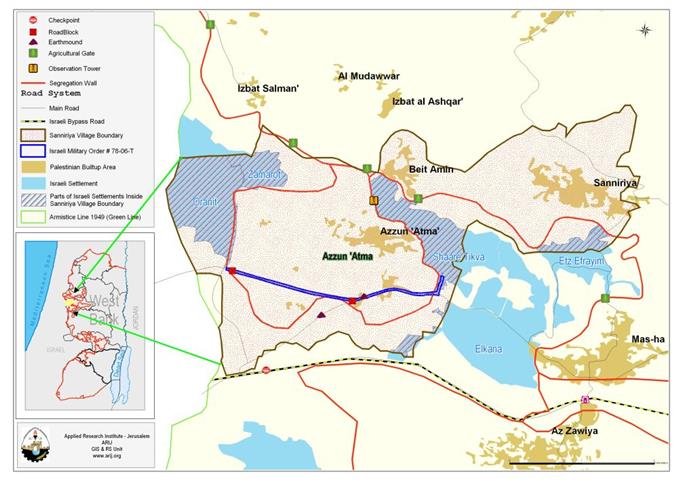
'Azzun 'Atma : location and Population The village of 'Azzun 'Atma (population 1791-PCBS 2005) is located about (2.75 km) ...
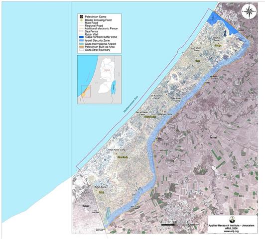
The Gaza strip is once again facing a prolonged period of closure, which is crippling the economy, and contributing to ...
On September 4, 2006, the Israeli Forces tossed in the fields of Al Khader and Artas villages a new military ...
Photo 1: Adhahiriay, Hebron: Part of the road opened near Tel ar Rahwa) Photo courtesy of Adhahiriay municipality Israeli ...
On the 5th of September 2006, the Israeli Army handed out residents from Bethlehem and Hebron Governorates new military order ...
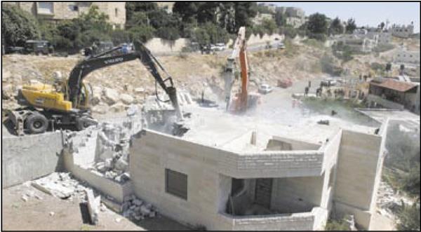
Photo 1: Jabal Al Mukaber- Jerusalem: Israeli bulldozers knocking down the Zahaika family's houses) Photo courtesy of Al- Quds newspaper ...
Photo 1: Bab Al Hawa- Beit Hanina: the wreckage of the 3 two-storey buildings of Abu 'Arafa family ...
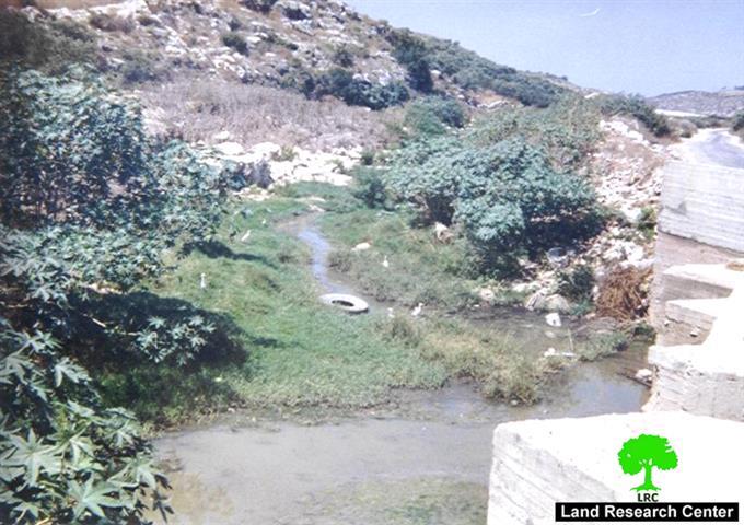
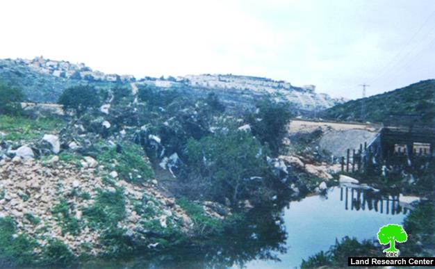
Photo 1: Wadi Beit Amin, Qalqiliya: Palestinian agricultural land flooded with swage water from Israeli settlements Waste and swage ...
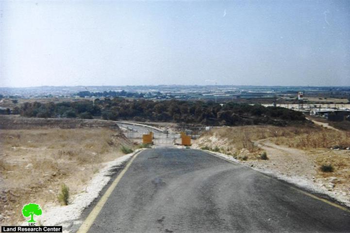
Photo1: Far'un, Tulkarem: an olive orchard field is threatened by the closure of gate number 708 seen in the forefront ...
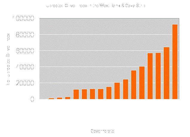
Overview: The Olive tree, signify history, tradition and a long relation between the farmer and the land, other than that, ...
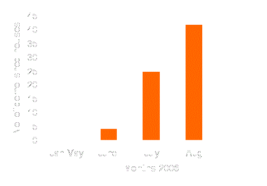
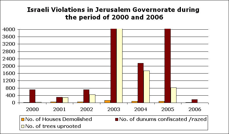
Introduction:- During the course of the Al-Aqsa Intifada, which erupted back in September 2000, Israel adopted unprecedented house destruction policy ...
Background Jannata municipality is an assembly of Palestinian villages/ communities, located south of Bethlehem city, in the southern part of ...
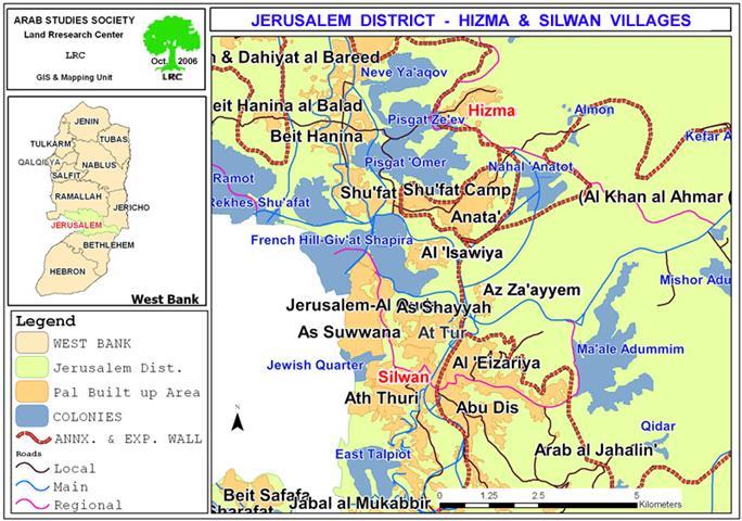
Residents Hizma village recently discovered that the checkpoint that separates them from Jerusalem would is to be transformed into a ...
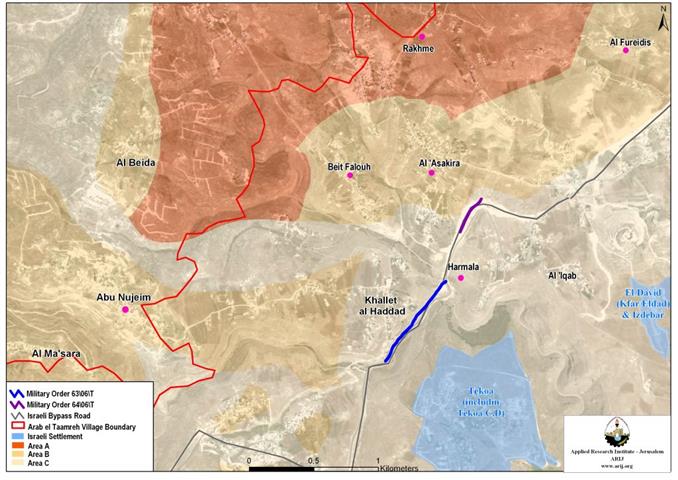
Some 12 Km southeast of Bethlehem city, lays Teqou village (population; 6,669 (PCBS-2005), became a target of the Israeli colonization ...
Ethnic Cleansing is the term that describes the Israeli practices in the Gaza Strip and the West Bank. Since the ...
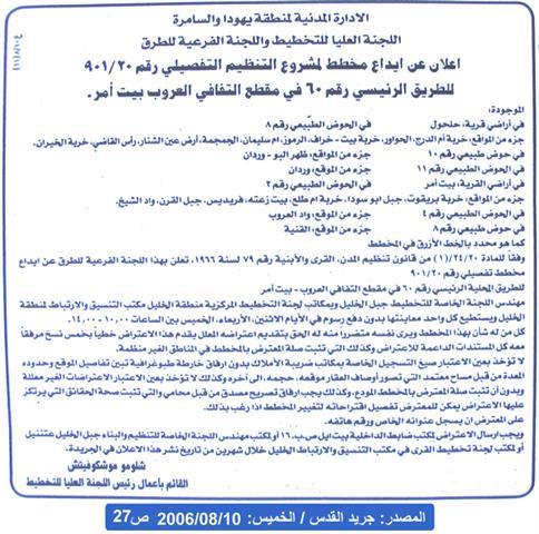
أصدرت قوات الاحتلال الإسرائيلي أمراً عسكرياً جديداً في محافظة بيت لحم بهدف الاستيلاء على ما مساحته 102 ...
The Israeli supreme committee for planning and the sub-committee for roads affiliated to the so-called Israeli 'civil administration in Judea ...

........................................................

........................................................

........................................................

........................................................

This website and its content were initiated in 1993 by the Applied Research Institute – Jerusalem (ARIJ) and the Land Research Center (LRC) with the support from the European Union up until 2023. Since then, the Applied Research Institute – Jerusalem (ARIJ) has taken over the continued development and maintenance of the website. The views expressed remain solely those of ARIJ) and do not necessarily reflect those of the European Union.