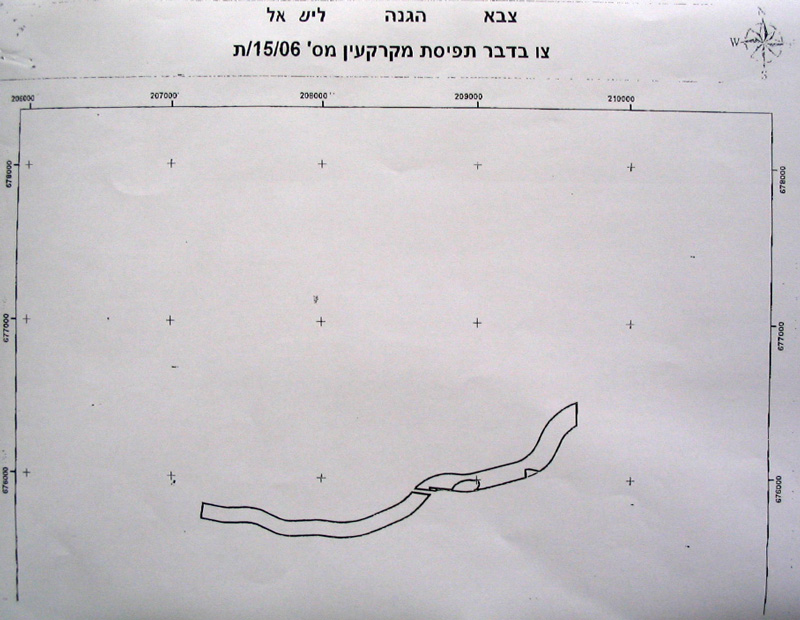
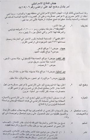
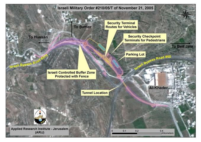
At the beginning of the current month (February 2006) the Israeli occupation authorities issued military order number T/15/06 stating the confiscation of 279 dunums from Qalqiliya and Salfit lands for the purpose of constructing a new stage of the Segregation Wall.
According to the order, a total of 279 dunums of lands will be confiscated for this purpose from the four Palestinian villages, Hajja, Qalqiliya (basin # 2 and 9); kafr Laqif, Qalqiliya (basin # 4 and 1); Deir Istiya, Salfit (basin # 18) and Azzun, Qalqiliya (basin # 2). The planned wall route is about 2.800 meters long and between 580100 meters wide. The above number doesn�t include the land that will be segregated behind the Wall which is estimated at thousands of dunums. See Copies of Military Order


(Photos 1, 2 & 3 : copies of the military order and the attached maps)
Location, population and area
The following table provides information about the four Palestinian villages by Location, population and area:
|
No |
Village name |
Location |
Population |
Area in dunum |
|
|
|
|
|
|
Total |
Built up |
|
1 |
Hajja |
Qalqiliya |
2444 |
11717 |
932 |
|
2 |
Kafr Laqif |
Qalqiliya |
951 |
2579 |
298 |
|
3 |
Azzun |
Qalqiliya |
7985 |
9140 |
1525 |
|
4 |
Deir Istia |
Salfit |
3730 |
34000 |
900 |
|
|
Total |
|
15110 |
|
|
Source: Palestinian Central Bureau of Statistics � Population Projection 2005
The Wall route is planned to penetrate through the lands of these four Palestinian villages so as to complete the bordering of the biggest finger-like corridor of 'Ariel settlement bloc.' in the West Bank which aims at ensuring the annexation of all Israeli settlements in the area. This finger- like corridor includes 15 Israeli settlements al located within the bloc. : Ariel, Neve Oranim, Carnei Shomron, Ginnot Shomron, Ma'ale Shomron, Immanuel, Nufim, Yakir, Qiriat Notifim, Revava, Barqan, Alei Zahav ( Yo'ezer), Pedu'el, Beit Arie and Ofarim. See Map 1
Map 1: The Wall route over the lands of the four villages
Map prepared by LRC
The Ariel finger like corridor will result in the annexation of thousands of dunums of Palestinian lands and dozens of underground water wells which, in effect, will cause disastrous impact on the very existence and welfare of Palestinian people in the area. The construction of the segregation wall around Ariel bloc started at the beginning of 2003.
The following are some of the impacts caused or to be caused to Palestinian citizens as a result of the construction of the Segregation Wall in this area
-
Bulldozing thousands of dunums of olive orchards considered to be the only source of living for Palestinian families, particularly, after loosing jobs inside Israel;
-
The difficulty of accessing into agricultural lands which have been already separated behind the Wall;
-
Giving Israeli settlers in the area a wide scale space of land for expansion and development at the expense of Palestinian land and future development.
-
The above mentioned Wall section between the villages of Azzun and Kafr Laqif will cut main road number 55 linking between the cities of Qalqiliya and Nablus. The Palestinian movement on this road will be under the mercy of the Israeli army who plan to establish a permanent checkpoint comprised of an iron gate and watch towers. No Palestinian will be able to pass without having valid passing permits from the Israeli military.
Prepared by
The Land Research Center
LRC


