• About The Project
  • Palestine in Century
  • Selected Maps
  • Glossary
  • About ARIJ
  • About LRC
  • By Year
    • Case Studies By Year
    • Daily Report By Year
Tuesday, June 9, 2026
POICA
No Result
View All Result
  • Home
  • Settlements
    • New Israeli Settlements
    • Settlement Expansion
  • Israeli Violations
    • Agriculture
    • Confiscation
    • Demolition
    • Environment
    • Eviction of Palestinians
    • Settlers Attacks
  • Bypass Roads
  • Israeli Plans
  • Segregation
    • Checkpoints
    • Closure
    • Separation Plans
  • Military Orders
  • Reports
    • Daily Report
    • Monthly Report
    • Quarterly Report
No Result
View All Result
POICA
No Result
View All Result

Evacuation Notices in Khirbit Tana in Beit Furik

May 28, 2010
in Military Orders
Evacuation Notices in Khirbit Tana in Beit Furik
Violation: issuing 3 evacuation orders against 3 structures in Khirbit Tana.
Date: April 21 and May 3, 2010.
Violators: the Israeli Occupation Army – the Construction and Organization Committee.
Victims:  a number of residents of Khirbit Tana.
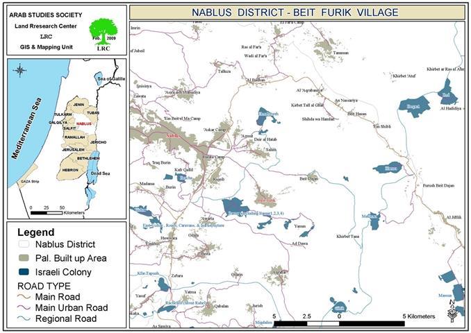
Location: Khirbit Tana is located 14 km to the east of Nablus city, Northern West Bank.


Most of the inhabitants of Tana are immigrants from Beit Furik who left years before the Israeli Occupation. Nowadays, more than 50 families, totaling around 300 people, reside in the village. Residents of Tana largely depend on farming and herding as their main sources of living.


Picture 1: Khirbit Tana
Details: 
On April 21, 2010, the so-called Construction and Organization Committee issued military orders demanding immediate dismantle of number of the simple structures in Khirbit Tana.
 
On May 3, 2010, the Israeli Occupation Army issued a demolition Order against a house in Tana, saying that the house is built ‘without permit’ in area classified ‘C’ according to Oslo Agreement.  The Israeli Army offered the owners 24 hours leeway before carrying out the order, or else, it will face the same destiny of tens of structures that were previously demolished.
 
The Israeli Occupation Authorities do not recognize the residents’ right to residency despite the fact that they have deeds proving their ownership of the land and despite living there long before the Israeli conquest of the West Bank in 1967. It must be known that ALL of the structures in Khirbit Tana have previously received either demolition or evacuation orders.
 
No.
Victim
Area (m2)
Type of Order
Type of Structure
1
‘Atif Hanani
60
Halt Construction
Residential
2
Shahir Hanani
40
Evacuation (military zone)
agricultural
3
Najih Fatafta
45
Evacuation (military zone)
agricultural
Total
145


The Orders  1-3
 
It must be known that the lands of Beit Furik as well as Khirbit Tana are lands registered officially in the records of previous sovereigns of the area, the Jordanians and the Ottomans.
 
Beit Furik is one of the most fertile parts of the West Bank which makes a constant target for the greedy Israeli colonists. Since the occupation of the WB, the Israeli expropriated more than 50% of the village lands, a total of 18000 dunums.
 
Soon after controlling the lands of Beit Frik, the Israeli Occupation Authorities commenced laying foundation for the colony of ‘Makhora’ as well as placing a military outpost in the area.
 
It is known that Khirbit Tana was never spared from the Israeli colonists’ aggressions against its residents and structures. Such aggressions are coordinated between the colonists and the Israeli Army which provide full protection for the colonists no matter how hostile the aggressions are.
 
On February 2009, the Israeli Supreme Court ordered the demolition of all the structures in Tana and the complete evacuation of its dwellers. Moreover, it ordered the confiscation of more than 30% of its total area (6000 dunums located in area classified ‘C’ according to Oslo agreement).
 
Regardless of the fact that Tana has been inhabited long before the occupation, the Israeli Civil Administration refuses to let the residents live in peace and refuses to allow them to make necessary expansions of the village.
 
The villagers in Tana live in blocks houses, metal houses, and caves. There is a simple school and a tiny mosque in the village. It must be known that a number of the village residences were demolished by the Israeli Occupation in 2005.
 
On January 20, 2010, Israeli Army dozers demolished 30 agricultural and residential structures in Khirbit Tana, the consequences of such action were:
1.     The destruction of 30 structures with a total area of 1183 m2.
2.     Rendering more than 50 people (including 30 children) homeless.
3.     Depriving more than 20 students from their right to proper education.
4.     Tens of animals were left shelter-less.
5.     The destruction of the only active society in the village.
Basically, Khirbit Tana drastically suffers from the lack of organizational plans where it is included. Whereas, Israeli colonies have proper plans made ready for them and implemented on Palestinian lands.
 
The Israeli Authorities never hesitate to demolishing the houses of the owners of the lands, the Palestinians. On the other hand, it offers all the needed financial, organizational, logistic, support to the non-owners, the intruders, expanding on Palestinian lands.


Prepared by
The Land Research Center
LRC


Recommended For You

سلطات الاحتلال الإسرائيلي بصدد الاستيلاء على موقع قبر النبي صموئيل شمال غرب مدينة القدس

by arij
May 23, 2026
0
سلطات الاحتلال الإسرائيلي بصدد الاستيلاء على موقع قبر النبي صموئيل شمال غرب مدينة القدس

 نشرت سلطات الاحتلال الإسرائيلي في الثامن عشر من شهر أيار من العام 2026 اعلانا مفاده الاستيلاء على الأراضي الفلسطينية في قرية النبي صموئيل شمال غرب القدس المحتلة. وجاء...

Read moreDetails

إقامة منطقة عسكرية عسكرية داخل أراضي (أ) في جنين

by arij
May 19, 2026
0
إقامة منطقة عسكرية عسكرية داخل أراضي (أ) في جنين

   في السابع من شهر أيار من العام 2026، وزعت سلطات الاحتلال الإسرائيلي أمرا عسكريا جديدة على أهالي مدينة جنين يقضي بمصادرة 7.2 دونما من الأراضي الفلسطينية في...

Read moreDetails

“بمساحة اجمالية 177 دونما من أرضي البيرة وبيتين”, طريق استيطاني لخدمة البؤر الاستيطانية في محافظة رام الله

by arij
May 18, 2026
0
“بمساحة اجمالية 177 دونما من أرضي البيرة وبيتين”, طريق استيطاني لخدمة البؤر الاستيطانية في محافظة رام الله

في الحادي عشر من شهر أيار من العام 2026, نشرت دائرة أراضي إسرائيل اعلانا جديدا يقضي بمصادرة المزيد من الأراضي الفلسطينية في محافظة رام الله لأغراض استيطانية في...

Read moreDetails

“في خدمة مستوطنة ناحال حيلتس”, طريق استيطاني إسرائيلي جديد على أراضي بتير وبيت جالا في محافظة بيت لحم

by arij
May 18, 2026
0
“في خدمة مستوطنة ناحال حيلتس”, طريق استيطاني إسرائيلي جديد على أراضي بتير وبيت جالا في محافظة بيت لحم

تواصل سلطات الاحتلال الإسرائيلي إحكام سيطرتها على المزيد من الأراضي الفلسطينية في الضفة الغربية المحتلة، وهذه المرة من خلال استهداف أراضي محافظة بيت لحم. ففي السادس والعشرين من...

Read moreDetails

مناطق نفوذ المستوطنات ودورها في إعادة تشكيل الجغرافيا الفلسطينية

by arij
April 23, 2026
0
مناطق نفوذ المستوطنات ودورها في إعادة تشكيل الجغرافيا الفلسطينية

أصدرت سلطات الاحتلال الإسرائيلي في العاشر من شهر نيسان 2026 الكراسة رقم (273)، وهي وثيقة تضم مجموعة من المناشير والأوامر والتعيينات الإسرائيلية المتعلقة بالجوانب الأمنية والعسكرية والإدارية، إضافة...

Read moreDetails
Next Post
إخطارات بالإخلاء لثلاث منشآت في خربة طانا في بلدة بيت فوريك

إخطارات بالإخلاء لثلاث منشآت في خربة طانا في بلدة بيت فوريك

LATEST NEWS

سلطات الاحتلال الإسرائيلي بصدد الاستيلاء على موقع قبر النبي صموئيل شمال غرب مدينة القدس

سلطات الاحتلال الإسرائيلي بصدد الاستيلاء على موقع قبر النبي صموئيل شمال غرب مدينة القدس

by arij
May 23, 2026
0

........................................................

إقامة منطقة عسكرية عسكرية داخل أراضي (أ) في جنين

إقامة منطقة عسكرية عسكرية داخل أراضي (أ) في جنين

by arij
May 19, 2026
0

........................................................

الآثار كأداة للضم الزاحف: مشروع القانون الإسرائيلي لإعادة هندسة الجغرافيا والهوية في الضفة الغربية

الآثار كأداة للضم الزاحف: مشروع القانون الإسرائيلي لإعادة هندسة الجغرافيا والهوية في الضفة الغربية

by arij
May 23, 2026
0

........................................................

النكبة الفلسطينية في ذكراها الثامنة والسبعين: من التطهير العرقي إلى الإبادة وإعادة هندسة الجغرافيا الفلسطينية 

النكبة الفلسطينية في ذكراها الثامنة والسبعين: من التطهير العرقي إلى الإبادة وإعادة هندسة الجغرافيا الفلسطينية 

by arij
May 18, 2026
0

........................................................

flag_yellow_lowEU-PfP-Logo

This website and its content were initiated in 1993 by the Applied Research Institute – Jerusalem (ARIJ) and the Land Research Center (LRC) with the support from the European Union up until 2023. Since then, the Applied Research Institute – Jerusalem (ARIJ) has taken over the continued development and maintenance of the website. The views expressed remain solely those of ARIJ) and do not necessarily reflect those of the European Union.

© 2026 Copyright | ARIJ | All Rights reserved.

No Result
View All Result
  • Home
  • Settlements
    • New Israeli Settlements
    • Settlement Expansion
  • Israeli Violations
    • Agriculture
    • Confiscation
    • Demolition
    • Environment
    • Eviction of Palestinians
    • Settlers Attacks
  • Bypass Roads
  • Israeli Plans
  • Segregation
    • Checkpoints
    • Closure
    • Separation Plans
  • Military Orders
  • Reports
    • Daily Report
    • Monthly Report
    • Quarterly Report

© 2026 Copyright | ARIJ | All Rights reserved.