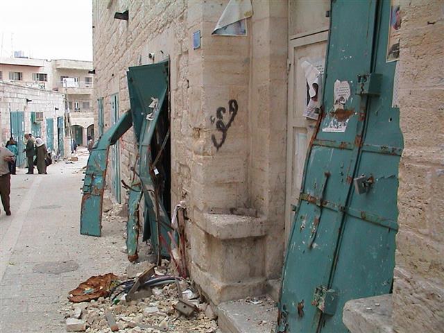
The villages of Al-Khas and Al-Nu'man are located at the interconnection of the municipality borders of Bethlehem, Beit Sahour and Jerusalem. The two villages have about 230 residents, and an area of 5000 dunums of very fertile agricultural lands. The area has not faced urban problems as it is decentralized from the above-mentioned cities. Unfortunately, today the villages are living a daily threat by the Segregation Wall, the so-called Israeli security 'Envelope of Jerusalem' that isolates Al-Nu'man (also called Mazmouria) and cuts off Al-Khas from its lands. See Photo 1
The suffering of the two villages started in the year 1992 when the Israeli municipality of Jerusalem and the Israeli Ministry of Interior prohibited the people from building new houses in the area. The reason was the claim villagesâ?? lands to be inside the Israeli redefined borders of the Jerusalem Municipality, in spite of the fact that the inhabitants are holding Palestinian IDs. See map of Jerusalem municipality borders

In the year 1996, the Israeli Ministry of Education decided to dismiss the students of Al-Khas and Al-Nu'man from the schools of Um Tuba and Sur Baher in East Jerusalem as they hold Palestinian IDs; in that the Israelis declared the area as part of Jerusalem municipality borders without admitting the residents civil rights. Furthermore, the main road that was leading to Sur Baher in East Jerusalem was closed, pushing the people to open an alternative road which was frequently blocked by the IOF.
The water networks of the two villages were destroyed by the Israeli Occupation Forces-IOF-, claiming that they are not allowed to get water from the West Bank because they are included within the New Jerusalem municipality boundaries. At the same time, the Jerusalem municipality refused to provide them with water networks under the pretext that the area is unregulated and is classified as green area. The Palestinian Authority provides most of the facilities such as electricity, telephone cables and water to the residents, but the Israeli Authorities interferes by cutting or by limiting the use of these facilities.
The IOF worked to depopulate part of the residents by preventing them from building new houses. Such actions obliged a large number of the young couples to leave and build outside the village boundaries.
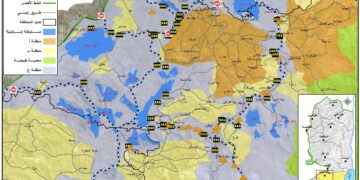
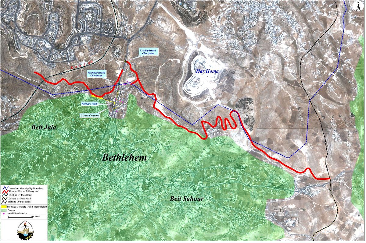
Now, the Israeli Authorities are constructing the segregation wall around Bethlehem district. The path of the military fenced road that represents the Segregation Wall in Bethlehem district is going to totally Isolate Al-Nu'man village as well as the agricultural lands of Al-khas. The total area of the two villages including the agricultural lands is about 5000 dunums of which 3000 dunums are going to be isolated behind the wall. See map of Fence..
At the beginning of April 2003 a man called Davir came to Al-Nu'man village saying that he is working in a coordinating institution between the Ministry of Housing and the Ministry of Defense. He was accompanied by Israeli soldiers and they asked for the names of house owners and their IDs. Davir said to the residents that their existence in that area is illegal and wrong, and that they should leave the whole area as it is located on the borderline between 'Jerusalem' and the Palestinian Authority. Also, he mentioned that 12 houses are going to be demolished. Moreover, the owners of homes that were built before 1993 are to leave their homes and to accept compensation.
The residents of Al-Nu'man managed to see the map that was with the Israeli soldiers and found that the Segregation Wall contains no gates or passages to their village, in addition there are two by-pass roads that will pass through the area. As a result the people will be totally isolated between the Segregation wall and the two by-pass roads. See Map of area
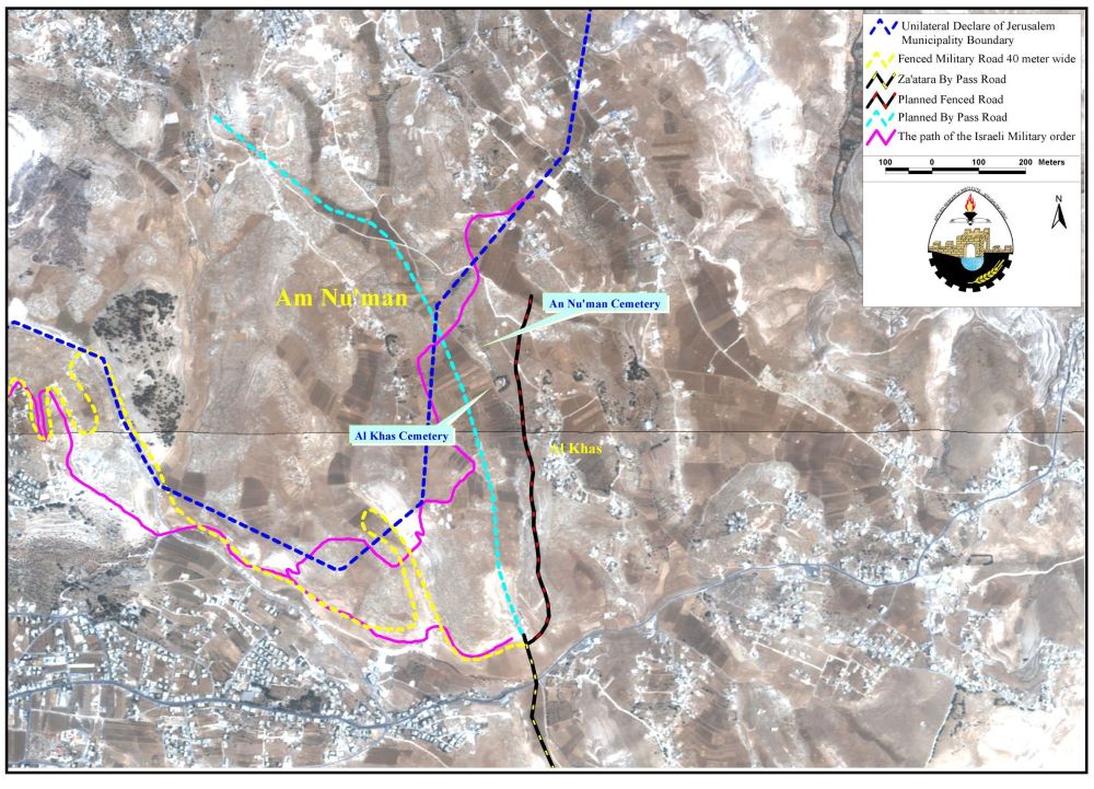
Al-Nu'man, also called Mazmouria, will be totally isolated behind the Segregation Wall without having any gate or corridor that may lead to the village, which has 25 houses sheltering 150 people. Al-Khas will loose a major part of its agricultural lands as well as the village's cemetery behind the fence. In other words, the previously mentioned places will be separated from the village's built-up area. The two villages have an area of 5000 dunums of land including the built-up area and the agricultural lands; due to the facts explained above around 3000 thousand dunums of land will be isolated behind this Segregation Wall. Za'tara by-pass road will pass through the two villages and will enclose about 400 dunums between itself and the Segregation Wall creating what is called a security or a buffer zone.
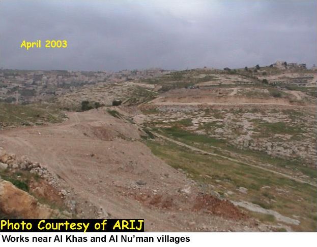
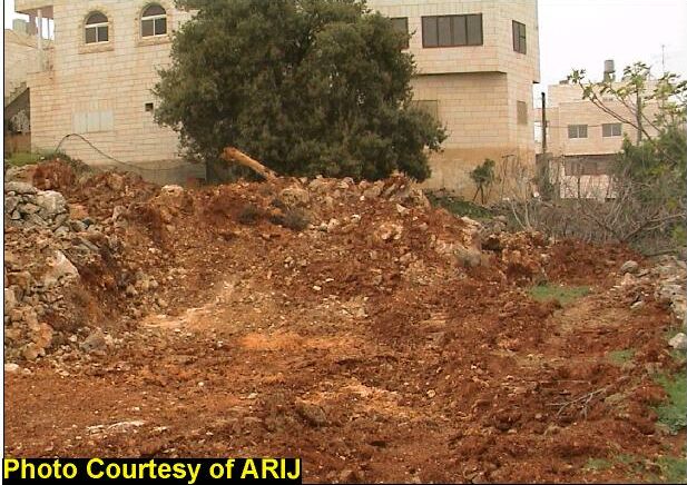
Asphyxiation is the method used by the Israeli's in order to oblige more and more Palestinians to leave their homeland; depriving the Palestinians from any open space for future urban expansion, condensing them in limited geographic areas, cutting them off their relatives on the other side of the wall and pushing them to indirect forced eviction or immigration. This method is to lead the Israelis into controlling more private property lands without its original Palestinian owners as in the case of Al-Khas and Al-Nu'man and other villages in the northern districts of the West Bank isolated or affected of the wall. Finally, the Israelis are rejecting all UN Resolutions and international laws by affirming East Jerusalem to be a part of the Israeli Jerusalem and not a shared Jerusalem making no possibility for the vision of two states solution. See Photo 2 & Photo 3
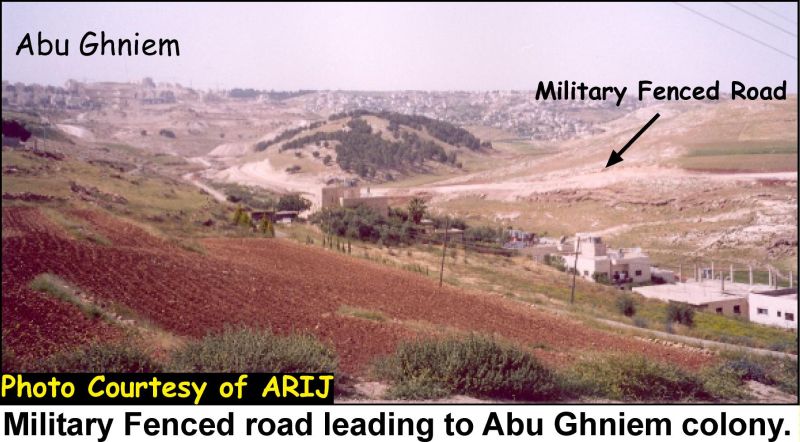
The road continues to link Abu Ghniem settlement as seen in Photo 4.
Prepared by:
The Applied Research Institute – Jerusalem