• About The Project
  • Palestine in Century
  • Selected Maps
  • Glossary
  • About ARIJ
  • About LRC
  • By Year
    • Case Studies By Year
    • Daily Report By Year
Tuesday, August 12, 2025
POICA
No Result
View All Result
  • Home
  • Settlements
    • New Israeli Settlements
    • Settlement Expansion
  • Israeli Violations
    • Agriculture
    • Confiscation
    • Demolition
    • Environment
    • Eviction of Palestinians
    • Settlers Attacks
  • Bypass Roads
  • Israeli Plans
  • Segregation
    • Checkpoints
    • Closure
    • Separation Plans
  • Military Orders
  • Reports
    • Daily Report
    • Monthly Report
    • Quarterly Report
No Result
View All Result
POICA
No Result
View All Result

Khallet Hamameh: another expansion of Jerusalem municipality boundaries

June 3, 2004
in Israeli Plans
Khallet Hamameh: another expansion of Jerusalem municipality boundaries

Expanding the municipality borders of Jerusalem city is one of the goals Jerusalem Israelization. Today, through the implementation of the Segregation Wall, Israel is annexing as much land as possible from the West Bank, mainly to expand the Israeli municipality borders of Jerusalem. Vast areas of East Jerusalem were unilaterally annexed after the 1967 war, and many areas were declared as part of Jerusalem while they belong originally to Bethlehem and Ramallah districts, Khallet Hamameh near Beit Jala adjacent to Ayda camp along with Al Nu'man and al Walaja villages is a clear example.


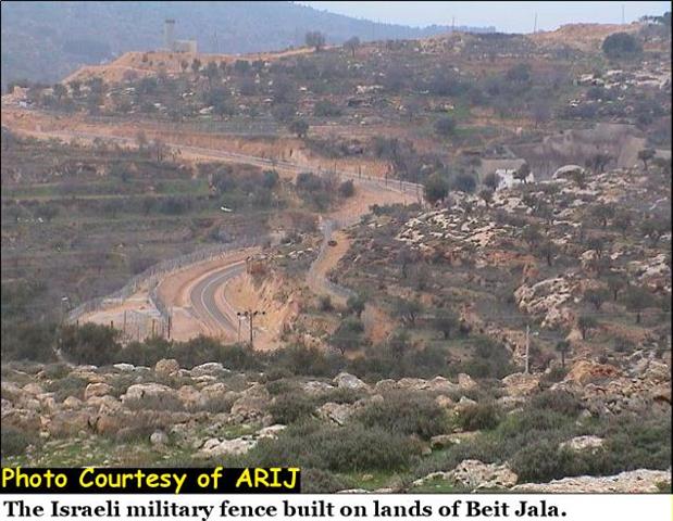
Khallet Hamameh, an area located between Ayda refugee camp and Beit Jala, it was declared as part of Jerusalem municipality borders after the annexation of East Jerusalem, but not all residents were considered as Jerusalemites. Today, the Segregation Wall is being built along the illegally expanded boundaries declared by Israel after the year 1967 and Palestinian residents are facing the threat of being considered as 'illegal dwellers' in their lands and homes. See pictures of the Segregation Wall constructed on Lands of Beit Jala.


Photo 1, Photo 2 & Photo 3

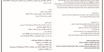
I'miah, a Palestinian family, is one of the cases facing the threat of loosing its land. The family has documents that prove its ownership of the land. See Doc 1 & Doc 2


I'miah's property includes an old house built in the heart of a five dunums land. See photo 4 & Photo 5


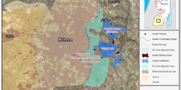
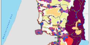
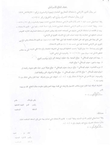
In 1995, the Israeli authorities decided to confiscate one-dunum of land from I'maih's land for building the Israeli bypass road # 60. (See maps). I'maih family has been paying the Israeli property tax 'Arnona' for the Jerusalem municipality; besides, water and electricity services have been facilitated by the Israeli ministry of infrastructure. See Doc 3, Doc 4 & Doc 5


The Israeli authorities are not willing to recognize the family as the legal owner of the land even though the family has all the necessary documents that proof its ownership of the land. The family pursued the case in Jerusalem municipality court and only succeeded to get a decision from the legal adviser of the Israeli army to issue permits for the family members in case of security, to enter the state of Israel. See permit


The family later received Israeli orders to displace the land and was prohibited from entering Jerusalem. The policy of constructing the Segregation Wall in the occupied territories is bringing many facts on the ground by the Israeli government, which in turn, deprives Palestinians from living in East Jerusalem, and pre-empting the Palestinians of 1967 borders, leaving no applicability to the right of return.

Related articles:-

  • The Segregation Wall: A skyline in Beit Jala, April 7, 2004
     
  • Walling in the Bethlehem Ghetto: Beit Jala Land Seizure, April 21, 2004


Prepared by:
The Applied Research Institute – Jerusalem


Recommended For You

حين تضيق الأرض: غزة الأعلى كثافة سكانية في العالم

by arij
July 15, 2025
0

منذ تأسيسها، سعت دولة الاحتلال الإسرائيلي إلى إبعاد الفلسطينيين عن أرضهم بهدف السيطرة على المنطقة وتقييد حركة الفلسطينيين. وقد بدأت بتطبيق هذا المخطط في العام 1948، عندما حصرت...

Read moreDetails

Israel maneuvers demography to manipulate geography

by arij
July 15, 2025
0

Ever since its establishment, Israel pushed Palestinians away from their land to control the territory and confine their movement. Israel resorted to such scheme in 1948 when it...

Read moreDetails

ورقة موقف: إسرائيل تصادق على استئناف تسجيل الأراضي في الضفة الغربية

by arij
June 9, 2025
0
Infographic – The Geopolitics of Area C

اعداد: د. جاد اسحق، ناصر الريس وسهيل خليلية صادق المجلس الوزاري المصغر الإسرائيلي (الكابينيت) بتاريخ 26/1/2025، على قرار استئناف تسجيل ملكية الأراضي في المنطقة (ج) من الضفة الغربية...

Read moreDetails

Israel Advances Settlement Plan on Ancient Olive Groves on lands of Beit Jala city, Violating International Law and depriving Palestinians their lands

by arij
April 29, 2025
0
Israel Advances Settlement Plan on Ancient Olive Groves on lands of Beit Jala city, Violating International Law and depriving Palestinians their lands

  In late February 2025, Israel has approved a new settlement construction plan on 22.2 dunums of privately owned Palestinian land in the city of Beit Jala, south...

Read moreDetails

Leveraging the Olmert Plan to Safeguard Palestinians amid US Displacement Plans of Gazans to Egypt and Jordan

by arij
February 5, 2025
0
Leveraging the Olmert Plan to Safeguard Palestinians amid US Displacement Plans of Gazans to Egypt and Jordan

  After the ceasefire in the Gaza Strip took effect on January 19, 2025, U.S. President Donald Trump made a highly inhumane statement on January 26, 2025, suggesting...

Read moreDetails
Next Post
A new type of Land annexation

A new type of Land annexation

LATEST NEWS

Escalation and forced displacement in Kisan

by arij
August 6, 2025
0

........................................................

بؤرة استيطانية جديدة وتهجير قسري في كيسان

by arij
August 6, 2025
0

........................................................

Villages and Communities of Masafer Yatta: A Model of the Forced Displacement of Palestinian Communities in Area “C”

Villages and Communities of Masafer Yatta: A Model of the Forced Displacement of Palestinian Communities in Area “C”

by arij
August 2, 2025
0

........................................................

قرى وتجمعات مسافر يطا: نموذج تهجير التجمعات الفلسطينية في المنطقة “ج” سياسة ممنهجة لاقتلاع الوجود الفلسطيني

قرى وتجمعات مسافر يطا: نموذج تهجير التجمعات الفلسطينية في المنطقة “ج” سياسة ممنهجة لاقتلاع الوجود الفلسطيني

by arij
August 6, 2025
0

........................................................

flag_yellow_lowEU-PfP-Logo

This website has been produced with the assistance of the European Union. The contents of this publication are the sole responsibility of ARIJ & LRC and can in no way be taken to reflect the views of the European Union.

© 2025 Copyright ARIJ . All Rights reserved. .

No Result
View All Result
  • Home
  • Settlements
    • New Israeli Settlements
    • Settlement Expansion
  • Israeli Violations
    • Agriculture
    • Confiscation
    • Demolition
    • Environment
    • Eviction of Palestinians
    • Settlers Attacks
  • Bypass Roads
  • Israeli Plans
  • Segregation
    • Checkpoints
    • Closure
    • Separation Plans
  • Military Orders
  • Reports
    • Daily Report
    • Monthly Report
    • Quarterly Report

© 2025 Copyright ARIJ . All Rights reserved. .