The Israeli 'Moriah Jerusalem Development Company' along with the Israeli Municipality of Jerusalem and the Israeli Ministry of Transportation are currently working to extend the length of Menachem Begin Road[1] (as known to the Israelis) to penetrate deep inside the 1967 borders, on lands of Beit Safafa and Sharafat south of Jerusalem city under the name 'Road No. 50'. The road, as planned, will cause the destruction and confiscation of 234 dunums of lands of the aforementioned Palestinian communities and will complete the Israeli road network in the southern part of the city of Jerusalem.
Description of the Israeli Bypass Road No. 50
The Israeli Bypass road No. 50, currently under construction, extends from Golomb[2] Intersection inside the 1948 lands and heads south towards Sport Beitar Agodat, passing by Teddy[3] Stadium and the Railway station in Al Malha town inside the 1948 lands. The road continues to extend southwards to Al Malha Shopping Mall to connect with Road No. 39 (Yetzhaq Modia[4] Road), which is the last connection point inside the 1948 lands. From this point (Road 39), the road extends towards the south, penetrating deep inside the lands of Beit Safafa and Sharafat south of Jerusalem city, inside the 1967 borders and heads towards the illegal Israeli settlement of Gilo[5], to finally connect with the Israeli Bypass Road No. 60 which is the main connection point between Israeli settlements in the South of Jerusalem (Bethlehem and Hebron Governorates) and those in the north and inside the 1948 Lands.
The Israeli Municipality of Jerusalem claims that the main goal behind constructing the Bypass Road No. 50 is to ease and improve the flow of Traffic in the southern outskirts of Jerusalem while the truth is that the road will mainly benefit Israeli settlers living in Israeli settlements south of Jerusalem, in the Gush Etzion settlement Bloc. in Bethlehem Governorate and the Israeli settlements in Hebron Governorate who will be able to drive to Jerusalem and to areas inside the 1948 Lands without having to stop at any single traffic light.
Israel also seeks to increase the length of the road, even if this is carried out at the expense of Palestinian lands, to link with the southern Israeli Road network south of Jerusalem, mainly with the Israeli Bypass Road No. 60, the main north-south artery of the West Bank. It is worth mentioning that the road, as stipulated by Moriah Israeli Company, is going to be implemented on three stages, they are:
-
Stage 1: This road section starts from Golomb Intersection inside the 1948 Lands and extends south towards Al Malha Shopping Mall, and passing by Sport Beitar Agodat and Teddy Stadium. This road section is intended to be completed by July 2014 at a cost of USD 400 Million.
-
Stage 2: This road section extends from Al Malha Shopping Mall to connect at some point with the Israeli Road No. 39 (Yitzhaq Modiai Road), inside the 1948 Lands. This road section is slated to be completed by January 2014.
-
Stage 3: This road section starts from Road 39 and heads south towards the Settlement of Gilo, through the lands of Beit Safafa and Sharafat, to finally connect with the Israeli Bypass Road No. 60. This section is slated to be completed by May 2015.
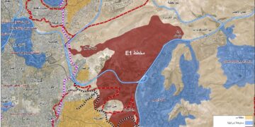
The overall budget of constructing the Israeli Bypass road No. 50 is USD 1.1 Billion and is to be completed by the end of May 2015. See Map 1
Map 1: The Israeli Bypass Road No. 50 penetrates deep inside the 1967 Borders
The Impact of the Israeli Bypass Road No. 50 on Beit Safafa and Sharafat Communities
At the time the Israeli Municipality of Jerusalem is creating a geographical contiguity between Israeli settlements inside the 1948 lands and those inside the occupied State of Palestine through the construction of the Israeli bypass Road No. 50, it will create a bitter and irreversible reality that will affect the Palestinian population of Beit Safafa and Sharafat as the under-construction road will separate between Beit Safafa and Sharafat communities; not forgetting to mention that both communities were on a permanent geographical connection over the past years and both depend on each other in all the services.
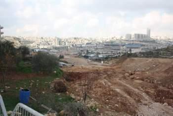
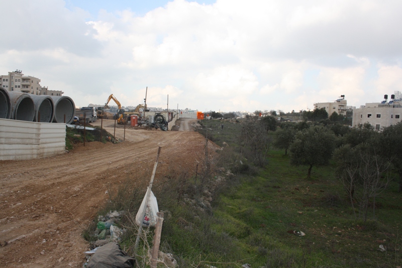
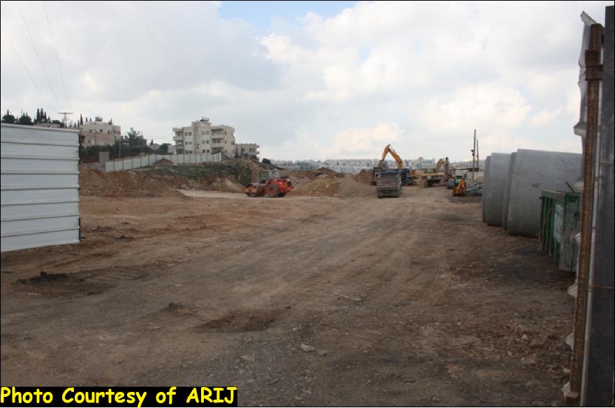
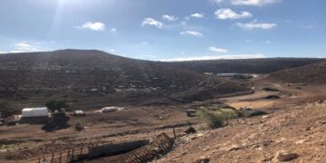
The new Israeli Bypass road No. 50 also passes near the homes of the Palestinians and will deprive them, upon its completion, access to many vital places in the two communities, which were previously accessible to them without having to take alternative routes. Upon road completion aslo, Palestinians of the two communities will be forced to take alternative routes, through bridges that will be set up as part of the plan of the road to get to their destinations. The following photos show the undergoing construction at the Israeli Bypass Road No. 50 which is being implemented by Moriah Jerusalem Development Company on lands of Beit Safafa and Sharafat. See Photos
|
The new Israeli Bypass road No. 50 separates Beit Safafa Town from its neighboring Sharafat. |
|
It should be noted that the undergoing construction work on the Israeli bypass road No. 50 is being implemented according to Israeli plans issued back in the early nineties but weren't exposed to public. At that time, the Israeli municipality of Jerusalem confiscated Palestinian lands in the area for that purpose but didn't start working on the road. Additionally, the Municipality of Jerusalem did not submit any detailed plans of the road for public review, whether for Palestinians or Israelis, and started working on the road accordingly. As a result, Palestinians, whose course of lives will be exposed to dramatic change by the construction of the road, lost their opportunity to submit their objections against the road as the work already started and no detailed plans were unveiled by the Municipality.
The Israeli Policies in Jerusalem City
Israel is upholding its illegal claim over the occupied city of Jerusalem as being part of what the Israelis call 'the unified city' since they translate their claim into tangible steps with plans to selectively enwrap areas considered significant to Palestinians to fulfill their vision and impose new realities on the ground that cannot be squared once negotiations over final status issues with the Palestinians begin.
The project, which Israel is seeking to impose on Palestinians of Beit Safafa and Sharafat, is just one of the obvious examples of the de-facto policies pursued by Israel in the Palestinian territory. Israel also strives to implement these policies at the expense of Palestinian lands and properties to provide its people with the necessary tools to sustain their livelihood in the country. These policies contradict with the International Law Rules and United Nations Security Council Resolutions such as 252 (1968), 298 (1971), 446 (1979), 267 (1969) ,465 (1980) and 478 (1980).
-
The UN Security Council resolution No. 252 of 21 May 1968 'Considers that all legislative and administrative measures and actions taken by Israel, including expropriation of land and properties thereon, which tend to change the legal status of Jerusalem are invalid and cannot change that status;'
-
The UN Security Council resolution No. 298 of 25 September 1971, 'Urgently calls upon Israel to rescind all previous measures and actions and to take no further steps in the occupied section of Jerusalem which may purport to change the status of the City or which would prejudice the rights of the inhabitants and the interests of the international community, or a just and lasting peace;' and ' Requests the Secretary-General, in consultation with the President of the Security Council and using such instrumentalities as he may choose, including a representative or a mission, to report to the Council as appropriate and in any event within sixty days on the implementation of the present resolution.'
-
The UN Security Council resolution No. 267 of 3 July 1969
'Reaffirms the established principle that acquisition of territory by military conquest is inadmissible,' and 'Reaffirms its resolution 252 (1968);' -
The UN Security Council Resolution 446 of March 22, 1979 calls on Israel to rescind its previous measures and to desist from taking any action which would result in changing the legal status and geographical nature and materially affecting the demographic composition of the Arab territories occupied since 1967, including Jerusalem and, in particular, not to transfer parts of its own civilian population into the occupied Arab territories'.
-
The UN Security Council Resolution 465 of 1 March 1980 'Determines that all measures taken by Israel to change the physical character, demographic composition, institutional structure or status of the Palestinian and other Arab territories occupied since 1967, including Jerusalem, or any part thereof, have no legal validity and that Israel's policy and practices of settling parts of its population and new immigrants in those territories constitute a flagrant violation of the Fourth Geneva Convention relative to the Protection of Civilian Persons in Time of War and also constitute a serious obstruction to achieving a comprehensive, just and lasting peace in the Middle East;' and 'Strongly deplores the continuation and persistence of Israel in pursuing those policies and practices and calls upon the Government and people of Israel to rescind those measures, to dismantle the existing settlements and in particular to cease, on an urgent basis, the establishment, construction and planning of settlements in the Arab territories occupied since 1967, including Jerusalem;' and 'Calls upon all States not to provide Israel with any assistance to be used specifically in connexion with settlements in the occupied territories;'
-
The UN Security Council Resolution 478 of 20 August 1980: 'Deeply concerned over the enactment of a 'basic law' in the Israeli Knesset proclaiming a change in the character and status of the Holy City of Jerusalem, with its implications for peace and security' and affirms that 'the enactment of the 'basic law' by Israel constitutes a violation of international law'.
[1] Also known as Road 50
[2] It was named after Eliyahu Golomb, the chief architect of the Haganah, between 1920 and 1948.
[3] Teddy Kolek served as the mayor of Jerusalem from 1965 to 1993
[4] Yetzhaq Modia was an Israeli politician, who served five terms in the Knesset for Likud.
[5] Gilo settlement was established on lands of Al Walajeh and Beit Jala in Bethlehem Governorate.
Prepared by:
The Applied Research Institute – Jerusalem


