In the early days of March 2009, the Commander of the Israeli occupation forces in the north of the West Bank declared the intention of the occupation forces to enlarge Al Jalama checkpoint which separates between the village of Al Jalama and the Palestinian lands occupied in 1948. The area of the new checkpoint is expected to be about 70 dunums.
The new enlargement calls for the sectioning of the checkpoint into three distinct divisions; the first division is planned to house a military camp with its associated observation towers and military hardware. The second division will be reserved for processing Palestinian workers to enter into Israel. It will be modeled after the Gilo checkpoint terminal in Bethlehem. As for the third division, it is planned to be a trade port between the West Bank and Israel.
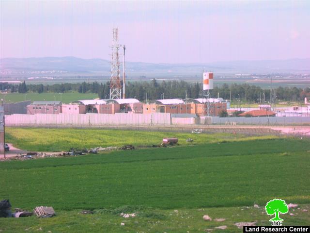
 Photo 1: Al Jalama Military Checkpoint – Jenin.
Photo 2: The picture shows the suggested industrial zone under construction.
The enlargement of the checkpoint aims at the entrenchment of the idea of the indefinite presence of the Israeli Racist Isolation Wall as an undeniable fact. Currently, the checkpoint is considered to be one of the main checkpoints that separates between the West Bank and lands occupied in 1948. The agony of Palestinian workers and businessmen at this checkpoint is omnipresent due to the practices carried out by the Israeli occupation soldiers stationed at the checkpoint.
The Village of Jalama and its Suffering Due to the Racist wall:
The village of Al Jalama used to have very strong social and economic ties with the towns of Sandala and Al Muqaibla which were occupied in 1948. The three communities were considered and treated as one unit as they used to use the one and only school, as well as the only mosque, present in these communities. The clans in these communities (Al Omaray, Abu Farha, Sahouri, Sha’aban, Abu Issa and Radi) come all from the same origin. Life was running smoothly for these communities until the Israeli occupation of 1948 which came and severed these strong ties.
Photo 3: An overview of the village of Jalama.
175 Dunums beneath the Racist Wall:
The Israeli Racist Isolation Wall built on Al Jalama lands had an extremely negative impact of the residents of the village. Its length in the village is 3.5 kilometers with a width of 50 meters, thus destroying 175 dunums of its lands and isolating the village from its natural expansion into the lands occupied by the Israel in 1948.
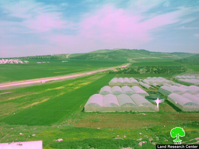
Photo 4: Greenhouses in front of the Israeli Racist Wall – Al Jalama Village.
It is worth pointing out that Israeli occupation forces placed only one agricultural gate in the Wall in Al Jalama and is often used by the soldiers to chase after the villagers under wane and lame “security” excuses.
The negative effects of the Wall on the residents of the village are multi-dimensional including the following:
-
The social and humanitarian dimension: The Racist Wall has led to an increasing difficulty of communication amongst Palestinian families who live in different villages isolated by the Wall. The situation has become even harder after occupation forces issued an order prohibiting Palestinian girls who carry Israeli IDs to live in Al Jalama, otherwise they would lose it. This order led to a wave of migration from the village towards villages inside the Green Line. A number of divorce cases took place due to this military order.
-
The economic dimension: The 2600 residents of the village used to depend on agriculture and on working inside the Green Line as the two main sources of income up until the beginning of the second Intifada in the year 2000. According to the Ministry of Agriculture, there were 550 Greenhouses planted with vegetables as well as 3,000 dunums filled with olive trees. The agricultural products used to have Israel as its natural market. The agricultural sector was devastated after the creation of the Wall and the inability to reach Israeli markets which caused a steep increase in the unemployment level in the village.


