|
#
|
Location
|
Barrier type
|
Nearby colony
|
Areas connected by barrier
|
Notes
|
|
|
From
|
To
|
|||||
|
1
|
Khirbet Hasaka
|
Earth mound
|
None
|
Hasaka
|
Bir Mahjar
|
It is located three meters from Road No.35
|
|
2
|
Bir Nahjar-Farsh Al Hawa
|
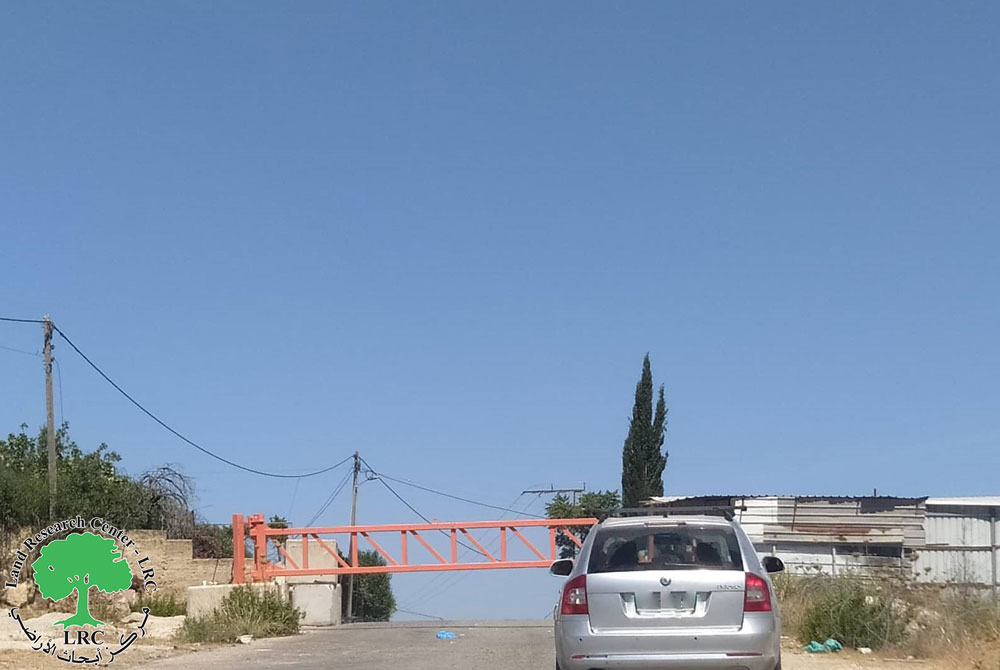
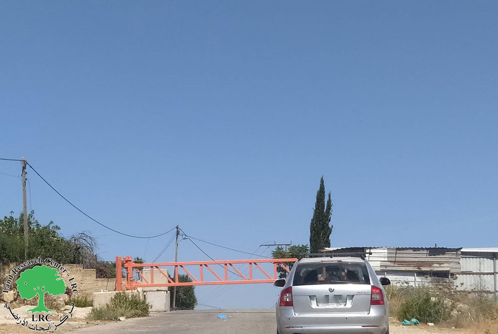
Iron gate
|
None
|
Idhna
|
Farsh Al Hawa-Bir Mahjar
|
Connecting between Hebron and road No.35
|
|
3
|
Farsh Al Hawa
|
Earth mound
|
Before Telem colony’s Military camp
|
Arid land affiliated to Hebron
|
Road No. 35
|
|
|
4
|
Farsh Al Hawa
|
Earth mound
|
Before Telem colony
|
Arid land affiliated to Hebron
|
Road No. 35
|
This barrier is only few meters from the one mentioned in point three
|
|
5
|
Farsh Al Hawa
|
Earth mound
|
Before Telem colony
|
Arid land affiliated to Hebron
|
Road No. 35
|
This barrier is only few meters from the one mentioned in point four
|
|
6
|
Tayba-Tarqumiya
|
Earth mound
|
Before Telem colony
|
Arid land affiliated to Tarqumiya
|
Road No. 35
|
Not used by Palestinians
|
|
7
|
Suba Junction
|
Earth mound
|
Telem and Idora colonies
|
Suba and the land to the north east of Idhna
|
Road No. 35
|
Next to Suba gate which is opened during daily work hours only
|
|
8
|
Zaghayer quarter
|
Earth mound
|
None
|
Zaghayer quarter
|
Road No. 35
|
A minor entrance that leads to some houses and barley used
|
|
9
|
Halhul bridge
|
Iron gate
|
Military watch tower
|
Halhul
|
Hebron
|
Vital road that can be re-closed at any time by soldiers manning the nearby watch tower
|
|
10
|
Ar Ramah quarter
|
Earth mound
|
None
|
Land to the north of the living quarter
|
Road No. 35
|
Dirt road linking between Ar Ramah quarter and Halhul and Road No. 35
|
|
11
|
Hahul-Wadi Qabun
|
Earth mound
|
None
|
Wadi Qabun quarter in Halhul
|
Road No. 35
|
Opposite Barrier mentioned in point ten separated by Road No. 35
|
|
12
|
Qayzon-Hebron
|
Earth mound
|
None
|
Qayzon agricultural land
|
Road No. 35
|
|
|
13
|
Bani Nai’m
|
Earth mound
|
Kiriyat Arba’
|
Wadi Al Juz Land west of Bani Na’im
|
Road No.60
|
An uneven dirt road connecting between arid land
|
|
14
|
Al Hijra
|
Earth mound
|
Hagai
|
Al Hijra south land
|
Road No.60
|
|
|
15
|
Wadi ash Shajna
|
Earth mound
|
None
|
Wadi ash Shajna land
|
Road No.60
|
A dirt road leading to arid land
|
|
16
|
Karma
|
Earth mound
|
Otne’il
|
Khirbet Basim
|
Road No.60
|
|
|
17
|
Wadi Qabun
|
Earth mound
|
None
|
Agricultural land
|
Road No.60
|
Leads to agricultural land
|
|
18
|
Wadi Qabun
|
Earth mound
|
None
|
Agricultural land
|
Road No.60
|
Leads to agricultural land
|
|
19
|
Ar Radeem land
|
Earth mound
|
Shema and nearby outpost
|
Ar Radeem land
|
Road 317
|
It connects a Radeem with as Samu’ town and is only used by one family and there is a nearby open road in better condition
|
|
#
|
Location
|
Barrier type
|
Nearby colony
|
Areas connected by barrier
|
Notes
|
|
|
From
|
To
|
|||||
|
1
|
Artas
|
Earth mound
|
Efrata
|
Artas
|
Road No. 60
|
|
|
2
|
Talita
|
Earth mound
|
None
|
Talita
|
Beti Jala
|
Once removed the street was paved
|
|
#
|
Location
|
Barrier type
|
Nearby colony
|
Areas connected by barrier
|
Notes
|
|
|
From
|
To
|
|||||
|
1
|
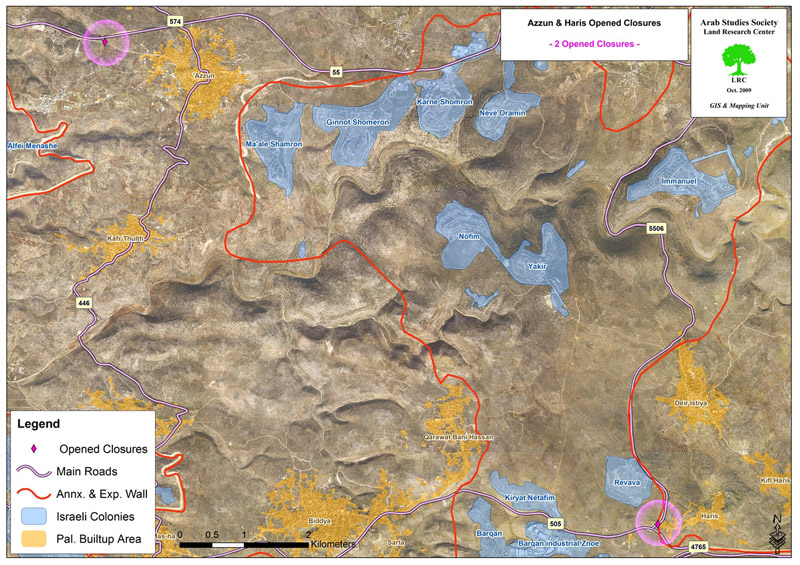
Haris
|
Earth mound
|
Revava
|
Haris
|
Road No. 505
|
|
|
2
|
Azzun ash Shamaliya
|
Earth mound
|
Ma’ale Shomron
|
Azzun ash Shamaliya
|
Road No. 55
|
|
The Land Research Center
LRC


