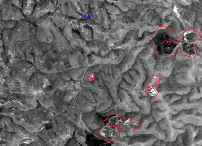
Yatta is one of the largest rural cities in Palestine, with a population of approximately 30,000. It is located in the Hebron Hills, 10 km south of Hebron City (Figure 1). It is surrounded by several small khirbats (communities) whose survival depends mainly on raising field crops and livestock (Figure 2).).
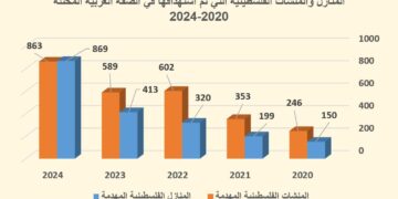
It is surrounded by several small khirbats (communities) whose survival depends mainly on raising field crops and livestock. Seven of the khirbats, located five kilometers south of Yatta village, received eviction and demolition orders in November 1997, namely: Al Fukhayt, At Tabban, Beir El-‘Eid, Janbah, Maq‘oura, Saroura, and Touba. Eight homes have thus far been demolished.
Table (1): Current Status of Khirbats in the Yatta Area
|
Location Name |
Number of Families |
Average Number of Family Members |
Total Number of Livestock |
Demolition of Caves / Confiscation of Fodder |
|
Al Fukhayt |
6 |
11 |
1200 |
threatened |
|
At Tabban |
11 |
10 |
2200 |
demolished/confiscated |
|
Beir El-‘Eid |
8 |
12 |
1600 |
demolished/confiscated |
|
Janbah |
4 |
9 |
800 |
demolished/confiscated |
|
Maq‘oura |
4 |
8 |
800 |
demolished/confiscated |
|
Saroura |
7 |
7 |
1400 |
threatened |
|
Touba |
5 |
12 |
1000 |
threatened |
The Palestinian inhabitants of these khirbats number between 400-450 people (Figure 3). These khirbats are located in natural grazing areas which provide feed to thousands of goats and sheep. The inhabitants live mainly in natural caves; many have documents which prove ownership, dating back to the Ottoman Empire. ). These khirbats are located in natural grazing areas which provide feed to thousands of goats and sheep. The inhabitants live mainly in natural caves; many have documents which prove ownership, dating back to the Ottoman Empire.
Figure 1: Satellite image of Yatta
Figure 2: Map showing the surrounding khirbats of Yatta
Figure 3: Palestinian inhabitant of one of the khirbats
Israeli colonization in the Yatta area began in 1981. Currently, five colonies exist in the area where the khirbats are located. The three largest colonies are: Shani, Beit Yattir, and Karmel. Table (2): Israeli Colonies Southeast of Yatta
|
Israeli Colony |
Number of Families |
Population |
Founding Date |
Population Type |
Built-up Area In (Dunums) |
|
Beit Yattir |
40 |
300 |
Aug 1979 |
Religious |
277 |
|
Karmel |
42 |
300 |
Jan 1981 |
Religious |
251 |
|
Ma’on |
34 |
150 |
Jan 1983 |
Religious |
143 |
|
Shani |
110 |
600 |
Jan 1982 |
Secular |
357 |
|
Susya |
50 |
330 |
Sep 1983 |
Religious |
114 |
Israeli harassment of the khirbats was documented as early as 1986. Since that time, they have been repeatedly threatened with the demolition of their homes and the expropriation of their livestock and fodder. Their livestock has even been shot at by the colonizers. Due to this harassment, some of the local inhabitants have temporarily fled the area.
In February 1991, an eviction order (number 2/91) was issued. According to this order, a large area south of Yatta was to be confiscated, including the seven mentioned khirbats. More recently, in November 1997, Israel issued eviction and demolition orders to the khirbat inhabitants.
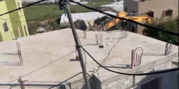
Consequently, Israeli military forces have since demolished eight of the inhabitants’ caves (Figure 4). Hundreds of heads of livestock and approximately 560 tons of fodder were confiscated, compelling the inhabitants to sell most of their remaining livestock. Due to advocacy on the part of a local legal aid group, the families were given permission to stay in their homes until their case is decided upon by the Israeli High Court. Israeli courts rarely decide in favor of property owners whose land is scheduled for confiscation. As of the writing of this report, their case is still pending.). Hundreds of heads of livestock and approximately 560 tons of fodder were confiscated, compelling the inhabitants to sell most of their remaining livestock. Due to advocacy on the part of a local legal aid group, the families were given permission to stay in their homes until their case is decided upon by the Israeli High Court. Israeli courts rarely decide in favor of property owners whose land is scheduled for confiscation. As of the writing of this report, their case is still pending.
Figure 4: One of the Palestinian homes that has been demolished
Figure 5: A homeless baby sitting on the ground outside her demolished home
Figure 6: A Palestinian woman in front of her home before the impending demolition
Also, during the month of November 1997, the Israeli government allowed two colonists named “Dov” and “Ya’quv” to establish two, one- person colonies in the area. “Dov” lives in a house, while “Ya’quv” in a caravan. They settled on privately cultivated lands belonging to Palestinians who have documents which record their ownership and date back to the British Mandate (Figure1).
According to Israeli law, Israeli military forces may take over possession of the land several years after evicting its owners. This allows space for the expansion of existing colonies and the creation of new ones. It also facilitates Israeli control over the West Bank prior to the final status negotiations and facilitates the cleansing of Palestinians from certain areas of the West Bank. Moreover, the confiscation of Palestinian agricultural land deprives many Palestinian families of their main source of income, thus increasing economic hardship.
Prepared by:
The Applied Research Institute – Jerusalem


