Lifta is one of the largest villages adjacent to Jerusalem and closest to the city from the west and northwest. The Israeli occupation of 1948 divided the city into two sections; the first section, consisting of Upper and Lower Lifta, contained most of the houses of the village. It was occupied in 1948. The second section contained the reserve land of the village. This section was occupied during the six-day war of 1967. (See Map)
Location:
The village is located west and northwest of Jerusalem on the road linking the city to Jaffa. The village is surrounded by the villages of Ein Karm, Al Malha, Deir Yaseen, Qaloonia, Beit Iksa, Beit Hanina, and Shua'fat. The total area of the village is 8743 dunums 153 of which are used as roads and 756 dunums taken over by Israel. The total number of Liftians exceeds 26,000 most of whom are refugees in Palestine and the Diaspora. Keep in mind that in 1945 the residents of Lifta were 2550 living in 420 stone houses.
Lifta throughout History:
Lifta, an Aramaic name meaning the corridor, was first built in the Cannanite era. It was first called Nafttoh, meaning the opening. During the Roman era it became known as Nifto, and in the Islamic era it regained its Cannanite name. It was renamed again during the Crusaders era to become called Kabesta.
The Lifta file, presently located at the Rockefeller museum, indicates that archeological diggings in the village produced artifacts dated as far back as the Bronze era (2000 BC) and the Late Bronze era (1400 BC). That is in addition to some artifacts dating back to the Iron and Persian eras. Yet, the most important artifacts were the ones stemming from the Roman, Byzantine, Islamic, and Crusaders eras. Such artifacts link Lifta with Nabi Samuel in the north and Jaffa and Lod in the west. In addition, ottoman documents were found dating back to 1596 indicating that taxes from the village were paid to the Jerusalem District.
Lifta's Landmarks:
The Romeima area of Lifta contains the resting-place of Sheikh Badr. The area was used during the British Mandate as a station to generate electricity and a station for the Israeli bus company, Egged. Another landmark is called Al Musallabah, named after the Musallabah chapel upon which a part of the Israeli museum and the Hebrew University was built on.
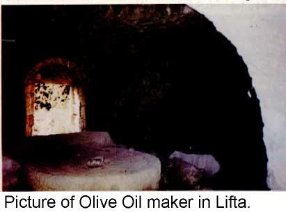
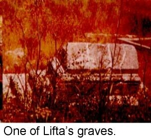
In addition, Lifta contains the resting-place of Saif El Dein Armoosh, one of Al Mujaheedein arriving with Salah El Dein during the crusades. Next to his grave the mosque and the graveyard of the village were established in addition to the olive oil press. The Lifta male school is still present and is being used by Israeli authorities as a Jewish school located at the beginning of the Jerusalem – Tel Aviv highway.
Furthermore, Lifta contains a number of neighborhoods or Khirbas. Such Khirbas include Khirbat Tayeh, Khirbat Kaydeh, and khirbat Al Karm (today's French Hill). Also, some of these Kirbats were expropriated to build upon it student housing for the Hebrew University and the Hayat Regency.
The geographical location of the village made it the western gate of Jerusalem. As so, it had suffered the repeated attacks by the Hagana, Palmakh, and Steirn terrorist groups. The eastern part of the village was the most affected. After the Israeli occupation of 1948, Israel established two settlements on the lands of the village. The first settlement was called Hai Tafooh while the second one was called Giv'at Shaoul. The two settlements were established in between the villages of Lifta and Deir Yassin and on the industrial zone between the headquarters of the Star of David and the Tnuva factories.
The expropriation of the land of the village continued after the Israeli occupation of 1967 as Israeli authorities confiscated 3245 dunums, half of which were of the village's lands located closer to Shu'afat, Al Essawiyah, the Hebrew University, and Wadi Al Joz. A number of settlements were built atop of this confiscated land. They include the settlements of Ramot, Ramat Ashkol, Giv'at Hathashomeit, Ma'alot Dafna, the French Hill, Giv'at Hamiftar, and the police headquarters in Sheikh Jarrah. Further expropriation of the land of Lifta was carried out until 1987 when it was declared to be a natural reserve and an open institute for historical architecture, thus safeguarding it from further expropriation.
New Colonial Activities in Lifta:
Israeli authorities responsible for housing and planning in Jerusalem secretly approved project number 6036 which calls for the establishment a colonial resort on Lifta's land occupied in 1948. As reported in the Yedeot Ahranot issue of February 22nd, 2000, the resort is especially designed for wealthy American Jews immigrating to Israel. It is planned to have 230 luxury homes, a big hotel, a shopping center, a tourist compound, in addition to the renovation of 55 of the remaining 410 Lifta houses. The renovated houses will serve as a nucleus of a museum for the area. The plan for this resort was designed by the then-minister of national infrastructure Ariel Sharon and the first information about it was leaked to the press on the 21st of August, 1999's issue of Kohl Haeer.
Liftians' Reaction to the Planned Resort:
Throughout their activities and meetings Liftians have expressed their total rejection to the planned resort and any other attempts to Judaize their village and remove its traces. Liftians in Ramallah, Jerusalem, and the Diaspora deplore the Israeli attempts aiming at the demolishing of more than 200 houses in the village. Such houses still stand witness on the Israeli crimes committed against the population of the village since 1948.
Prepared by


