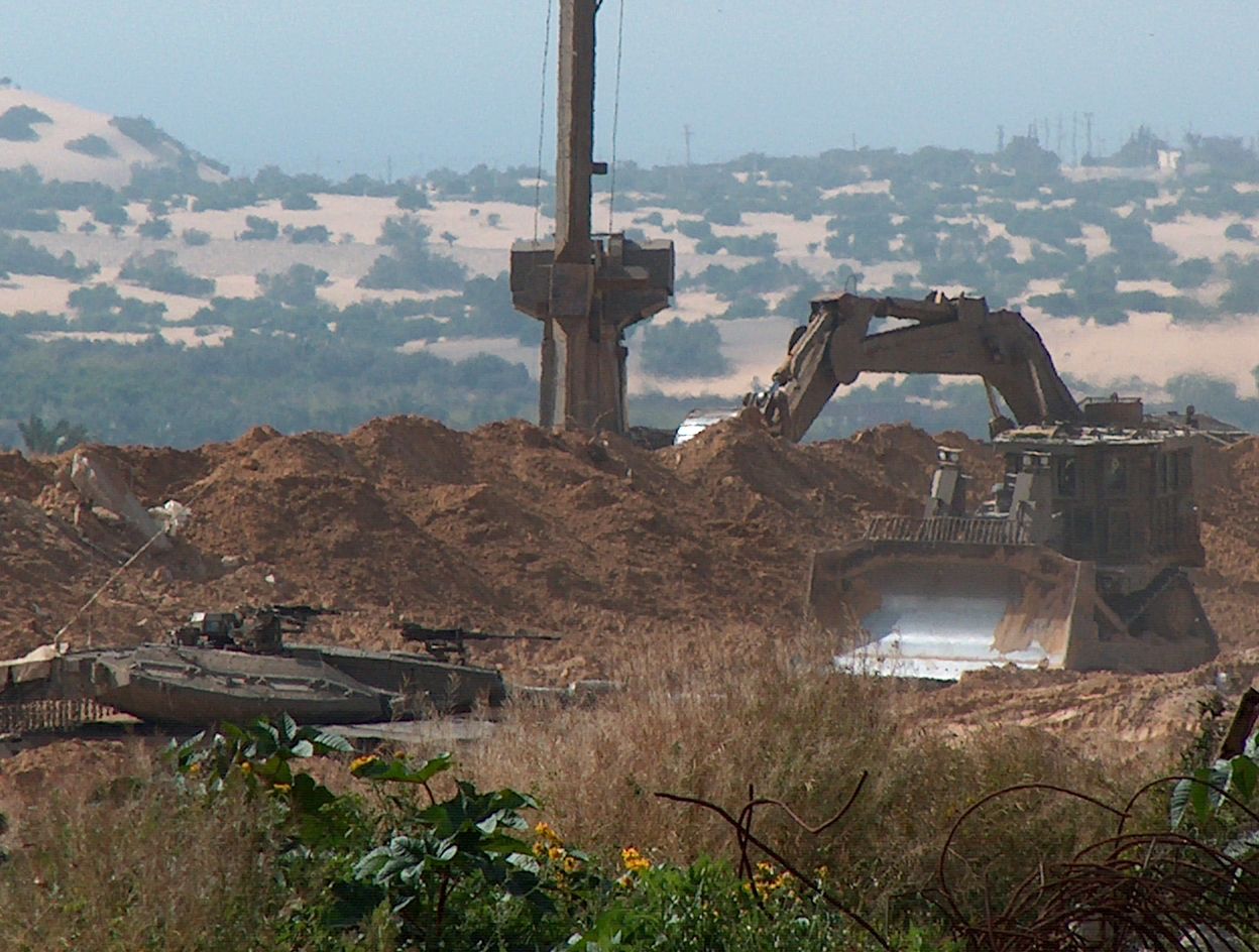
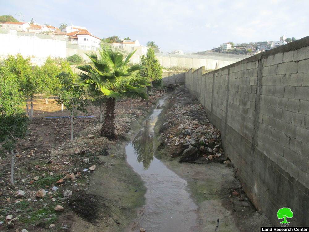
The large amount of rain water that befell the City of Qalqilia lately has led to the flooding of tens of planted dunums that belonged to the clans of Nazzal and Al Samman. The affected dunums are located in the vicinity of the Israeli Racist Isolation Wall north west of the City of Qalqilia. Israeli occupation has installed pumps into the Wall upon its construction which are used to siphon water from the Israeli side of the Wall into Palestinian lands in Qalqilia. Add to these amounts of water the fact that the sewage gates in the Wall has become dysfunctional due to the presence of large amounts of sands that disrupts its operation. Subsequently, this fact leads to the formation of pools that drowns all plants and destroys crops on the Qalqilia side.
Israeli occupation forces have repeatedly refused to fix the sewage gates installed within the Wall north west of the City of Qalqilia despite numerous calls by rights organizations as well as the International Committee of the Red Cross (ICRC). Recently, the water level in some of the affected areas has reached more than 100 cm due to the gathering of the water below the Racist Wall. In turn, the Qalqilia Municipality was forced to create trenches near the Racist Wall in an effort to reduce the damage the water causes for the lands and crops.
The Palestinian Ministry Agriculture in Qalqilia has warned that the continuation of the gathering of rainwater in the area threatens the destruction of more lands in light of the continued fall of rainwater. It indicated that between 300 to 400 dunums filled with grown crops were covered with water which left them in ruin.
The Racist Wall in Qalqilia Governorate:
Israeli occupation forces began the establishment of the Racist Wall in 2002 in two sections; the western section which is located near the Green Line. Work in this segment of the Wall is done with. The second segment is the eastern one which contains the colonial blocks located east of the Governorate. It is still under construction.
Details of the two sections are as follows:
First: The Western Section
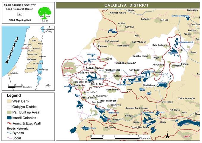
The Wall in this section runs parallel to the Green Line as it starts from the village of Flamiya in the most northern part of the Governorate of Qalqilia. It encompasses the colony of Tsufin and goes deep into the middle of the Governorate and surrounds the city of Qalqilia and the village of Al Nabi Ilyas from the northern, western and southern direction. The Wall continues southward as it circles around the village of Azzun Al Atma as to annex the colonies of Oraniet, Sha’ari Tikva and Alfe Minshe.
The length of the Wall in this section is 53 kilometers with a width that varies between 55 to 120 meters. It isolated around 41,960 dunums of the Governorates’ lands behind it. It also destroyed 4,000 agricultural dunums beneath it affecting around 2,500 Palestinian farmers. The Wall also isolated 19 water cisterns, demolished one while causing structural damage to an additional 42 cisterns.
Moreover, the construction of the Wall in this section caused the destruction of Greenhouses over an area of 41 dunums while it isolated Greenhouses extending over an area of 700 dunums. The number of uprooted trees reached 40,880 while an additional 179,481 trees became isolated behind the Racist Wall. In terms of chicken barns, 11 of them, containing more than 50,000 chickens, became isolated behind the Racist Wall.
Israeli occupation forces placed 22 gates in the Isolation Wall which are most of the time closed. Some of them are opened for specific, limited time which makes it hard for the farmers to reach their lands in a timely manner leading to big losses.
The Isolation Wall isolated 4 villages behind it in addition to 3 Bedouin communities. The villages are Azzun Al Atma, Ras Tira, Magharat Al Daba’a and Wadi Al Rasha. The Bedouin communities include Arab Abu Farda, Arab Al Ramadien Al Shamali and Arab Al Ramadien Al Janoubi.
Second: The Eastern Section
It is currently under construction and it aims at the annexation of the largest agricultural area in the Governorate for the benefit of the Israeli colonies located east of the Governorate. The colonies include Ma’ale Shomron, Ghanat Shomron, Karni Shomron in addition to the colony of Amanoeil in an effort to fuse the colonies into one colonial block surrounded by the Wall.
Prepared by:
The Land Research Center
LRC


