The construction of new settlement infrastructure in the occupied Palestinian territories has profound implications for local communities, threatening livelihoods, increasing isolation, and impairing socio-economic vulnerabilities. This case study examines the impact of a newly planned settlement road on the village of Bardala, located in the Tubas Governorate within the northern Jordan Valley. The road, initiated by the Israeli Civil Administration in September 2024, exemplifies how such infrastructure projects serve to entrench Israeli control while undermining the viability of Palestinian rural communities.
 About Bardala:
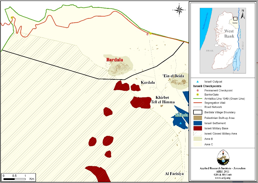
Bardala is a small agricultural village in the northern Jordan Valley, with a population of approximately 1,500 residents. The village’s land area within its structural plan (classified as Area B) is 478 dunams, while thousands of additional dunams fall under Area C, where Israel maintains full civil and security control. The village is bordered by Ibziq village from the West, Ein al-Beida village from the East, Qa’oun Plain and the Green Line (1949 Armistice Line) from the North and Kardala and Jabara communities from the South.
Bardala’s economy relies heavily on agriculture, with about 95% of residents dependent on farming and livestock. The village’s fertile lands and water resources make it a critical hub for agricultural production in the Jordan Valley.
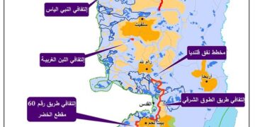
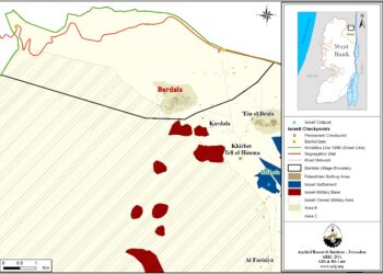 Bardala in Tubas Governorate
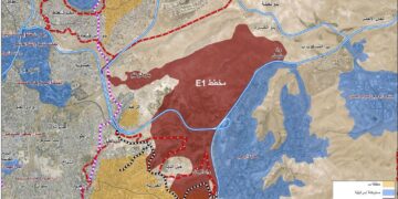
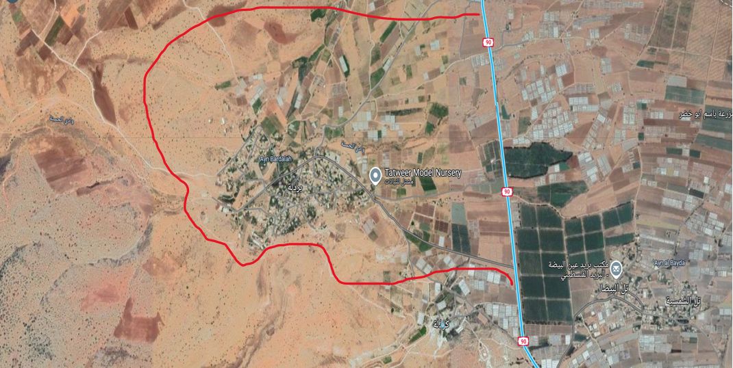
 Satellite photo showing planned road in red
About the Road:
In September 2024, the Israeli Civil Administration announced the construction of a 6-kilometer settlement road encircling Bardala. The project began two months prior to the announcement. The road’s path starts eastward, intersecting Route (bypass road) 90 near the Israeli settlement Mehola. It continues southward around Bardala then turns westward across the Qa’oun Plain on the village’s outskirts, only to reconnects with Mehola settlement, crossing Route 90 again.
This project is part of broader settlement expansion efforts designed to facilitate settler mobility while restricting and controlling Palestinian movement.
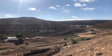
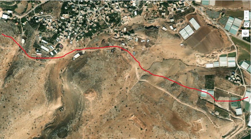
 Satellite photo showing isolated land behind the road
How the new Israeli Road stands to affect the area:
A) Land Confiscation and Environmental Impact
- The road will confiscate and destroy approximately 1,500 dunams of agricultural land (both irrigated and rain-fed).
- An additional 15,000 dunams of grazing land will become inaccessible, preventing shepherds from grazing at least 8,000 sheep.
- A 2-kilometer water pipeline was destroyed, affecting agricultural projects spanning 200 dunams.
These losses are devastating in a community where livelihoods depend heavily on agriculture and livestock farming.
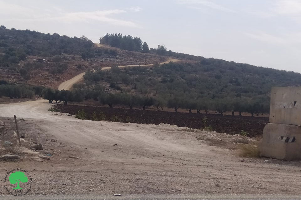
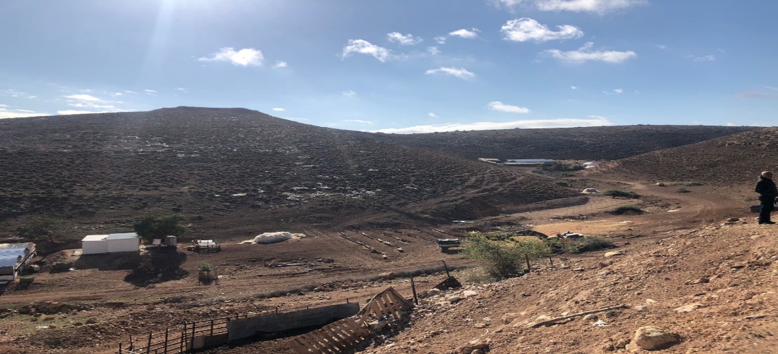
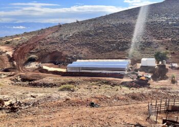
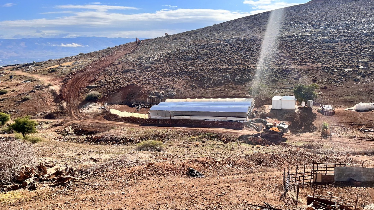
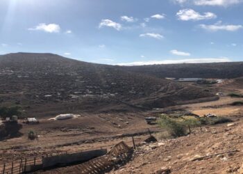
 Satellite photo showing three sheep barns threatened with demolition due to road construction isolated land behind the road
B) Displacement and Demolition Orders
- The Israeli Civil Administration (ICA) issued evacuation orders for three sheep barns (two existing and one under construction), which house about 800 sheep. The evacuation deadline was set for December 4, 2024.
- Demolition orders that target 15 structures (homes and facilities) located along the road’s path in the Qa’oun area.
 C) Impact on Movement and Accessibility
- The new road will further isolate Bardala by restricting access to neighboring villages and the city of Tubas.
- Residents already face movement restrictions due to the Tayasir checkpoint, which operates between 8 AM and 4 AM.
- The road create a physical barrier that separates Palestinian traffic from settler routes, enforcing segregation and making it harder to travel.
D) Economic Consequences
- With agricultural land and grazing areas confiscated or isolated, local farmers and shepherds, face severe economic distress.
- The reduced availability of pastureland will force many livestock farmers to sell or reduce their flocks, leading to increased unemployment and poverty.
- The destruction of farmland and water infrastructure threatens food security and agricultural productivity in Bardala and surrounding communities.
E) Increased Settler Violence and Tensions
- The road’s proximity to Bardala creates new points of friction between settlers and Palestinian residents, increasing the risk of settler attacks on people, homes, and livestock.
- The road effectively encircles Bardala, enabling settlers to impose further restrictions and intimidation tactics.
The Implications:
The settlement road project in Bardala is not an isolated development but an indicator of a broader Israeli strategy aimed at controlling the Jordan Valley and fragmenting Palestinian territory. This initiative aligns with several key strategic objectives, they are:
- It applies the separation plan of Palestinian and the Israeli settler populations by establishing distinct road networks, enabling unhindered movement for settlers while severely restricting Palestinian mobility.
- The road serves the purpose of de facto annexation and land control by connecting settlements and consolidating Israeli control over strategic areas.
- The project tends to economically marginalize the Palestinian rural communities, particularly agricultural villages like Bardala, by undermining their livelihoods and pushing residents to abandon their lands.
- The road contributes to the isolation and displacement of Palestinians by making it increasingly difficult for them to access essential services, markets, and neighboring communities, thereby compelling them to leave their homes. These interconnected strategies reflect a calculated effort to weaken Palestinian presence and consolidate Israeli control over the area.
To Conclude:
The settlement road around Bardala exemplifies the broader impact of Israeli settlement policies on Palestinian rural communities. By confiscating land, destroying infrastructure, and restricting movement, these projects impair the foundations of Palestinian life and livelihoods.
The residents of Bardala, who rely almost entirely on agriculture and livestock, face an uncertain future marked by economic hardship, displacement, and social fragmentation.
Addressing this issue requires international attention to the rights of Palestinian communities and the broader implications of settlement expansion for peace, security, and human rights in the region.
**************************************************************
Prepared as part of the project:
“Mapping and Diagnosing Palestinian Rural Women’s Livelihood and Economic Empowerment in Area “C”
Implemented by: The Applied research Institute-Jerusalem (ARIJ)
Prepared by:
The Applied Research Institute – Jerusalem