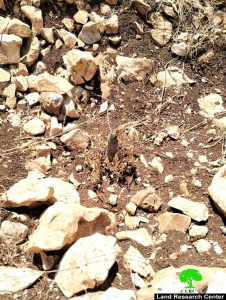
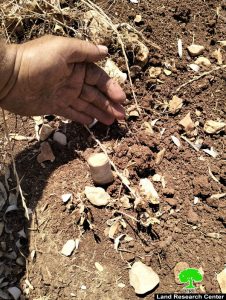
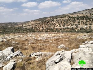
- Violation: uprooting 850 olive plants.
- Location: Hajjah Village / Qalqilya Governorate.
- Violation date: 27/07/2022.
- The aggressor: the so-called civil administration of the occupation.
- Affected party: farmer Nihad Youssef Othman Al-Daas.
Violation details:
The Israeli occupation continues to target agricultural lands in the eastern countryside of Qalqilya Governorate, where the occupation imposes strict restrictions that prevent the exploitation of agricultural lands or even the benefit of them, while unleashing the settlers towards the Judaization of agricultural lands and the establishment of random settlement outposts here and there.
On Wednesday morning 27/7/2022, the occupation authorities stormed the “Wadi Zeid” area, located to the west of Hajjah village, Qalqilya Governorate, within the natural basin No. (9), plot No. “17” of the village’s lands, using bulldozers and trucks. It started uprooting and sabotaging 860 olive plants, aged 3-5 years, planted on a plot of land with an area of 70 dunums, as the occupation claims that the land is classified as government property “according to its description”.
The damaged land belongs to the farmer, Nihad Youssef Othman Daas (62 years old). He stated:
“My brothers and I own a plot of land with an area of 70 dunums, part of it we inherited from father to grandfather, and the other part was inherited according to farm contracts with my cousins as well, and they inherited it from the grandfathers. The occupation army raided the land and confiscated a bulldozer that was working to rehabilitate the land, and the Israeli occupation imposed a fine of (4600 shekels) as the fees for returning the bulldozer. On the date (2/23/2022), the so-called government property inspector put a military notice on my land bearing the number (1228) that included vacating the land and returning it to its former state within a period of (72 hours), despite that I was insisting on preserving the land, until the occupation came and uprooted the vast majority of the plantings, 850 out of 1,000 plants, Despite that, I was insisting on preserving the land, until the occupation came and uprooted the vast majority of the plants, which is 850 out of 1,000, but despite that as some of the plantings were confiscated by the occupation, we insist on re-cultivating the land again”.
 Eviction notification No. 1228, which targeted the lands of citizen Nihad Al-Daas
 |
 |
 |
 |
 |
 |
Photos 1-7: The effects of uprooting trees from the lands of the daas citizen
It is noteworthy that the affected farmer is the breadwinner of a family consisting of (9) members, including (4) females, and there is one child in the family, which is agriculture is the only source of income for them. The total number of individuals benefiting from this land is 48, who are the family of citizen Nihad and his brothers.
It is worth noting that the damaged land was targeted by the Israeli occupation, with a notification of eviction under the pretext that it was government property in February 2022. For more, see the report issued by the Land Research Center at the time (The report).
In addition to the above, the occupation army closed the agricultural road leading to the damaged land using earth mounds, which added new suffering to the farmer and caused his inability to introduce agricultural machinery to the land in order to rehabilitate it.
Over the past years, Hajja village has been subjected to a fierce campaign by the occupation by confiscating part of its lands in favor of expanding the “Shomron” settlement complex on parts of it, not to mention the continuous harassment by closing the village’s roads and preventing urban expansion in it.
Hajjah Village[1]:
The village of Hajjah is located to the east of the city of Qalqilya, to the north of the alfunduq village, which is cut by bypass road No. 55, and its total area is 11,718 dunums, of which 377 dunums is the built-up area. The population of Hajja village is about 2,148 people. Its residents depend mainly on agriculture, especially olives and field crops, in addition to employment within the Palestinian Authority areas and within the occupied territories.
[1] GIS – LRC.
Prepared by
The Land Research Center
LRC


