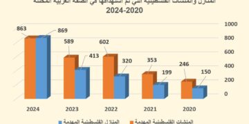
- Violation: forcing a citizen to demolish his house.
- Location: Deir Istiya, north of Salfit.
- Date of violation: 05/18/2022.
- The aggressor: the so-called building inspector of the Israeli Civil Administration.
- Affected party: Citizen Naim Abdul-Karim Abdullah.
- Details of the violation:
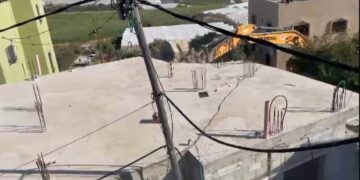
On the morning of Wednesday, 18/5/2022 AD, the citizen Naim Abdel-Karim Abdullah, from the town of Deir Istiya, began a self-demolition of a building under construction located near the western entrance to the town of Deir Istiya, which was to be planned for two adjacent apartments. Noting that the construction was in the stage of the basic pillars, the demolishing comes after the occupation court approved the demolition order for the building on the pretext of lack of a permit in early May 2022.
It is noteworthy that the targeted building consists of (8) ground warehouses with a total area of 280 m², in addition to two apartments under construction in the basic stage on the roof of the warehouses with an area of 140 m² for each apartment, where the columns of the two apartments were completely demolished by the affected citizen himself through a bulldozer. Abdullah supports a family of (8) members, including (4) females, and (3) children.
In light of the demolishing, Naim detailed to the Land Research Center researcher the following:
“In the summer of 2015, I started building 8 commercial stores near the western entrance to the town of Deir Istiya, which is adjacent to the bypass road that crosses the Wadi Qana area. What happened is that the occupation, through the so-called construction inspector of the Israeli Civil Administration, notified the entire building of halting construction on the pretext of non-licensing, on the date (4/25/2021), when I began preparing the legal file with the aim of submitting it to the competent authorities in the so-called Civil Administration, the Israeli occupation, however, refused the request for a permit, and as a result of a number of sessions in the corridors of the occupation courts, the removal of columns and the prohibition of building over the shops was approved a short time ago, knowing that these shops are also not have been decided for the licensing by the occupation court so far, and I removed the columns for fear that the occupation would destroy large parts of the building, and would bear the costs of demolition, and this in turn caused huge losses to me”.
Human rights activist Nazmi Al-Salman commented:
“What happened is added to the long recording of violations of the occupation, as the occupation had previously announced that the area in which the threatened building is located was closed militarily, during the year 1996, and it is now trying to prevent people from construction there, by restricting the citizens and deprive them of their basic rights to expansion and construction, knowing that all the surrounding lands were previously attacked by the settles and the trees in the land were vandalized during the past years.
 |
 |
The town of Deir Istiya, north of Salfit, is one of the main towns in the governorate that has suffered greatly from the harassment of the Israeli occupation, in addition to preventing urban expansion in the town, and depriving the residents of the right to cultivate their lands, especially in the Wadi Qana area, not to mention the continued closure for many years of a large number of agricultural roads in the town.
Deir Istiya village[1]
10 km north Salfit , Deir Istiya is surrounded by Ematin , Jinsafut and Kafr Laqif (north), Azzun and Kafar Thulth (west), Zita, Jama’en and Kafl Haris (east), Haris and Qaraqwat, Bani Hyssan (south) Deir Istiya has a population of (3,696) people in 2017 census. The town has a total area of 34,125, of which 640 dunums are a built up area.
- The Israeli occupation confiscated (4,257) dunums for the following purposes:
|
Settlement name |
Establishing year |
Area in dunums |
Number of settles 2018 |
The size of the settlement’s appropriation of village lands |
|
Revava |
1991 |
167 |
2,664 |
|
|
Yakir |
1981 |
757 |
2,341 |
The entire settlement |
|
Ginat Shomron |
1985 |
944 |
NA |
|
|
Karnei Shomron |
1978 |
540 |
8,388 |
|
|
Novim |
1986 |
663 |
867 |
The entire settlement |
|
Immanuel |
1981 |
879 |
4,220 |
|
|
Ma’ale Shomron |
1980 |
52 |
1,002 |
|
|
Al-Matan |
1981 |
22 |
NA |
The entire settlement |
2- Bypass roads number 55 and 5066 looted an area of (118) dunams.
3- The racist wall under with its path looted (115) dunums, and its length (1,148) meters. If the wall continues, it will isolate (8,408) dunams and confiscate (160) more dunams.
The lands are classified according to the Oslo agreement for the village:
Areas classified as B (6,132) dunums.
– Areas classified as C (27,993) dunums.
[1] Source: GIS Unit – Land Research Center.
The Land Research Center
LRC


