• About The Project
  • Palestine in Century
  • Selected Maps
  • Glossary
  • About ARIJ
  • About LRC
  • By Year
    • Case Studies By Year
    • Daily Report By Year
Tuesday, July 1, 2025
POICA
No Result
View All Result
  • Home
  • Settlements
    • New Israeli Settlements
    • Settlement Expansion
  • Israeli Violations
    • Agriculture
    • Confiscation
    • Demolition
    • Environment
    • Eviction of Palestinians
    • Settlers Attacks
  • Bypass Roads
  • Israeli Plans
  • Segregation
    • Checkpoints
    • Closure
    • Separation Plans
  • Military Orders
  • Reports
    • Daily Report
    • Monthly Report
    • Quarterly Report
No Result
View All Result
POICA
No Result
View All Result

The Israeli Occupation Army closes an agricultural road in Tulkarm governorate

January 15, 2018
in Closure
The Israeli Occupation Army closes an agricultural road in Tulkarm governorate

• Violation: closing an agricultural road.

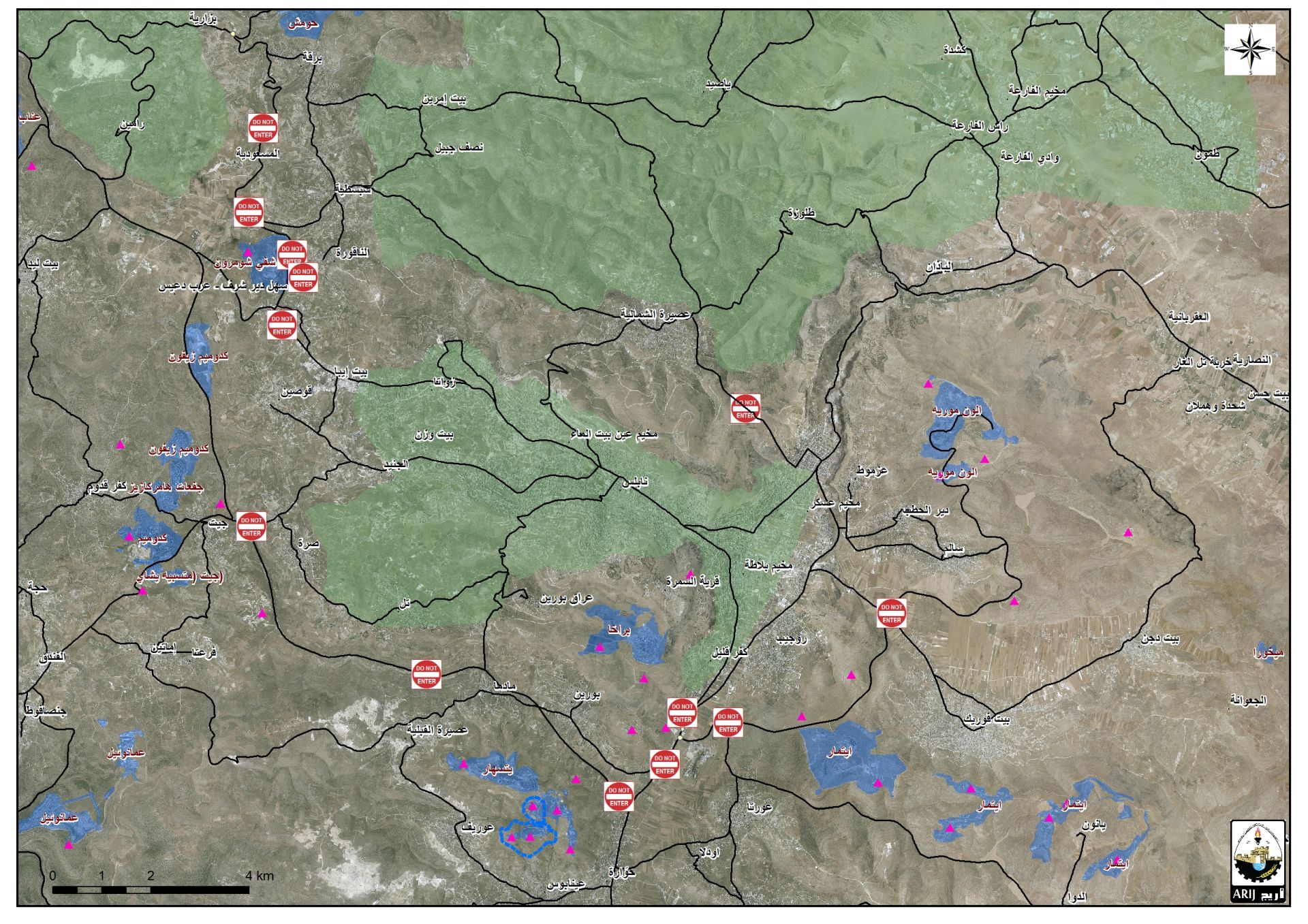
• Location: south of Kafr Al Lubbad village / Tulkarm governorate.

• Date : September 28, 2017.

• Perpetrators: the Israeli Occupation Army.

• Victims : Farmers in Kafr El Lubbad and Shufa towns.


• Details:

  With the start of olive season in the northern part of the West Bank, the Israeli army began implementing arbitrary measures that would hamper the olive harvest season.

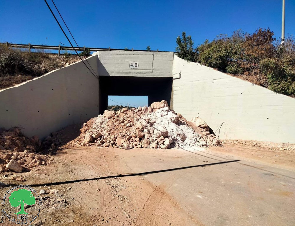
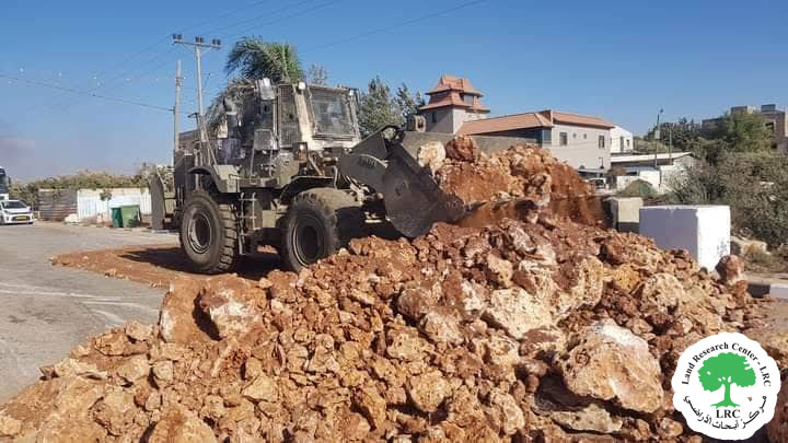
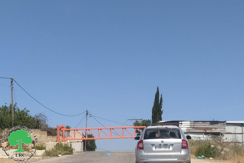
    On Thursday, September 28, 2017, the Israeli army closed an agricultural road southwest of the village of Kafr Al-Lubbad via eath mounds. Noteworthy, the road serves hundreds of dunums of agricultural land.

    The Israeli army justified the closure of the agricultural road under reasons that claim to be security as the area is close to lands controlled by "Avni Hefts" colony. This is why thus farmers were prevented from going to the agricultural area.

     Ziad Jibaiti, head of Kafr Al Lubbad municipality, told the Land Research Center that the road, which was closed, serves at least 50% of the town's land, especially Al- Wajh AL-Qabali and Ras Shomer area. Not only, the road links the town to the neighboring town of Shufa.

     He added that the closure of the road will affect the agricultural sector in the region, especially as most of the agricultural lands require means of transportation to access and service, and this will cast a shadow on the current olive season. In addition to this, the  road is a linking point with a number of agricultural roads spread throughout the region.

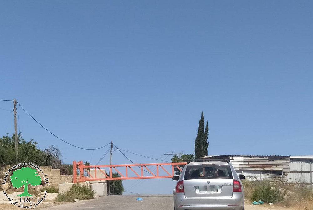
Photos 1-3: the closed agricultural road

Ban on using lands:

The farmers whose lands are located in the nearby of Avnei Hefetz are most of the times denied access to them. This gives colonists a room to destroy the lands and uproot the trees planted in there. Over the past couple of years, many violations and attacks against farmers and lands have been documented.

It should be marked that the colony was established in 1987 on confiscated lands from Izbat Shufa, Kfar Al-Lubbad and Izbat Al-Haffasi. Noteworthy, colonists of Avnei Hefetz are active in expanding the area of the colony through building and annexing new residential units.

Avnei Hefetz populates 964 on  a built-up area of 1,397 dunums (source: geographical information system GIS – LRC.


Prepared by
 The Land Research Center
LRC
 

Recommended For You

Israel tightens the Grip on Nablus Governorate –  الحصار يخنق محافظة نابلس 

by arij
October 20, 2022
0
Israel tightens the Grip on Nablus Governorate –  الحصار يخنق محافظة نابلس 

  The map of Israeli checkpoint stifling the daily life of more than 388 thousand Palestinians   الحصار يخنق محافظة نابلس  The Israeli Closure Policy in International Law The...

Read moreDetails

الاحتلال الإسرائيلي يغلق مدخل بلدة سلواد الجنوبي في محافظة رام الله والبيرة

by arij
November 7, 2022
0
الاحتلال الإسرائيلي يغلق مدخل بلدة سلواد الجنوبي في محافظة رام الله والبيرة

  الانتهاك: اغلاق طريق بالسواتر الترابية. الموقع: بلدة سلواد/ محافظة رام الله والبيرة. تاريخ الانتهاك: 06/10/2022م. الجهة المعتدية: جيش الاحتلال الاسرائيلي. الجهة المتضررة: أهالي بلدة سلواد. تفاصيل الانتهاك:...

Read moreDetails

إغلاق مدخل بلدة قصرة الرئيسي / محافظة نابلس

by arij
September 28, 2022
0
إغلاق مدخل بلدة قصرة الرئيسي / محافظة نابلس

  الانتهاك: إغلاق طريق. الموقع:بلدة قصرة جنوب مدينة نابلس. تاريخ الانتهاك:13 أيلول 2022م. الجهة المعتدية:جيش الاحتلال الإسرائيلي. الجهة المتضررة:أهالي بلدة قصرة والقرى المجاورة. تفاصيل الانتهاك: اقتحمت قوة كبيرة من...

Read moreDetails

Closure of the main iron gate entrance of Aboud village, Ramallah governorate

by arij
July 4, 2022
0
Closure of the main iron gate entrance of Aboud village, Ramallah governorate

  Violation: Closing the main entrance to the village. Location: Aboud village / Ramallah and Al-Bireh governorate. Violation date: 09/06/2022 AD. Perpetrators: The Israeli Occupation Army. Affected party:...

Read moreDetails

إغلاق المدخل الرئيسي بالبوابة الحديدية في قرية عابود بمحافظة رام الله

by arij
July 2, 2022
0
إغلاق المدخل الرئيسي بالبوابة الحديدية في قرية عابود بمحافظة رام الله

  الانتهاك: إغلاق المدخل الرئيسي بالبوابات الحديدية. الموقع: قرية عابود/ محافظة رام الله والبيرة. تاريخ الانتهاك: 09/06/2022م. الجهة المعتدية: جيش الاحتلال الاسرائيلي. الجهة المتضررة: سكان قرية عابود. تفاصيل...

Read moreDetails
Next Post

ARIJ Daily Report – Fri, 29th 09 2017

LATEST NEWS

أمر عسكري إسرائيلي يستهدف أراضي قرية زبوبا الفلسطينية لأغراض أمنية مستعجلة

Israeli Order Targets Zububa Village Under Security Claims

by arij
June 24, 2025
0

........................................................

أمر عسكري إسرائيلي يستهدف أراضي قرية زبوبا الفلسطينية لأغراض أمنية مستعجلة

أمر عسكري إسرائيلي يستهدف أراضي قرية زبوبا الفلسطينية لأغراض أمنية مستعجلة

by arij
June 21, 2025
0

........................................................

At the Southeast Bethlehem Governorate: Al-Minya and Kisan Villages Caught Between Forced Displacement and Israel’s Expanding Settlement Plans

At the Southeast Bethlehem Governorate: Al-Minya and Kisan Villages Caught Between Forced Displacement and Israel’s Expanding Settlement Plans

by arij
June 21, 2025
0

........................................................

جنوب شرق بيت لحم: قرى المنيا وكيسان بين مطرقة التهجير وسندان مخطط التوسع الاستيطاني الإسرائيلي

جنوب شرق بيت لحم: قرى المنيا وكيسان بين مطرقة التهجير وسندان مخطط التوسع الاستيطاني الإسرائيلي

by arij
June 21, 2025
0

........................................................

flag_yellow_lowEU-PfP-Logo

This website has been produced with the assistance of the European Union. The contents of this publication are the sole responsibility of ARIJ & LRC and can in no way be taken to reflect the views of the European Union.

© 2025 Copyright ARIJ . All Rights reserved. .

No Result
View All Result
  • Home
  • Settlements
    • New Israeli Settlements
    • Settlement Expansion
  • Israeli Violations
    • Agriculture
    • Confiscation
    • Demolition
    • Environment
    • Eviction of Palestinians
    • Settlers Attacks
  • Bypass Roads
  • Israeli Plans
  • Segregation
    • Checkpoints
    • Closure
    • Separation Plans
  • Military Orders
  • Reports
    • Daily Report
    • Monthly Report
    • Quarterly Report

© 2025 Copyright ARIJ . All Rights reserved. .