• About The Project
  • Palestine in Century
  • Selected Maps
  • Glossary
  • About ARIJ
  • About LRC
  • By Year
    • Case Studies By Year
    • Daily Report By Year
Monday, October 13, 2025
POICA
No Result
View All Result
  • Home
  • Settlements
    • New Israeli Settlements
    • Settlement Expansion
  • Israeli Violations
    • Agriculture
    • Confiscation
    • Demolition
    • Environment
    • Eviction of Palestinians
    • Settlers Attacks
  • Bypass Roads
  • Israeli Plans
  • Segregation
    • Checkpoints
    • Closure
    • Separation Plans
  • Military Orders
  • Reports
    • Daily Report
    • Monthly Report
    • Quarterly Report
No Result
View All Result
POICA
No Result
View All Result

Israeli Orders targeted Palestinian structures in Beita town in Nablus Governorate

February 11, 2016
in Military Orders
Israeli Orders targeted Palestinian structures in Beita town in Nablus Governorate

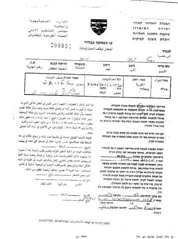
On the 8th of February 2016, the Israeli Civil Administration issued orders to stop the construction of 13 Palestinian structures/ stores in Beita town, south of Nablus city.

According to the Israeli halt construction orders, the targeted structures were “built without permits” form the Israeli Civil Administration (ICA).

Noted that the targeted structures used by Palestinians as stores and commercial structures; for the purposes of  buying and selling  vegetables and fruits.

Following details about the targeted structures:

Table No.1: details about the targeted structures

#

No. of military order

Type of structures and the area

Name of owner

1

200954

2 structures (80 + 120 square meters)

Owned by the Municipality of Beita

2

200955

2 structures (100 + 150 square meters)


Ra’oul Lutfi Issa

3

200956

1 structure (100 square meters)

4

200958

2 structures (180 +180 square meters)

Issam Mahmoud Najar

5

200959

1 structure (50 square meters)

Mahmoud Mohammad Odeh

6

200960

1 shed (150 square meters)

Owned by the Municipality of Beita

7

200961

1 shed (150 square meters)

Mohammad Rizeq Alla Mahmoud

8

200962

1 structure (150 square meters)

Owned by the Municipality of Beita

9

302024

1 structure (60 square meters)

Owned by the Municipality of Beita

10

302025

1 shed (80 square meters)

Nabeh Nasser Ma’ale

Total

13 structures


It’s worth pointed that the Israeli Authorities issued two types of military orders in this case, where the first one is the halt construction orders (from order No 1-8 in the table No.1), where the Israeli Authorities demanded the owners of the structures to an immediate halt of the construction  in the structures and to attend a previously appointed session to discuss the objections against the orders that set in this case by the Israeli Authorities on the 2nd of March 2016.

On the other hand, the Israeli Authorities issued another type of demolition orders .These orders granted the owners of the targeted structures more time (3 days from the date that the Israeli Authorities issue the orders which it the 8th of February 2016) to submit the objection against the demolition order. Noted this type of orders issued a step after the Israeli Authorities issued the “halt construction orders”.

The analysis conducted by the Geo-Informatics department in the Applied Research Institute-Jerusalem (ARIJ), showed that the targeted structures and stores located at the western entrance of Beita town, south of Nablus city, and within the “Farmer Markets” (Hisba) and the  surrounded ones. See the map below:

The analysis showed also, that these structures located in the area classified as “Area C” (according to Oslo Agreement, 1995), which it under the control of the Israeli Occupation Authorities. And since these structures located in the Area C, the Palestinians need to get “building permits” from the Israeli Civil Administration.

Furthermore, the targeted structures not only located at the western entrance of Beita town, but also located adjacent to the Israeli bypass road No.60,which used by the Israeli settlers, living in the northern part of Beita town.

In other words,  the targeting of these structures came according to  its location, and proximity to the bypass road No. 60, and the Israeli authorities adopted the claim of “illegal structures” or “build without permits” as a  “legal”  allegation to targeted the structures in aforementioned area.

Beita Town in Nablus Governorate:-

Beita (including Za’tara locality) is a Palestinian town in the Nablus Governorate. It is bordered by Osarin and Aqraba villages to the east, ‘Awarta and Odala to the north, Huwwara and Yasuf to the west, and Yatma and Qabalan to the south. For more information about Beita town follow the link below: 

http://vprofile.arij.org/nablus/pdfs/vprofile/Beita_vp_en.pdf


To sum up:

The Israeli Occupation Authorities used the claim “illegal structures” or “build without permits” to target Palestinian structures and houses. While always there are an ulterior  reasons with the aim of serving the Israeli settlers living in the illegal Israeli settlements in the occupied West Bank, and to emptying the “Area C”, which it about 60% of the total area of the West Bank, to pave the way for the implementation of the Israeli colonial projects. 

Prepared by:
The Applied Research Institute – Jerusalem

Recommended For You

ما يزيد عن 1900 دونما من الأراضي الفلسطينية في بيت لحم مهددة بالعزل لصالح مستوطنة افراتا

by arij
October 8, 2025
0
ما يزيد عن 1900 دونما من الأراضي الفلسطينية في بيت لحم مهددة بالعزل لصالح مستوطنة افراتا

في الثاني من شهر تشرين أول من العام 2025، أصدرت سلطات الاحتلال الإسرائيلي أمرًا عسكريًا جديدًا يحمل الرقم (ت/3/25) تحت عنوان "تعديل حدود – يهودا والسامرة، 5785-2025". ويأتي...

Read moreDetails

سلطات الاحتلال الإسرائيلي تستغل ‘المنفعة العامة’ لنهب الموارد الفلسطينية

by arij
September 30, 2025
0
سلطات الاحتلال الإسرائيلي تستغل ‘المنفعة العامة’ لنهب الموارد الفلسطينية

في الاول من شهر ايلول من العام 2025، نشرت الإدارة المدنية الإسرائيلية، الذراع الأيمن لحكومة الاحتلال الإسرائيلي أمرا عسكريا جديدا تحت عنوان " أمر ءبشأن قانون الأراضي (الاستملاك...

Read moreDetails

The Occupation Targets the Village of Raba Southeast of Jenin with Military Orders and Seizes Vast Areas of Its Lands

by arij
September 13, 2025
0
الاحتلال يستهدف بأوامر عسكرية قرية رابا جنوب شرق جنين ويصادر مساحات واسعة من أراضيها

 The Israeli occupation Army have continued their policy of plundering Palestinian lands, as their bulldozers leveled wide areas of agricultural land in the village of Raba, southeast of...

Read moreDetails

الاحتلال يستهدف بأوامر عسكرية قرية رابا جنوب شرق جنين ويصادر مساحات واسعة من أراضيها

by arij
September 13, 2025
0
الاحتلال يستهدف بأوامر عسكرية قرية رابا جنوب شرق جنين ويصادر مساحات واسعة من أراضيها

  واصلت قوات الاحتلال الإسرائيلي سياسة نهب الأراضي الفلسطينية، حيث أقدمت آلياتها على تجريف أراض زراعية واسعة في قرية رابا جنوب شرق محافظة جنين، تمهيدا لشق شارع عسكري...

Read moreDetails

Nablus Governorate’s Archaeological Sites Face Israeli Expropriation Plans

by arij
September 11, 2025
0
” المواقع الأثرية في محافظة نابلس… ساحة مفتوحة أمام مخططات المصادرة الإسرائيلية “

On 10 August, 2025, the Israeli Civil Administration (ICA), issued a booklet of military orders signed by the head of the so-called ‘Israeli Civil Administration’ in the occupied...

Read moreDetails
Next Post
الاحتلال يهدد بهدم مسكن في تجمع ” أبو فلاح ” شرق القدس المحتلة

الاحتلال يهدد بهدم مسكن في تجمع " أبو فلاح " شرق القدس المحتلة

LATEST NEWS

محافظة أريحا على خريطة المصادرة الإسرائيلية- إسرائيل تسعى للاستحواذ على أكثر من 7000 دونم في منطقة النبي موسى

محافظة أريحا على خريطة المصادرة الإسرائيلية- إسرائيل تسعى للاستحواذ على أكثر من 7000 دونم في منطقة النبي موسى

by arij
October 13, 2025
0

........................................................

ما يزيد عن 1900 دونما من الأراضي الفلسطينية في بيت لحم مهددة بالعزل لصالح مستوطنة افراتا

ما يزيد عن 1900 دونما من الأراضي الفلسطينية في بيت لحم مهددة بالعزل لصالح مستوطنة افراتا

by arij
October 8, 2025
0

........................................................

Annexation of the Jordan Valley: Implications for the Two-State Solution and Regional Stability

Annexation of the Jordan Valley: Implications for the Two-State Solution and Regional Stability

by arij
September 29, 2025
0

........................................................

Isolation of Three Villages Northwest of Jerusalem: Silent Annexation Creeps toward the Capital

عزل ثلاث قرى فلسطينية شمال غرب مدينة القدس: الضم الاسرائيلي الصامت يزحف نحو محيط العاصمة

by arij
September 24, 2025
0

........................................................

flag_yellow_lowEU-PfP-Logo

This website and its content were initiated in 1993 by the Applied Research Institute – Jerusalem (ARIJ) and the Land Research Center (LRC) with the support from the European Union up until 2023. Since then, the Applied Research Institute – Jerusalem (ARIJ) has taken over the continued development and maintenance of the website. The views expressed remain solely those of ARIJ) and do not necessarily reflect those of the European Union.

© 2025 Copyright ARIJ . All Rights reserved. .

No Result
View All Result
  • Home
  • Settlements
    • New Israeli Settlements
    • Settlement Expansion
  • Israeli Violations
    • Agriculture
    • Confiscation
    • Demolition
    • Environment
    • Eviction of Palestinians
    • Settlers Attacks
  • Bypass Roads
  • Israeli Plans
  • Segregation
    • Checkpoints
    • Closure
    • Separation Plans
  • Military Orders
  • Reports
    • Daily Report
    • Monthly Report
    • Quarterly Report

© 2025 Copyright ARIJ . All Rights reserved. .