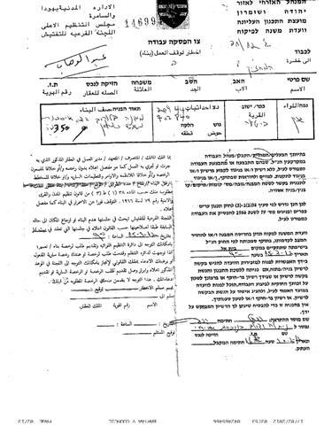
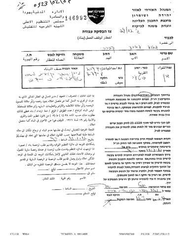
On the 21st of February 2012, the Israeli Occupation Forces raided the village of Bart’aa Al-Sharqya and delivered several halt-of-construction orders to families of the village, under the pretext of lacking the necessary building licenses, due to their location in ‘Area C’, which according to Oslo II Interim Agreement of 1995 is under the complete control of Israel. Table 1 gives details of the threatened properties.
|
Table 1:- List of the threatened properties in Bart’aa Al-Sharqya village, Jenin Governorate
|
|
No.
|
Owner
|
Military Order #
|
Facility Type
|
Area m²
|
Building Type
|
|
1.
|
Abdl-Wahab Mustafa Qabha
|
# 146991
|
Storage Room
|
350
|
Tin
|
|
2.
|
Jawad Abed Qabha
|
# 146992
|
Poultry Farm
|
700
|
Tin
|
|
3.
|
Sabri Ibrahim Qabha
|
# 146993
|
Retaining Wall
|
60
|
Cement
|
|
4.
|
Sabri Ibrahim Qabha
|
# 146993
|
Cement Ground
|
2000
|
Cement
|
|
5.
|
Ramadan Abdallah Mas’oud
|
# 146995
|
Cement Ground
|
60
|
Cement
|
|
6.
|
Nour Al-Dyn Ali Qabha
|
# 148324
|
Poultry Farm
|
400
|
Tin
|
|
7.
|
Anwar Ali Qabha
|
# 148325
|
Stone Factory
|
200
|
Tin
|
|
8.
|
Bilal Muhammad Qabha
|
# 148326
|
Poultry Farm
|
300
|
Tin
|
|
9.
|
Bilal Muhammad Qabha
|
# 148327
|
Storage Room
|
45
|
Tin roof
|
|
10.
|
Amneh Mahmoud Zbarqah
|
# 148328
|
Poultry Sheep Farm
|
230
|
Tin
|
|
11.
|
Hussam Abdallah Qabha
|
# 148330
|
Poultry Farm
|
400
|
Tin
|
|
12.
|
Hussam Abdallah Qabha
|
# 148331
|
Storage Room
|
30
|
Tin
|
|
13.
|
Muhammad Othman Qabha
|
# 148332
|
Sheep Farm
|
600
|
Tin
|
|
Source: Bart’aa Al-Sharqya Local Council – 2012
|


Previous Israeli Assaults against properties in Barta’a Ash Sharqiya:-
On the 16th of January 2006, the Israeli occupation authorities carried out a demolition campaign against houses, commercial and agricultural installations in the village under the pretext of un-licensing. The destroyed installations are only 50 meters from the 1949 Green Line (1949 Armistice Line). For more Information, follow the link:
Moreover, on the 18 of March 2010, the Israeli occupation forces delivered 9 demolishing orders to Palestinian residents in Barta’a Ash Sharqiya (East Barta’a) west of Jenin city. The 9 orders that were set out by the Israeli civil administration and handed out to residents at the hands of the Israeli occupation forces came all under the pretext of lacking proper building authorization due to their location in areas classified as ‘C’. For more Information, follow the link
In addition, on 22 June 2011, the Israeli Occupation Army started a large-scale demolition campaign against Palestinian coal factories in Barta’a Ash Sharqiya under the pretext that the smoke coming out of the factories, disturbs residents of nearby Israeli settlements, although the nearest Israeli settlement, Mevo Dotan, is 10 km far from the factories. Furthermore, the Israeli Occupation Authorities claimed that factories are located in areas classified as ‘C’ and lack the proper licensing documents.
Barta’a Ash-Sharqya: Location and Population-
The village is located 30 km east of Jenin city and stands on a total area of 11104 dunums, including 781.8 dunums that constitute the built up area. According to Oslo II Interim Agreement of 1995, the Village’s lands are classified into areas ‘B’ & ‘C’; where 9987 dunums, 89.9% of the total village area is classified as area ‘C’, while the remaining area, 932 dunums, 10.1% of the total village area, is classified as area‘B’. From the north, its bordered by the 1949 Armistice Line (Green Line), from the south, it is bordered by Qiqis and Dhahr El ‘Abed villages. As from the east, it is bordered by Rihan Israeli settlement and from the west, it is also bordered by the 1949 Armistice Line (Green Line). According to the Palestinian Central Burea of Statistics (PCBS) of 2011, the village has a total population of 5107 people.
The Israeli Segregation Plan in Barta’a Ash Sharqiya Village:-
The latest Israeli revised map of the Segregation Wall that was published on the Israeli Ministry of Defense’s website in April 2007 showed that Barta’a Ash Sharqiya village along with 6 other Palestinian communities, are entrapped in an enclave and isolated from the center of life in Jenin city and the nearby Palestinian villages which, are set outside the enclave. The enclave includes the villages of Al Muntar Al Gharbi, Kh. Ash Shiekh Saed, Kherbit Abdullah Al Younis, Um Ar Riham, ‘Arab Al Hamdoun, Kherbit Al Maleh and Barta’a Ash Sharqiya. See Table 2 & Map 2:-

The Segregation Wall in Barta’a Ash Sharqiya enclave extends for about 17 km, starting from ‘Anin village near the 1949 Green Line (Armistice Line), then it extends to the east towards Arqa village cutting through its lands. It then stretches southeast towards Ya’bad and Barta’a villages where it isolates a considerable area of lands of the two villages and then continues towards Zabda village in the south where it isolates some of its lands within the enclave. Table 2
|
Table 2: Palestinina communities isolated inside Barta’a Enclave
|
|
No.
|
Name of Enclaved Palestinian Communities
|
Population
(PCBS 2011)
|
|
1.
|
Umm Ar Rehan
|
434
|
|
2.
|
Abdullah Al Younis
|
163
|
|
3.
|
Kherbit Ash Sheikh Sa’ed
|
253
|
|
4.
|
Kherbit Al Mintar Al Gharbi
|
22
|
|
5.
|
Barta’a Ash Sharqiya
|
4180
|
|
6.
|
Arab Al Hamdoun
|
105
|
|
7.
|
Daher Al Maleh
|
252
|
|
|
Total
|
5409
|
Furthermore, the Wall enclave contains four illegal Israeli Settlements, where the Israeli Occupation Authorities has plotted plans to annex them to Israel through the construction of the Israeli segregation wall. Table 3 gives details of the Israeli Settlements that Israel annexed to its proper through Barta’a enclave:-
|
Table 3:- Israeli settlements annexed to Israel through Barta’a enclave
|
|
No.
|
Settlements inside Enclave
|
Date of Establishment
|
Area (Dunum)
|
Population (2008)
|
|
1.
|
Rehan
|
1977
|
418
|
170
|
|
2.
|
Shakid
|
1981
|
858
|
578
|
|
3.
|
Hinnanit
|
1981
|
769
|
811
|
|
4.
|
Tel Menashe
|
1994
|
275
|
452
|
|
5.
|
Total
|
|
2320
|
2011
|
|
Source: Geographical Information Syytem unit, ARIJ 2012
|
In addition to that, many Palestinian communities were indirectly affected by the construction of the wall around Barta’a enclave. Although these communities were set outside the enclave, but lost considerable portions of their lands inside the enclave and no longer can access their isolated lands. Table 4 gives details of the Palestinian villages that were indirectly affected by the construction of the Segregation Wall around Barta’a Ash Sharqiya enclave.
|
Table 4:- Palestinian communities affected by the construction of the wall around Barta’a enclave
|
|
No.
|
Enclaved Village Boundary
|
Area Within Enclave (Dunum)
|
Total Village Area (Dunum)
|
Percent from Village Boundary
|
|
1.
|
Zibda
|
2661
|
11601
|
22.9 %
|
|
2.
|
Barta’a
|
10760
|
13462
|
79.9 %
|
|
3.
|
Anin
|
7140
|
11614
|
61.5 %
|
|
4.
|
Ya’bad
|
6323
|
37539
|
16.8 %
|
|
5.
|
Arqa
|
868
|
5663
|
15.3 %
|
|
6.
|
Silat Al Harthiya
|
63
|
8964
|
0.7 %
|
|
7.
|
Total
|
27815
|
88843
|
31.3 %
|
|
Source: Geographical Information Syytem unit, ARIJ 2012
|
Conclusion:-
The Israeli policy of house demolition violates two distinct articles of the Fourth Geneva Convention that clearly render any destruction of property as illegal under international law, unless this act is crucial for military purposes. The Fourth Geneva Convention also utterly renounces any form of collective punishments. (Scroll down to see articles 33 & 53 of the convention).
The Fourth Geneva Convention: (August 12, 1949): CONVENTION (IV) RELATIVE TO THE PROTECTION OF CIVILIAN PERSONS IN TIME OF WAR
– Article 33: No protected person may be punished for an offence he or she has not personally committed. Collective penalties and likewise all measures of intimidation or of terrorism are prohibited.
– Article 53: Any destruction by the Occupying Power of real or personal property belonging individually or collectively to private persons, or to the State, or to other public authorities, or to social or cooperative organizations, is prohibited, except where such destruction is rendered absolutely necessary by military operations.
The system of control over Palestinian land is justified legally on military orders enacted by the Israeli army to demolish and seize land for ‘security’ reasons. However, ‘security’ reasons are better translated to strategic, political and economic reasons, and the ongoing development of settlements is testament to this idea. Israeli actions do not comply with international law which sets out clear instructions for the behavior of an occupying force concerning an occupied population. Israel therefore continues to violate international law.
- Article XXXI of the 1995 Oslo agreement provides that: Israelis forbidden from building or planning to any project or settlements or any colonial expansion or any plan that lead to change the status of the West Bank and Gaza Strip. The article provides “Neither side shall initiate or take any step that will change the status of the West Bank and the Gaza Strip pending the outcome of the permanent status negotiations”.
-
Furthermore, the existence of the Israeli settlements in the West Bank and its expansions are Illegal and in contradiction with the international law rules, United Nations Security Council Resolutions such as 237 (1967), 271 (1969), 446 (1979), 452 (1979), 465 (1980.
Prepared by:
The Applied Research Institute – Jerusalem
ARIJ


