On April 7, 2011, the Israeli Army bulldozers under the protection of the Israeli Occupation Army, stormed Khallet Im- Al Fahem and Al-Kharame areas in Al- Khader village west of Bethlehem Governorate, and demolished two agriculture wells and a barracks owned the two local residents from the village Mr. Muhammad Hussein Mohammad Issa and Mr. Khalil Mohammad Mustapha Salah.
In an interview with ARIJ field workers, Mr. Issa indicated that he had received an Israeli military demolition order for his barracks and 90 cubic meter agriculture well which were built in October 2010 with a total cost of 40.000 NIS.
On the other hand Mr. Khalil Muhammad Mustapha Salah provided that he received a demolition order three months ago for his 80 cubic meters agriculture well under the pretext of lacking building permit. He also added that the estimated cost for the well is 30,000 NIS.
The owners added that the construction of the two wells was within a project implemented by the “Palestinian Agriculture Relief Committee” and funded by the Dutch Government.
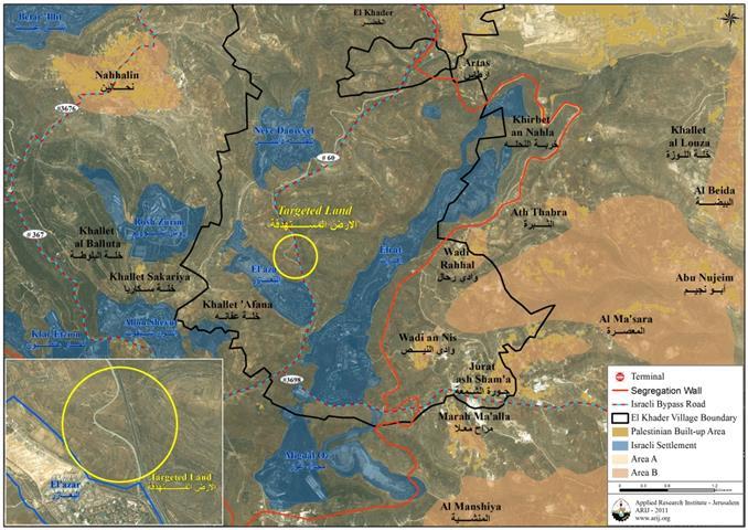
It is worth mentioning that the demolished wells located in lands classified as Area “C”
adjacent to the Illegal Israeli settlement of Eli’ezar
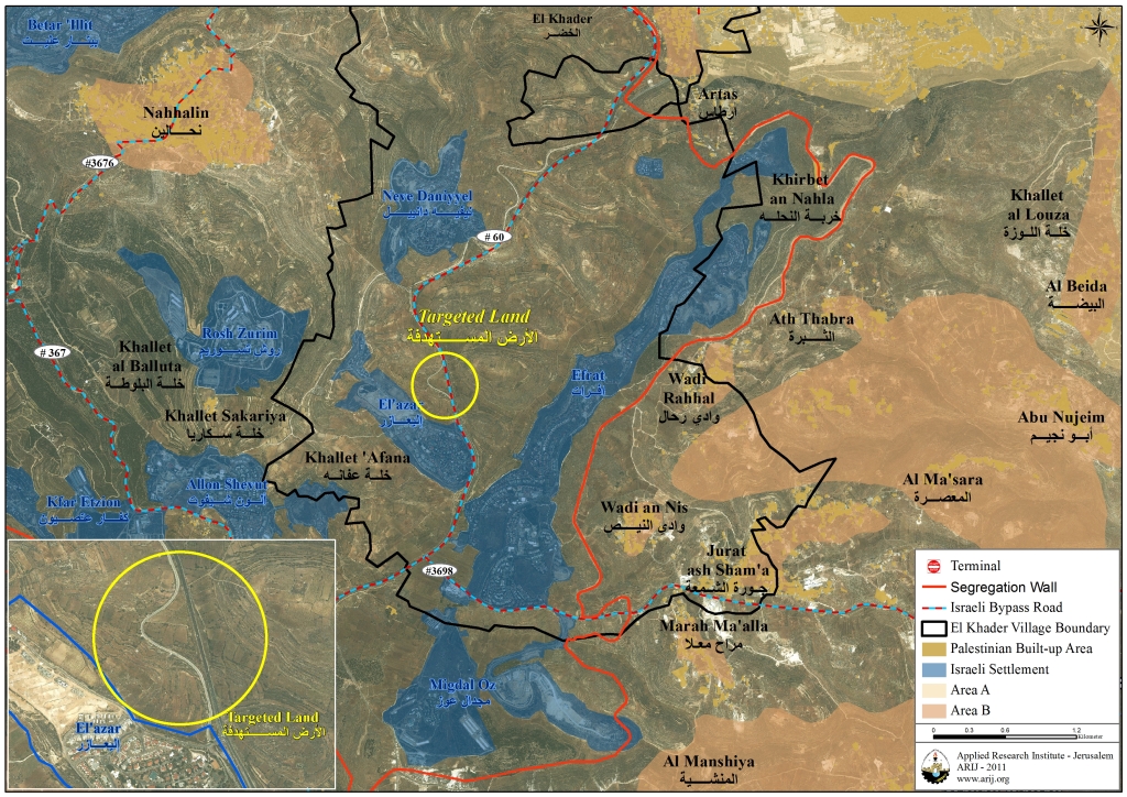
. See map 1 below:
Map of the targeted lands in Al-Khader Village
Al- Khader village is located some 4.5 kilometers west of Bethlehem city. It is bordered by Bethlehem city from the east, Husan and Battir villages from the west and northwest, Al Doha and Beit Jala cities from the north and northeast, and Al Duheisha Refugee camp and Artas village from the south. The built-up area of Al- Khader village spreads on 601 dunums of land, about 3% of the village’s total land area (20,090 dunums).
The village is home to 11,666 inhabitants (PCBS 2010), most of whom depend on land cultivation and agricultural work for income, where the rich and fertile soil has made farming and agriculture feasible in the village, therefore, agriculture has been and still is considered the major source of income for residents of the village.
Hebron: Land Leveling in Yatta town
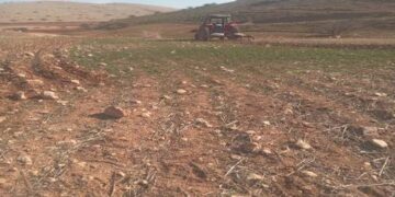
On April 6, 2011, the Israeli Army bulldozers under the protection of the Israeli Occupation Army, stormed the eastern parts of Yatta town south of Hebron Governorate at the southern parts of the West Bank, and razed 80 dunums of lands cultivated with fruits, owned by the local resident Mr. Jamil Hushieyeh.
The targeted lands have been snatched by an Israeli settler from the nearby Israeli settlement of Susiya
more than four years ago, in an attempt to illegally annex these lands to the settlement, and from that time the owner of the land has been relentlessly trying to get back his land through the Israeli Courts, which issued just within these few past weeks an order calling on the Israeli settler to evacuate the land but the Israeli Army leveled the land and destroyed hundreds of fruit trees cultivated by Mr. Hushieyeh before evacuating the Israeli settler.
Yatta, a Palestinian town located 9 kilometers south of the city of Hebron in the southern parts of the West Bank. It is bordered by Ar Rihiyya village and Al Fawar Refugee Camp and Wadi As- Sada from the north, As Samu’ village from the south, Beit ‘Amra village from the west, Zif and Khallet Al Maiyya communities from the east. The total population of Yatta town is 54,608 (PCBS 2010), where the total area of it is 270,000 dunums, of which, 14,000 dunums (5.2%) is classified as built-up area.
The Israeli settlers from nearby settlements carryout systematic attacks against Yatta’s cultivated land, next to the fact that they; in coordination and cooperation with the Israeli Army, deny the farmers of Yatta access to considerable areas of land to do any cultivation. In March 2011, a clique of Israeli settlers from the Illegal Israeli settlement of Susiya released flock of sheep into 50 dunums of lands cultivated with wheat and barley owned by local Palestinian residents of Yatta town, where they turning the land into pastures leading to the destruction of the entire crops.
New Bypass-Colonial Road in Hebron
On April 7, 2011, in Hebron Governorate, what is so-called “Israeli Minister of Transport and Road Safety”, Yisrael Katz , had visited Kiryat Arba’
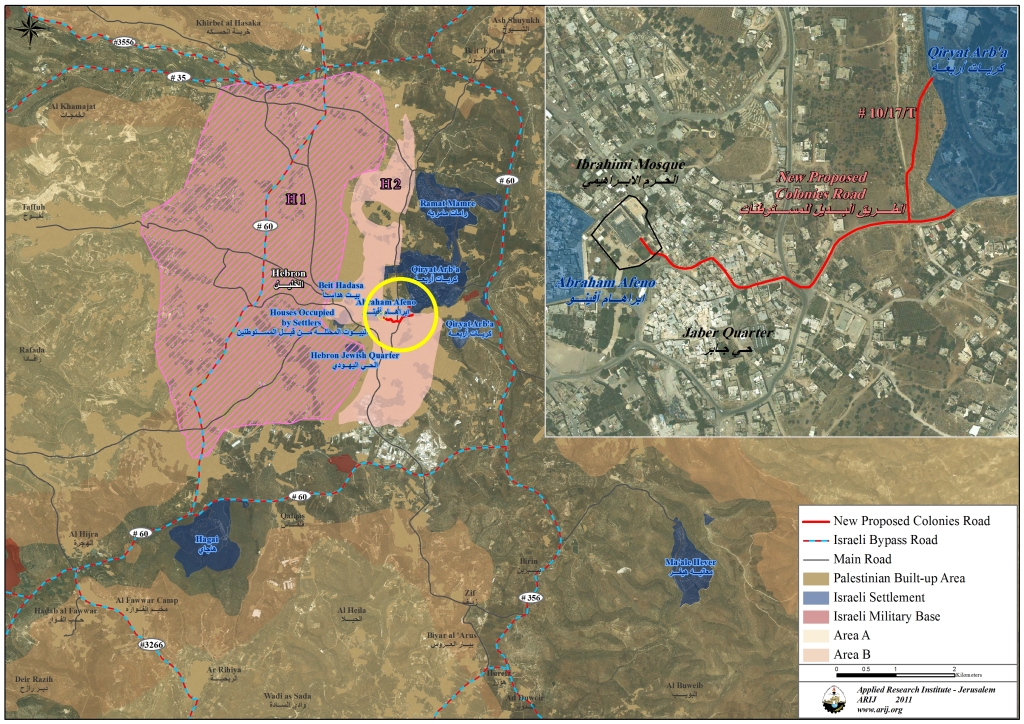
settlement in the heart of Hebron Governorate to launch the first phase of a new colonial project for a new road to link between the settlement of Kiryat Arba’ and Al-Ibrahimi Mosque. The road will pass through two Palestinian communities in Hebron: “Wadi Al-Nasara and ancient Jaber quarter. The realization of such road would require that dozens of Palestinian houses and buildings be seized and demolished within these communities.
The Israeli step came as a result of a pressure from the Israeli settlers of Kiryat Arba settlement in order to shorten the distance between their settlement and Al-Ibrahimi Mosque or the “Tomb of Patriarchs” as named by the Israelis. See the map 2 below:
Map of the proposed colonial road in Hebron
In an attempt to cast a historic and religious legitimacy on the project the Israeli Minister Katz said “an ancient and unbroken ties between the Jewish people and its lands for more than 3700 years “Haaretz newspaper 7/4/2011.
The project consists from 3 phases, with a total cost of 25 million Shekels (7.2 USD).
Jerusalem: 180 New Housing units in Ramot Settlement
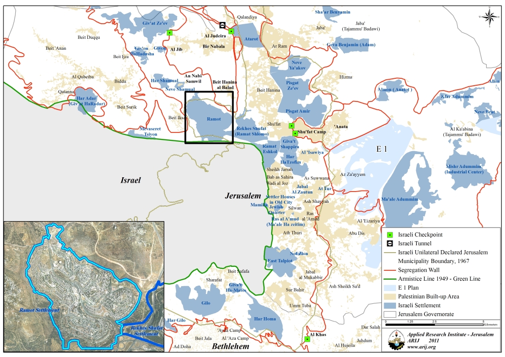
On April, 6, 2011, “Ir Amim, a Jerusalem- based Organization for Equitable and Stable Jerusalem with an Agreed Political Future”, revealed an Israeli project to build new housing units in Ramot Settlement
northwest of the city of Jerusalem.
According to the project three- 13-story buildings will be built in Ramot settlement as a part of what is so-called “Master Plan #8186”, which includes the building of 180 housing units, 60 units in each building. See map 3 below:
Map for Ramot Settlement in Jerusalem
The organization provided also that the proposed project will be approved by the “Regional Committee for Planning and Construction” in the Israeli Ministry of Interior within few days.
More on this issue, on March 13, 2011, the Israeli Ministerial Committee headed by Benyamin Netanyahu approved a new colonial plan to build 508 new housing units in the Illegal Israeli settlements of Ma’ale Adumim east of Jerusalem city, Ariel settlement north of Salfit city, Gush Etzion settlement bloc southwest of Bethlehem city, and Modi’in ‘Illit settlement west of Ramallah city.
To Conclude
The Israeli colonial procedures taking place rapidly and steadily on the ground, aim to fortify the esistance of settlers and the occupation for that matter in the occupied territory, particularly in Jerusalem but more than that it tends to eradicate the Palestinians’ legitimate right to have an independent, viable, contiguous State on their own lands.
A repeated emphasis is also note that all of the Israeli Occupation procedures, activities and plans in the occupied Palestinian territory are Illegal and constitute a grave breach of the International law rules and conventions and accordingly the unilateral changes conducted by the Occupation on the ground null and void.
The Israeli demolition of the Palestinian houses, confiscating their lands, building the Illegal settlements and outposts, clearly violates International agreements and conventions such as:-
-
Articles 147 & 53 of the Fourth Geneva Convention of 1949 indicated that: Extensive destruction and appropriation of property not justified by military necessity and carried out unlawfully and wantonly. Is a grave breach of the Convention.
-
Article 23 of The Hague Convention Art. 23 of the Hague Convention of 1907 also provides: In addition to the prohibitions provided by special Conventions, it is especially forbidden to destroy or seize the enemy’s property, unless such destruction or seizure be imperatively demanded by the necessities of war.
-
Also Under the Universal Declaration of Human Rights adopted and proclaimed by General Assembly resolution 217 A (III) of, December 10, 1948, Article 17 reads: ‘No one shall be arbitrarily deprived of his property.’ Which means it bans Israel from destroying or confiscating the property of the Palestinians at any case.
-
United Nation Security Council Resolution No. 446 of 1979 calls on Israel to rescind its previous measures and to desist from taking any action which would result in changing the legal status and geographical nature and materially affecting the demographic composition of the Arab territories occupied since 1967, including Jerusalem and, in particular, not to transfer parts of its own civilian population into the occupied Arab territories’
-
Also UNSCR No. 452 of 1979 “calls upon the Government and people of Israel to cease, on an urgent basis, the establishment, construction and planning of settlements in the Arab territories occupied since 1967, including Jerusalem.”
-
Moreover ,UNSCR No. 465 of 1980 ‘called upon Israel to stop building in the Israeli settlements in the occupied territories and to dismantle all of the Israeli settlements built in the aforementioned territories since the year 1967, and demanding all of the state parties of the UN not to help Israel in building these Illegal settlements’.
::::::::::__
[1] Area C Lands: Israel retains full control over security and administration related to territory according to Oslo II Interim Agreement of 1995 signed between Israel and the PLO- Palestinian Liberation Organization.
[2] Eli’ezar: Illegal Israeli settlement (is one of the settlements comprising the Gush Etzion settlement bloc) established in the year 1975, over 536 dunums of Al Khader village lands. Today, the settlement has a population of 1706 settlers.
[3] Susiya: Illegal Israeli settlement established in 1983, over 953 dunums of Yatta lands. Today, the settlement has a population of 792 settlers.
[4] Kiryat Arba’: Illegal Israeli settlement established in 1972 over 1193 dunums of lands in the heart of Hebron Governorate. The settlement is inhabited by 7226 settlers.
[5] Ramot: Illegal Israeli settlement established in 1973 over 3,383 dunums of lands in the northern part of the city of Jerusalem and adjacent to Beit Hanina Neighborhood. The settlement is inhabited by 41,448 settlers.


