The Village of Burin:
The village is located 8 kilometers south of the city of Nablus. Its area totals 10,416 dunums of which 335 dunums are its build-up area. Its population is around 3500. Two Israeli colonies were established atop its lands; Barakha which was built on 205 dunums of Burin lands while the second one is Yetzhar which was built on 150 dunums of Burin lands.
Map 1: The geographical location of the village.
The Violation:
On the 18th of July, 2009, a group of Yetzhar colonists burnt 300 olive trees planted in Palestinian lands in the village of Burin. The burning took place in the aftermath of the spread of a rumor about the intention of Israeli occupation forces of removing an illegal outpost close to the colony of Ma’ale Labona south of the city of Nablus. The said outpost consists of only one wooden shed placed on the top of an isolated hill. No more. No less.
The fire was set to lands located in Al Mayadeen Parcel south west of the village. The lands are owned by ten Palestinian farmers including Jamal Abdel Jabbar Abdel Hadi Eid, Waleed Mustafa Yaseen Al Najjar, Zakariya Mohammad Najjar, Hussein Waked, Ammar Ismaeil Mahmoud Eid and Ibrahim Deib Imran, among others.
The attack on Burin lands was carried out under the protection of a large number of Israeli occupation forces who played a major role in protecting the colonists during the rampage. The conduct of the occupation forces during the rampage is an undeniable proof of the real intentions of the occupation as its forces remove an illegal outpost (which was not inhabited to begin with) while providing assistance to colonists’ crimes.
Mr. Ali Mohammad Eid, the head of Burin’s village council, expressed the following to Land Research Center’s field researcher: ‘Around 80% of the agricultural lands of Burin are located in the vicinity of the colonies of Barakha and Yetzhar. This fact made the lands a prey for Israeli aggression; most of these lands were classified as Military Closed Areas to which Palestinian access is totally forbidden without prior coordination with the so-called “Israeli Civil Administration” and only during specific times of the year. The repeated attacks by colonists on these lands (especially in Karem Saleem and Al Mayadeen Parcels) under the protection of Israeli occupation forces made the control of these lands easier. A large number of attacks by colonists were recorded over the past 9 years in the villages of Assira Al Qibliya, Madama and Burin. Such attacks took the form of shootings at Palestinian farmers, raiding their homes, stealing their tools, using sharp objects to cause damage to olive trees in addition to burning lands. As of the time of writing this report, more than 1470 dunums of Burin lands were burnt since the year 2000. These lands contained 1200 olive trees and dunums upon dunums of wheat which were considered the main source of income for at least 14 farmers in the village. The residents of Burin filed a large number of complaints with human rights organizations, yet to no avail.’
On the other hand, there are more than 14 Burin houses located near the by-pass road that runs parallel to the colony of Yetzhar. These houses have been a frequent, almost daily, target of attacks of colonists.
The latest such attack took place during the past week when more than 20 colonists attacked Burin and destroyed 4 water tanks and cut off 4 old olive trees. In response, the residents of Burin tried to defend themselves with sticks and stones while the colonists opened fire and then fled the scene. Also, on the 23
rd of July, 2009, Burin was attacked again with a series of automatic gunfire that hit a number of houses. No injuries were reported.
In the meantime, colonists have torched more than 300 olive trees planted in 18 dunums belonging to Mr. Yousef Qaloos during the month of June 2009. Mr. Qaloos indicated the following to LRC’s field researcher: ‘This is the second time that the colonists burn my land. I did not have any rest for the past 10 years due to such attacks.’
Israeli Colonies Devouring Burin Lands:
-
Yetzhar Colony: It was established in 1983. Its build-up area is about 788 dunums. It has 440 colonists living it. It was established atop Palestinian lands from the villages of Burin, Hiwwara, Einyabous, Orief, Asira Al Qiblia and Madama
-
Barakha Colony: It was established in 1982 with a 647-dunum build-up area. There are 880 colonists living in it. It was established atop lands belonging to the Palestinian villages of Burin, Kufr Qallil and Arraq Burin

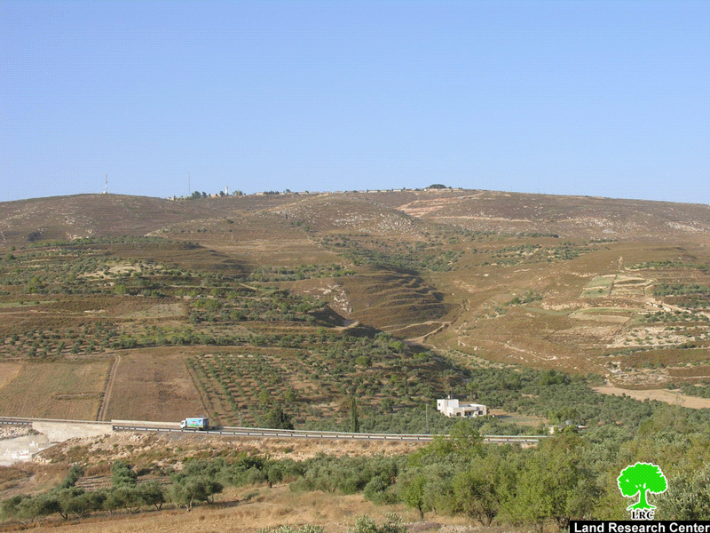
Photo 2: a general view of the village of Burin. Yetzhar looms in the back
For additional examples of colonists’ attacks on Burin, please refer to the following case here, here and here.
[2] Burin Village Council


