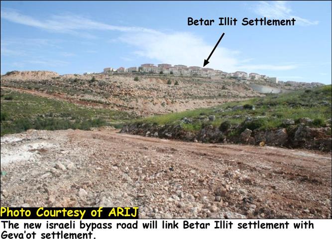
On Friday March 20th, 2009 a group of Israeli colonists, protected by Israeli occupation forces, attacked Palestinian farmers from the town of Deir Istia, west of the Governorate of Salfeet. The colonists prevented the farmers from reaching their lands in the location of Khirbet Shihada about 2 kilometers west of the town. Occupation soldiers took away the IDs of the farmers and forced them to remove their clothes under the pretext of “security check.” That was despite the fact that the farmers held special permits issued by the so-called Israeli ‘Civil Administration.” that allow them accessing their lands.
The Colony of Yakeer; a Source of Terror for Palestinian Farmers
Khirbet Shihada is considered one of the most fertile areas of the town of Deir Istia. Around 230 Palestinian farmers/land owners used to attend to their lands as its agricultural production forms the main source of income for them and their families. A number of water springs are present in the area that makes farming easy and covers the drinking needs of their herds and flocks while grazing.
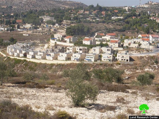
Life has changed upon the arrival of a group of colonists in the year 2000 to the area. They overtook Parcels 7 and 8 and established an outpost of the colony of Yakeer. Since then, the outpost became a source of agony and annoyance to the Palestinian farmers and villagers due to an ever increasing frequency of colonist attacks. In turn, Israeli occupation forces implement strict procedures against the residents of the village especially in its western region (a.k.a. Al Sahlat) atop which the colony of Yakeer was built. Such procedures included preventing farmers and landowners from reaching their lands except after being issued special permits by the Israeli occupation authorities.
Photo 1: The colony of Yakeer built atop Deir Istia lands.
Deir Istia:
The town of Deir Istia is considered one of the largest towns in the governorate of Salfeet. It is located in an area known as Jabal Al Deeb northwest of the city of Salfeet. A number of villages surround the town including Kafal Haris, Haris, Qarawat Bani Hassan, Waqira, Zeita Jama’ein, Jinsafout, Azzun Al Shamaliya, Till, Siniria, Bidya and Ammatien. According to the Palestinian Central Bureau of Statistics (PCBS), there are about 4,000 Palestinians living in the town.
A number of clans live in the town including Abu Hijla, Abu Faris, Sa’ed, Sahban, Salman, Aqel, Awad, Kujak, Makhalifa, Mansour, Abu Naser, Al Sheikh Abdulla, Al Qadi, Hakeem, Khateeb, Diab, Zeidan and Al A’araj.
In terms of livelihood, around 47% of the population depends on working in the private and the public sectors, about 13% depends on working inside the Green Line while 24% work in the agriculture sector. The high percentage of agriculture dependency is due to the fact that a large number of water springs and water cisterns are present in the Wadi Qana area of the town.
The total area of the town is 34,765 dunums of which 1527 dunums are its built-up area. Around 40% of the town’s area is being used for Israeli colonial activities as a large number of settlements and outposts spread atop Deir Istias’ lands including the following:
|
Name of Colony
|
Type
|
Establishment Date
|
Area in dunums
|
Built-Up Area in dunums
|
No. of |Colonists as of 2006
|
|
Amanoeil
|
Residential
|
1982
|
1909
|
328
|
2585
|
|
Yakeer
|
Residential
|
1981
|
1364
|
342
|
960
|
|
Nofim
|
Residential
|
|
331
|
248
|
414
|
|
Ravava
|
Residential
|
1991
|
1200
|
|
703
|
|
Karni Shamron
|
Residential and industrial
|
1978
|
7339
|
1351
|
6170
|
|
Ma’ale Shamron
|
Residential
|
1980
|
1903
|
216
|
549
|
|
Ghanat Shamron
|
Residential
|
1985
|
484
|
|
|
|
Nof Oraniem
|
Residential
|
1991
|
153
|
|
|
The Israeli colonies spread over the lands of Deir Istia form a threat on the region from a number of angles including the following:
-
The confiscation of water springs and grazing areas in the village for the benefit of the colonies. In turn, this has an adversely negative effect on the economy of Deir Istia given that most of its residents depend on herding as one of main sources of income.
-
The 8 colonies listed above rest atop 40% of the area of the town and surround it from all directions. Moreover, Israeli occupation forces embarked on a massive enlargement of the colonies as well as the confiscation of hundreds of agricultural dunums for the purpose of establishing a network of roads connecting between the colonies.
-
Farmers are prohibited from reaching their lands located in the vicinity of the colonies without prior permit and coordination with the occupation forces.
-
Colonists continue to carryout attacks and physical beatings against Palestinian farmers under the protection of occupation forces especially during the olive harvest season.


