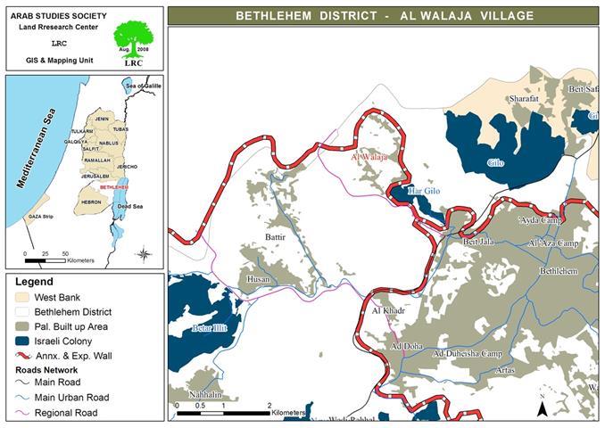
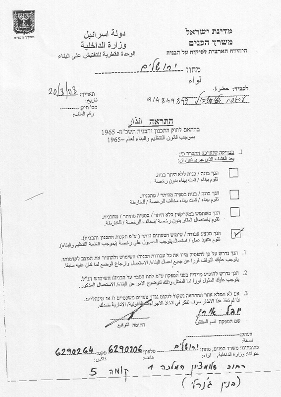
At 8:30 AM on the 20th of August 2008 Israeli occupation forces raided the village of Al Walaja in Bethlehem Governorate. The force headed towards the Ein Al Juwweiza neighborhood and specifically to a location named Al Huwwar. Present on location was a bulldozer and Palestinian workers trying to construct a 2-kilometer road leading to the oldest olive tree in the world (about 3,000 years old). The road was designed to connect between Khillet Al Huwwar with the neighborhood of Ein Al Juwweiza. Most of the construction was carried out as only 200 meters were left to finish the project. However, Israeli occupation forces raided the construction location along with a jeep associated with the Jerusalem Municipality. The soldiers forced the driver of the bulldozer to stop his work on the site under the pretext that the area in which he was working lies under the jurisdiction of the Jerusalem Municipality. The soldiers also threatened to arrest anyone who would continue to work in the area. Moreover, the soldiers handed the workers an order issued by the Israeli Ministry of Interiors Construction Inspection Unit which stated the following: ' The work carried out on location needs a permit. As such, all construction work must be terminated instantly. Those carrying out the construction must meet the General Inspector immediately to explain the construction to him. Legal and administrative steps will be taken against those who defy this order.'
The irony here is the fact that while Israel stopped the work on this road, it also issued a new military order (no. Sh.M.S /05/8/0) that called for the construction of a new road (width 6 meters x length of 147 meters) that would allow Israeli colonists to reach colonies northwest the Governorate of Hebron. Israeli occupation authorities also gave the green light to build additional 400 colonial units in the colony of Neve Yaqob in East Jerusalem.
The Village of Al Walaja: Targeted by Israel Since 1948:
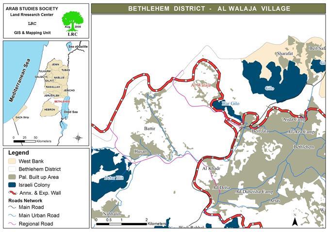
Since 1948 until nowadays Israel has been targeting the village of Al Walaja which is located 8.5 kilometers southwest of the City of Jerusalem. In 1948 the area of the village was 17,793 dunums. In the aftermath of the 1948 War Israel occupied 11,793 dunums of the lands of the village. After the Six Day War, the area of the village shrunk again to become 6,000 dunums. Around 500 dunums were taken from the area of the village in 1996 for the purpose of constructing a by-pass road. An additional 1,000 dunums were confiscated between 1996 and 1997 for the benefit of the nearby colony of Gilo. As such, a mere 4500 dunums were left of the total original area of the village. Currently, Israeli occupation authorities are trying to confiscate additional 2100 dunums to be used for the construction of the Israeli Racist Isolation Wall. If the construction is successful, the village will be left with only 2400 dunums.
Photo 1 & Photo 2: Picture of the lands that is expected to be confiscated for the benefit
of the Wall in the village of Al Walaja
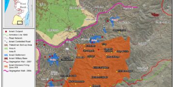
On the 6th of June 2008 Israeli occupation forces embarked on surveying the lands of the village after it gave Al Walaja village Council a notification of the proposed route of the Racist Wall.
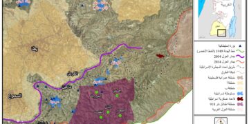
Photo 3: The route of the Wall as submitted to Al Walaja village council
In January 2008 Israeli occupation authorities made public its intention to build an additional 3,000 colonial units atop Al Walaja lands
Photo 4: A general view of the village of Al Walaja
Is Occupation Racist?
A resident of the village replied to the above questions by saying: ' There is a social and historical fact that indicates that each occupation has to be racist as it does not respect the right of human beings to free movement. The prevention of the construction of the proposed road by the Palestinians in Al Walaja is a clear evidence of this fact; the prevention took place while road networks are being constructed at a large scale to be used only by the colonists. Another example is the fact that the occupation has constructed a road in January 2007 through the village of Al Walaja with a length of 1000 meters as to facilitate the construction of colonial units atop Walaja lands. Palestinians have no right to improve their basic infrastructure or to build houses atop their lands while Israeli colonists have all the right to do so on lands that does not even belong to them in the first place. Israeli occupation has always tried to ease the movement of the colonists through constructing direct routes between colonies, enlarging the roads and illuminating them. On the other hand, Palestinian roads are narrow, unpaved, leghthy and time consuming. These roads have more than 600 closures (earthmounds, checkpoints, gates, etc.) while it lacks the very basic infrastructure that is needed for a safe movement. Even when Palestinians try to improve their roads and establish new ones, Israeli occupation interferes and prohibits them from doing so under lame pretexts. '
Mr. Saleh Khalif, the head of Al Walaja village council, indicated the following to Land Research Center's field worker: ' We have finished the final stages of constructing a road connecting between the neighborhood of Ein Al Juwweiza and the location known as Al Huwwar. Constructing the road was done in cooperation between Al Walaja Agricultural Society and the Italian Cooperation. There is an old olive tree in Al Huwwar nicknamed Al Badawi whose ages in estimated to be 3000 years. However, Israeli occupation forces ordered us to stop the construction immediately. This land is ours for generations upon generations. Yet now the Israeli occupation is preventing us from carrying out any kind of activity on it 'without a permit.' We, at the village council, refuse the occupation's policy and stress that it is our right to construct and develop our lands. We have only 2500 dunums left of the original area of the village after the occupation confiscated 3500 dunums and placed them under the authority of the so-called 'Civil Administration', while thousands of dunums were confiscated and placed under the authority of the Jerusalem Municipality. '
Prepared by:
The Land Research Center
LRC


