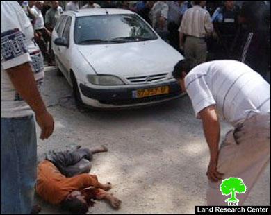
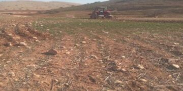
(Photo 1: Hawwara-Nablus: child Qassam Amira after being hit by a settler's car)
Location, Population and area
The colony of Yizhar was founded in the year 1983 over the lands of Palestinian farmers from the villages of Burin and Asira Al Qibliay to the south west of the city of Nablus. Ever since, it has horizontally and gradually expanding over dozens of dunums from the neighboring villages of Orif, Madama and Hawwara. By the end of 2005, Yizhar municipal boundaries were 1223 dunums of which 269 dunums as built up area (source: Foundation for Middle East Peace- Washington). See Map 1
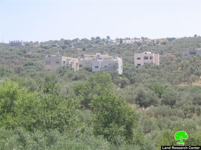
The colony is located in basin number 8, namely in the areas of Al Marj, Jabel an Nada and at the top of the mountain adjacent to Salman Al Farisi hill top. Salman Al Farisi is a companion of prophet Mohammed and the hill top was named after him. See Photo 2
Table 1: Gradual increase of Yizhar setters by year
|
Year |
No. of settlers |
|
1983 |
64 |
|
1998 |
291 |
|
2004 |
534 |
|
2005 |
590 |
Erection of new caravans
Starting from the beginning of 2007, settlers of Yizhar began a series of measures aiming at bringing more settlers into the site by adding additional caravans ( mobile homes) at the confiscated land of Asira Al Qibliya which is located to the east of the village. The newly erected caravans are one km away from the current boundaries of the colony's built up area which means that the settlers are aiming at a huge expansion of the colony in the future. A road and necessary infrastructure were introduced to the newly expansion site. Nowadays, the colony of Yizhar has a Yeshiva school, dormitories, and a kindergarten. See Photo 3
Yizhar is connected with other colonies
As a means of facilitating Yizhar settlers' movement, tightening grip over Palestinian land and natural resources and facilitating provision of services the colony was linked to road No. 60 passing by the northern edge of the colony to serve two goals:
1. Connecting it with road No. 57 and 557 that lead to the colonies of Itimar, Bracha and Allon More to the north east of Yizhar in the main heartland mountainous region of the West Bank;
2. Connecting it with the Israeli proper passing by the cluster of Kaddumim colonies and Shave Shomron at the western slopes of the West Bank.
Announcing Salman Al Farisi hill top as nature reserve
After including the Salman Al Farisi hill top within the municipal boundaries of Yizhar colony, the Israeli occupation authorities announced it as a nature reserve prohibited for Palestinian access and use. As a result of this measure, farmers and land owners are under the threat of loosing hundreds of dunums of their agricultural lands for the future expansion of the colony, as the Israeli occupation authorities have a long reputation of changing nature reserves into exclusive Jewish built up areas whenever that deems necessary from their point of view. See Photo 4
Impacts of Yizhar colony on Palestinian life
Looting and burning of land:
-
The Yizhar colonists continue to steal Palestinian agricultural land within the Israeli announced municipal boundaries which were used in the past by Palestinian farmers to cultivate olives, grapes and irrigated agriculture of all types. Farmers are no longer allowed to access their lands, consequently, stripping them off their sources of livelihood and raising the percentage of unemployment in the affected villages to more than 50%.
-
Between now an then, the Israeli occupation army shoots flare bombs setting fire to agricultural land. For instance, 200 dunums located in the areas of Bir Asira, Al Kurom and Adhaher of Asira Al Qibliya village were set on fire in the year 2002 as a result of the Israeli army's flare bombs.
Stealing of cattle and attacking shepherds
-
The Yizhar colonists wander in the area surrounding the colony attacking Palestinian shepherds and farmers, and sometimes, stealing their cattle. The latest such attack, for example, took place in April, 2004, when shepherd Mohammed Hamid, 72 years old, from Asira Al Qibliya was severely beaten and his 15 sheep stolen at the hands of Yizhar colonists. Even, donkeys are no exception. For instance, two donkeys belonging to Mr. Ibrahim Mohammed Makhlof and Mr. Abdul Basit Mohammed Amin were stolen and ridden inside the colony.
-
During the olive harvesting season farmers are met with bullets fired by Yizhar colonist who chase them in the fields and mountains to force them out of the area. In one incident in 2005, farmer Hani Abdul Ra'oof Shehada, 35 years old, was critically hit with a bullet in the neck and he was hospitalized for many days in the intensive care unit. He was fired at whilst trying to defend a group of women from Asira Al Qibliay village who became under settlers' attack.
Obstructing farmers' movement
During the expansionist steps of the colony, the Israeli occupation army cut all the roads that link the villages of Burin, Orif and Asira Al Qibliay with their agricultural lands. This colonial measure has led to separating these villages from their only resources of livelihood and, consequently, paralyzing the agricultural life in these areas.
Death road for Palestinians
Yizhar, Itimar, Bracha and Alon More colonists speedily drive their cars through the town of Hawwara using road number 60 which is now called 'the death road ' by the Palestinian citizens because of the many deadly car accidents on this road. The pace of accidents on this road is once or twice a week, claiming the lives of Palestinian citizens. On June, 15th, 2007, for instance, a speedy settler hit and killed with his car a 46 years old man, Bassam Amira, and critically injured a 12 years old child, Qassam Damidi.
The Hawwara town's municipality has been asking permission from the Israeli military to rehabilitate the road and build a pedestrian bridge over it, but, to no avail under the pretext that this road is located in zone C which under total Israeli security and civic affairs, according to Oslo agreement.
Prepared by
The Land Research Center
LRC


