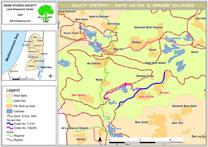
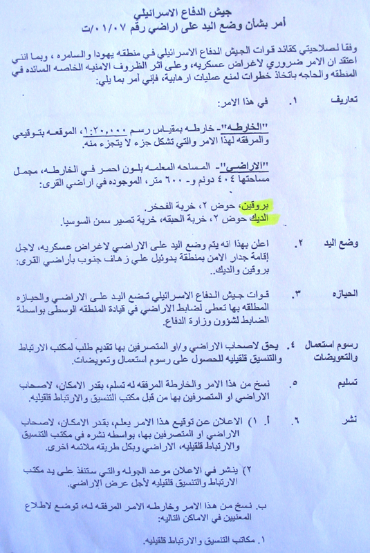
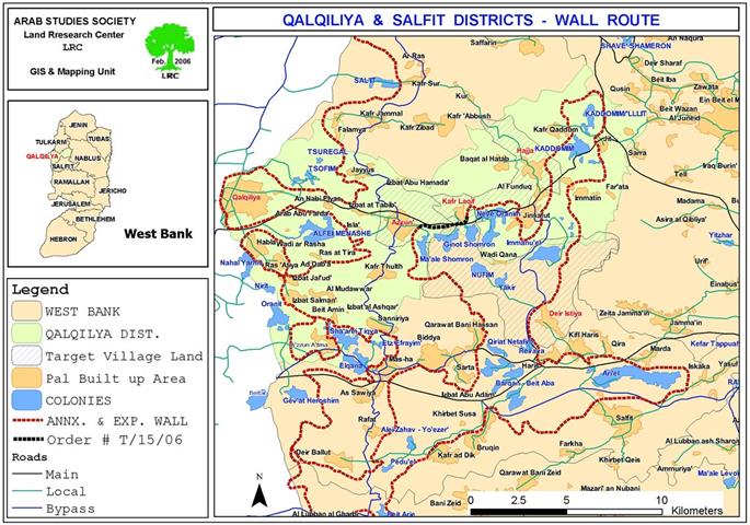
The Israeli occupation army issued a new military order stating the confiscation of 404 dunums and 600 squarer meters of Palestinian lands in Bruqin and Kafr Ad Dik villages in Salfit governorate. The land which is located in basin number 2 was confiscated for the purpose of building a new section of the Segregation Wall to the east of the colonies of Eli Zahav and Pedu'el as an introduction to annexing them into Israel.
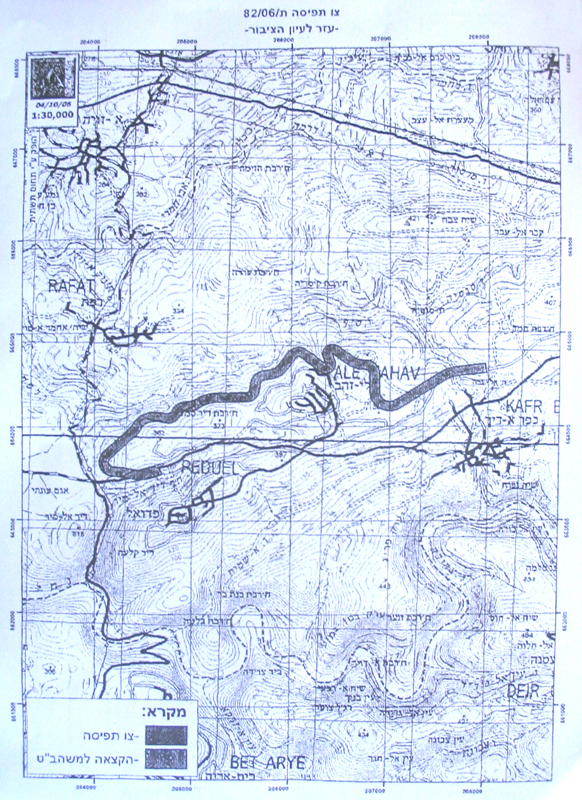
The aforementioned order was preceded last year with another one carrying the number of T/82/06 and stating the confiscation of 538 dunums of land belonging to Kafr ad Dik and Deir Ballut villages for the purpose of building a Wall section to the west and north of the two colonies of Pedu'el and Alei Zahav.
(Photo 1 & 2: a copy of the order No T/01/07 and attached map)
Bruqin and Kafr Ad dik
The village of Bruqin is located 13 kilometers to the west of the city of Salfit. It is considered to be one of the villages that depend mainly on agriculture to meet its basic needs. The population of the village is estimated to be 3,500.
The total surface area of Bruqin village is about 13237 dunums of which 1336 dunums are the build-up area. Around 1,200 dunums are planted with fruitful trees especially olives. That is in addition to 3,000 dunums of land used for shepherding while 8,000 dunums are used for settlement purposes (including settlements and by-pass roads).
Kafr ad Dik is adjacent Bruqin. Its population ranks to 4500, its total land area is estimated to be 17807 dunums, including 1150 dunums as built up area.
Around 70% of the families in the tow villages depend on farming and agriculture as the main source of income while the remaining 30% work in the private and public sectors. The unemployment in the villages reached about 60%.
Pedu'el and Alei Zahav
Pedu'el was established in the year 1984. In 2004, it had the total population of 1219. Now, it has the built up area of 171 dunums and municipal area of 595 dunums ( source- Foundation for Middle East Peace- Washington).
Alei Zahav began to exist in the year 1982. Its built up area is now 255 dunums and its municipal area is 2003 dunums, while its population reached 429 in the year 2004 ( source-ibid). Both colonies were built on lands confiscated from surrounding Palestinian villages.
The Wall route is planned to pass through the lands of these two villages so as to complete the bordering of the biggest finger-like corridor in the West Bank which aims at ensuring the annexation into Israel of all Israeli colonies in the area. This finger- like corridor of Ariel settlement's block includes, in addition to the above two settlements, another 13: Ariel, Yakir, Revava, Qiriyat Netafim, Neve Oranim, Carnei Shomron, Ginnot Shomron, Ma'ale Shomron, Immanuel, Nufim, Barqan, Beit Arie and Ofarim.
(Photo 3 & 4: a copy of the order No T/82/06 and attached map)
A Series of Israeli Violations against the Village of Bruqin
The village has faced a series of Israeli violations since its occupation back in 1967. Some of these violations include:
-
During the 1970s Israeli authorities confiscated a large portion of the lands of the village in its northeastern direction. Upon this confiscated land Israeli authorities established the settlement of Ariel in 1978 which is considered to be one of the West Bank�s largest settlements especially that it rests upon hundreds of dunums confiscated from the villages and towns of Salfitt, Iskaka, Kafl Haris and Bruqin in the governorate of Salfit (built up area 2479 dunum; municipal area 13775 dunums; population in 2004 was 16 414 settlers).
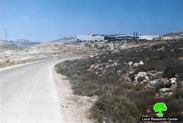
The danger faced by the residents of Bruqin is the continuous expansion of the settlement at the expense of the lands of the village as Israeli occupation authorities established in 1999 a group of factories to manufacture plastic items on the lands of the village. The factories (located east of the village and west of the settlement) were called the Ariel Factory Group and are expandable and evolving at the expense of lands of the village. Such expansion threatens to shut down completely the eastern entrance of the village in case the expansion of the factories takes place in the future.
(Photo 5: a group of Israeli factories near Ariel)
The establishment of the Israeli Segreation Wall around the settlement of Ariel on the lands of Bruqin and a number of other villages in the region has had an adversely negative effect on the people of Bruqin. Such an effect was produced through the expropriation of lands, the isolation of hundreds of dunums behind the Wall, in addition to the establishment of water canals beneath the Wall which led to the submerge of the agricultural lands behind the Wall with polluted water last winter. The reason was the fact that litter, dust and stones were collected around those canals which led to its obstruction and the hindering of water flow through it. What adds insult to injury is the fact that the settlers from the settlement of Ariel pumped sewage water towards the agricultural lands of the village which led to the destruction of the crops as well as the pollution of 3 water springs. These springs provides the village of Bruqin with 70% of the necessary water supply needed for drinking and watering the plants and crops. The springs include Al Matwi, Al Barkoni and Ein Al Baten which are all located in the eastern side of the village.
(Photo 6: Ariel sewage running in Palestinian land)
-
The settlement of Al Barkan ( Barqan). The settlement was established in 1981 north of the village. In 2004, it had the population of 1215 settlers. Its built up area is 349 dunums while its municipal area is 2720 dunums. It is an industrial settlement as it contains a number of chemical, plastic and oil factories which negatively affected Palestinian lands as most of the waste coming from these factories are dumped into these lands. Liquid waste usually finds its way between Palestinian houses especially in Al Barkooni Valley where the stream of liquid pollutants runs only 8 meters away from Palestinian houses. These liquid poisons have caused a large number of health problems in the village most important of which is cancer as there exist 4 cases of cancer in the village due to soil and crop pollution with industrial wastes from the factories.
(Photo 7: another Israeli factory near Barak settlement)
-
The release of a large group of wild pigs into the lands of Palestinian residents of the village of Bruqin and the nearby villages has caused a number of problems. Such problems include the spoilage of the crops of tens of agricultural dunums in addition to spreading the feelings of fear and horror amongst Palestinians due to the fact that these pigs usually attack humans violently.
-
In the year 2000 Israeli occupation authorities established a freeway on the lands of the village with a width of 100 meters that connects between the settlements of Ariel with Ras Al Ein ( Rosh Haiyen) location inside the Green Line. This has led to the confiscation of hundreds of dunums, not including the buffer zone which is 150 meters on both sides of the freeway along its total span. No Palestinian is allowed into the buffer zone for any reason whatsoever.
Impacts on both villages
In addition to the confiscation and destruction of hundreds of dunums under the path of the Wall as a result of the two military orders more thousands dunums will be separated behind and by so doing, the majority of the people in the two agriculturally dominant villages will totally loose or have limited access to their livelihood resources. This measure will increase poverty in the two villages to unprecedented levels as most people have already lost their jobs inside Israel at the beginning of the current Intifada. Moreover, Two of Kafr ad Dik northern houses will be separated behind the Wall path which will create more obstacles in the face if their occupants.
Legal action
The village councils of Kafr ad Dik and Bruqin presented a quick objection to the Israeli legal advisor at Beit Eil in the names of affected farmers and land owners against the proposed Wall plan. No response has yet been given from the Israeli side.
Prepared by
The Land Research Center
LRC


