The Israeli occupation army in the West Bank issued last month military decree number T/79/06 stating the confiscation of 72 dunums and 200 square meters from the lands of az Zawiya village, Salfit governorate. According to the decree the target land will be used for opening ' a temporary security road for Israeli military patrols in the land of az Zawiya'.
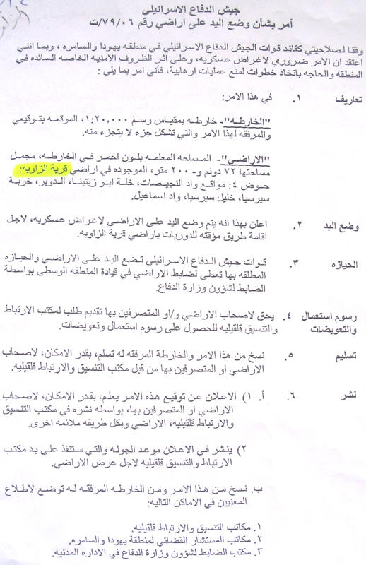
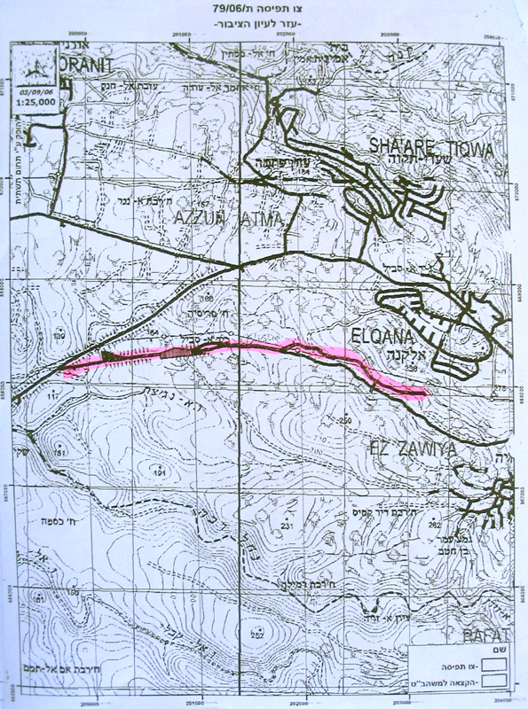
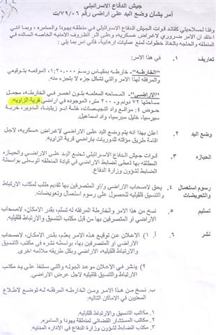
Photo 1 & 2: copy of the military decree and attached map) &: copy of the military decree and attached map)
The confiscated land is located to the north of the village between the colony of Elkana and Trans Samaria bypass road number 5 in the following sites of basin number 4: Wadi an Nigisat, Khalet Abu Zeita, ad Dwayer, Khirbet Sirsiya and Wadi Isam'il.
The planned road which aims at linking between Elkana and Trans Samaria 5 is a three km long.
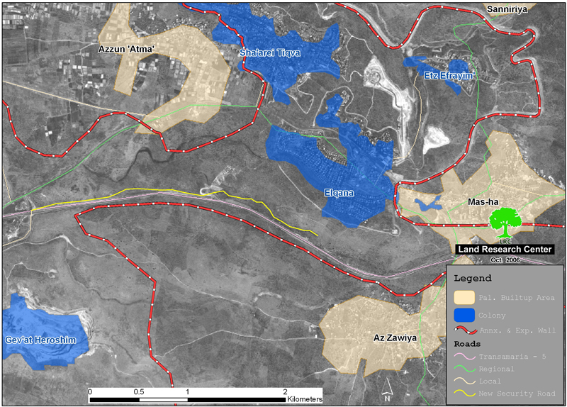
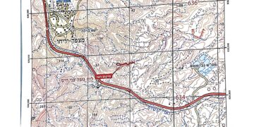
photo 3: the new security road ( in yellow color) adjacent to Trans Samaria 5
Location, population and area
The village of Az Zawiya is located 15 km to the west of Salfit city in Salfit governorate. It has a population of about 4000 people, mostly dependent on agriculture and animal breeding as main income. The village's remaining area is 12669.5 dunum as it lost thousands of dunums to Israel during the 1948 war and as a result of the construction of the Segregation wall on it land. Of the afore-mentioned area, only 906.6 dunums serve as built up area, in addition to other hundreds of dunums that have been separated behind the Wall.

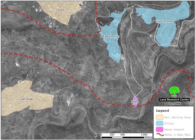
(Map 1: location of Az Zawiya village and planned security broad in purple color)
Map prepared by LRC
Impact of road construction on the village
1. Destroying more agricultural land and uprooting more olive trees from the lands of az Zawiya. It is worth mentioning that the construction of Trans Samaria highway 5 had led to the devastation of more than 35 000 dunums of Palestinian agricultural lands from az Zawiya and others. Thousands olive and almond trees were also cut down during this process. In the meanwhile, the Elkana colony started as a small nucleus in the year 1977 over the ruins of a deserted Jordanian army camp from the pre-1967 era and continued to expand at the expense of Palestinian land in the area. Now, Elkana's built up area is 758 dunums, its municipal area is 1198 dunums and its population in 2004 was 2983.
2. The road construction will hinder the Palestinians' access to their agricultural lands which will be separated behind it .
3. There are fears that the planned road may become a permanent main road for the use of Elkana's settlers' vehicle and for the future expansion of the colony given that every colonial expansion starts with a road.
Legal action
The municipality of az Zawiya and affected lands owners levied a complaint to the Israeli supreme court against this confiscation, yet, no response has been given. The law case was supported by all necessary documents and land registration and ownership papers.
Ongoing land grabbing
Apart from the above, the following is a list of violations and land grabbing measures that have taken place against the lands of Az Zawiya:
1- On March 4th, 2005 and after 7 month stop Israeli bulldozers resumed work in the construction of the Annexation and Expansion Wall to the north, west and south west of the village after introducing minor modifications on the path of the Wall according to which it was pushed a little further towards the green line. These modifications were announced in the Israeli army's Wall plan of February 20th, 2006.
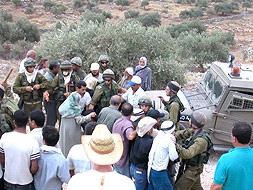
( photos 4 & 5: Anti Wall activities in az Zawiya) & : Anti Wall activities in az Zawiya)
The previous Wall plan of October, 2003 intended to expropriate larger areas of the village lands, in addition to the devastation of 400 dunums located under the path of the Wall. Although it was pushed westward towards the 1949 Armistice Line (Green Line) the Wall traveled at the length of 6 km and maximum width of 100 meter over the lands of Az Zawiya. The last Wall modification has led to the total destruction of an extra 600 dunums under the path of the Wall and the separation of hundreds of dunums behind it.
2. The gradual confiscation of hundreds of dunums for the establishment and expansion of many settlements in Salfit governorate, including, in addition to Elkana, the settlement of Sha'are Tikva (established in 1982: pop. in 2004 was 3685; built up area is 915 dunums; municipal area is 1045 dunums).
3. The construction of stone quarries to the west of the village expropriating more than 500 dunums of agricultural lands.
4. The erection of an army training camp over 300 dunums of the Az Zawiya separated village lands.
5. The continuous prevention of farmers and land owners from tending their lands and picking olives, especially in the areas of Khallet Rumaila and Khirbet Sirisiya under the pretext of proximity to Israeli settlements. Such a measure, which was put in force for the fifth running year has inflicted heavy losses on many families whose main income comes only from olives and olive oil after loosing jobs in Israel.
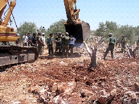
6. The burning of about 1000 dunums of olive groves last July at the hands of Israeli settlers from the settlements of Sha'are Tikva and Elkana ( See case study titled 'Az Zawiya Wall- separated land put in fire at the hands of Israeli settlers from Sha'are Tikva and Elkana, Salfit Governorate, July '.
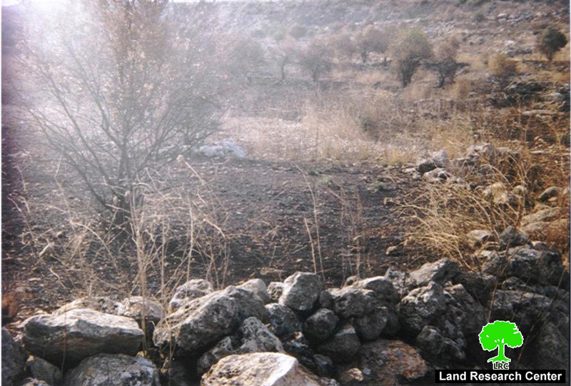
photo 6: az Zawiya olive field burned by settlers
Prepared by
The Land Research Center
LRC