Location and population
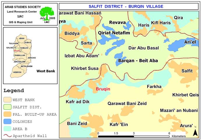
The village of Bruqin is located 12 km to the southwest of Salfit city, in the northern West Bank. The village houses a population of 4000 inhabitants. Before the year 2002, most of Bruqin man power worked inside Israel. Today, about 71% of this manpower is jobless.
Map 1: location of Bruqin
The area of Bruqin
The total area of Bruqin village is 13237 dunums, including 1336 as built up area.
Continuous land grabbing
Following the Occupation of the West Bank and Gaza Strip in 1967, the village, like many others in the same area, has witnessed a series of land confiscations, the first of which took place in the year 1981 when the Barqan settlement was initially established in the area of Al Wadat and Al Batin in the northeastern side of the village. The settlement gradually expanded until it took about 650 dunums (5%) of Burgin lands. In addition to residential areas, the settlement has a compound of food, plastic and military parts' factories.
Polluted nature and atmosphere
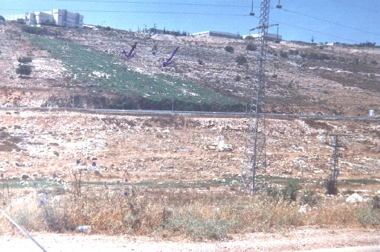
Palestinian residential areas in the village of Bruqin and agricultural fields affiliated to the village suffer acute ecological problems as a result of the deliberate pumping of industrial waste and sewage water into the lands from the near by settlement of Barqan. Such ecological problems are affecting man, animal and nature. They include, amongst others, poisoning, spread of diseases, air contamination, breathing difficulties, damage of underground water, destruction of trees and crops as well as the ensuing damage caused to wild life in the area.

( Photo 1: Israeli sewage pouring in the valley of Bruqin – Photo courtesy of LRC
At the beginning of the year 2000, the Israeli occupation authorities founded a new industrial zone in the southeastern side of the village under the name of 'Ariel's western industrial zone' specialized in oil industries. Smoke stemming from this new industrial zone pollutes air and increases the possibility of diseases.

(Photo 2: One of the new factories of Ariel's western industrial zone – Photo courtesy of LRC)
On the other hand, the waste water coming out of Ariel settlement, located to the east of the village, contributes towards the contamination and destruction of agricultural lands and, even, hitting some parts of residential areas in Bruqin.

( Photo 3: Industrial waste of Barqan contaminating nature in Bruqin – Photo courtesy of LRC )
The area has been visited by a number of local and foreign Human Rights and juristic delegations, nevertheless, the Israeli occupation authorities pretended that the waste water coming out of the settlements goes through filtration processes without harming Palestinian lands and properties. In reality, the filtration stations were built as a camouflage since waste water goes near them and, for certain, don't pass through them. The aim behind such an action is to expel Palestinians out of their lands and houses, a prelude for land annexation at favor of Barqan settlement.
( Photo 4: a general view of Ariel's western industrial zone– photo courtesy of LRC )
Prepared by
The Land Research Center
LRC


