Location;
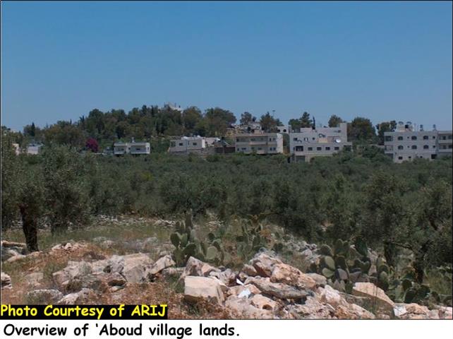
39;Aboud, the city of flowers, is located 30 kilometers northwest of Ramallah city and reaches up to approximately 450 meters above the sea level. 39;Aboud village's lands are mostly mountainous and cultivated with olive trees.The name of the village was given to 39;Aboud describing its charming nature and the various types of cultivations growing on its lands. See Photo 1
The skeleton of the village takes the linear form where the entire geographical area occupies an overall area of 13857.5 dunums (13.8575 Km2) and extends over a series of mountaintops, that over look Jerusalem city, (which is located 45 kilometers southeastern of the village). The village is surrounded by El Nabi Saleh and Deir Nadham from the east, Deir Abu Mas'al from the south and Shuqba from the southwest. See Map 1
Area and Population: –
The population of 39;Aboud village recorded 754 inhabitants in the year 1922, however, according to the Palestinian state information service (SIS), the population continued to grow reaching up to 1610 and 1663 inhabitants in the years 1987 and 1996, respectively. Today, the village's population exceeds 2,500 according to the Palestinian Central Bureau of Statistics 2005 and occupies a built-up area of 492 dunums (0.492 Km2) 3.5% of the village's total area.
Livelihood: –
Despite of the agricultural holdings, which are considered a source of income for local inhabitants, more than 80% of the villagers have an income from other sources such as working in governmental and private sectors, industrial sector, constructional work and animal raising. An essential feature of Aboud39;s village is that people who are running agricultural holdings work only part-time in agriculture or the agricultural work is confined to the growing season.
Following the eruption of the second Intifada, in September 2000, 10% of the Palestinian villagers who worked in construction inside Israel lost their jobs. They turned to work in Agriculture as an alternative source of income; thus increasing the number of labor force in Agriculture to 19% (about 500 inhabitants).
The village39;s major cultivation is olive which represented 43% of Aboud39;s village lands, cultivated on 6000 dunums of land before the eruption of the second Intifada in 2000, While the remaining lands that were considered suitable for cultivation represented 57% and included grapes, apples, figs and almonds (39;Aboud Village Council year 2004). The main agricultural products in 39;Aboud village are olive oil, soap, wine, and dried figs.
In addition, the village of 'Aboud has a variety of social facilities detailed in Table (1) below: –
|
Table one: the number of social facilities in 'Aboud village 2005. |
|
|
Facilities |
Number |
|
|
|
|
1- Schools |
Four |
|
2- Kindergartens |
Three |
|
3- Sports |
One |
|
4- Village councils |
One |
|
5- Mosques |
One |
|
6- Churches |
Nine |
|
7- Youth clubs |
One |
|
8- Clinics |
Two |
|
9- Monasteries |
Two |
|
10- Communities Charities |
Three |
|
11- Highway streets |
One |
|
12- Bus stations |
One |
Source: Aboud Village Council 2005
Historical Sites: –
Historically Speaking, 39;Aboud, among the Palestinian villages, is considered historical due to the fact that the village has a number of churches, monasteries and mosques built on foundations belonging to the Byzantines, Ottomans, and crusades empires. Those historical sites were built during the Fourth and seventh centuries.
The churches are listed below:
-
39;Messieh Church': It is believed to be the oldest church in the village and is located in its center.
-
Knnasieh Church: located in the eastern side of the village.
-
Simon39;s Church
-
Saint Todros Church: located few meters away from 39;Aboud's city center.
-
Saint Anastasia Church: located to the south of 39;Aboud village.
-
Saint 39;Obadiah church: located to the north of 39;Aboud village.
-
Virgin Marry Church: built on the foundations of a 5th century church and has been renovated in the 11th century.
-
39;Dare Al-Kawkab Church: located to the East of the village.
-
Saint Barbara Church: anancient monastery lies on a rocky hill at a distance of one kilometer to the West of Aboud village. Source: Ramallah Village Profile- ARIJ
Natural resources: –
To the east of 39;Aboud village lies the 39;Lemon Valley39; as called by residents of 39;Aboud. The valley was given this name due to the fact that it used to be cultivated by lemons, oranges and other fruitful trees by people who lived in39;Aboud in the past. Besides, the nine water springs that formed the irrigation system for this valley increased its importance as a blossoming valley and attracted the attention for its agricultural value. Today, The valley is no longer cultivated with fruitful trees and it has not been taken care of. Likewise, the springs are dry because they were not invested properly by 39;Aboud residents and therefore affected the cultivation in the valley.
Israeli Settlements Hemming 39;Aboud Village: –
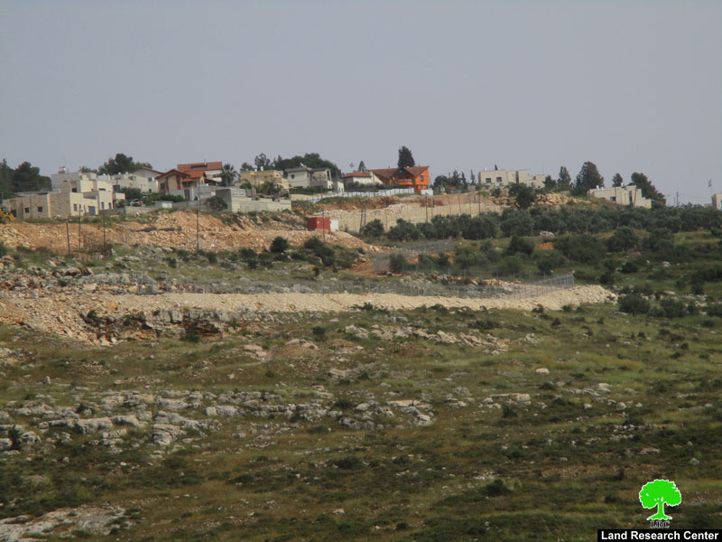
The Israeli settlement activities in 39;Aboud village are similar of those in other Palestinian villages in Ramallah governorate. In 1980, the Israeli authorities declared the confiscation of 780 dunums of agricultural lands for military purposes. This declaration commenced the establishment of the first Israeli settlement on 39;Aboud Village39;s lands, the settlement of Beit Arye. Later in 1988, the Israeli authorities announced the establishment of another Israeli settlement called 39;39;Ofarim39; which allowed for a total confiscation of 633 dunums of 39;Aboud village39;s lands. The two settlements are located to the west and northwest of39;Aboud village and occupy an area of 1960 dunoms (1.96 Km2)of the village39;s total area. See table 2
|
Table two: The illegal Israeli settlements in 'Aboud village. |
|||||
|
Settlement name |
Date of establishment |
Total area August 2004 (in Km2) |
Occupies from the village boundary (in Km2) |
Distance from village (km) |
Location from 'Aboud Village |
|
Beit Arye |
1980 |
1.42 |
0.401 |
0.96 km |
Northwest |
|
Ofarim |
1983 |
0.55 |
0.203 |
1.54 km |
West |
|
|
|
|
|
|
|
|
Total |
1.96 |
0.604 |
|
||
Israeli Violations Committed Against Aboud village: –
In December 2000, Israeli settlers living in both settlements Ofarim and Beit Arye backed up with Israeli occupation forces attacked 39;Aboud village and uprooted more than 4000 olive trees belonging to the Palestinian villagers. of 39;Aboud. Villagers, on the other hand, went out in the streets peacefully demonstrating against this violation since many of them depend on olive oil selling.
On May 31, 2002, the Israeli army completely blew up the Church of Santa Barbara, the most ancient and sacred religious site of 'Aboud village. Archeologists trace the building of this church back to the 6th century. The inherited legacy point out to its Byzantine roots.
The church was built enclosing a very old cave which was used as a place of habitation for St Barbara (according to39;Aboud Christian Youth council). Since then, the place has been particularly characterized with sanctity and continued to be used for religious purposes. 39;Aboud residents go there often in great march once a year, on the anniversary of St. Barbara to perform their ritual prayers and celebrate this festival until the unfortunate blast of the church by the Israeli forces. The Israeli forces claimed that the church was destroyed by mistake and they were unaware of the existence of such a sacred place.
On December 1, 2003 and under the supervision of Moshe Kaplenski, the previous Chief Commander of the Israeli Defense Forces in Judea & Samaria,the Israeli Occupation Forces (IOF) hanged on each tree unofficial papers notifying the residents of 39;Aboud of the IOF39;s willingness to uproot more than 35 olive trees in 39;Aboud village. Papers were hanged on trees announcing the following:
|
1. Olive trees to be uprooted for Security purposes. 2. Owners have the right to object the incident in a maximum duration of three days at the civil administration of Beit Ill in Ramallah district.
Moshe Kaplenski the |
The Israeli Segregation Wall in 39;Aboud Village: –
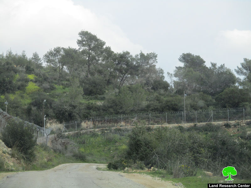
The Israeli Segregation Wall Plan promises a real disaster in 39;Aboud village, in which it will confiscate large areas of agricultural lands, mostly cultivated with olive trees, In addition, to the lands that are going to be isolated behind the wall. According to Israel39;s updated wall plan of February 20, 2005, the Segregation Wall will physically stretch on 8.134 kilometers (length) and will cut-off 4825 dunums (4.825 Km2) of agricultural lands (32% of the village39;s total land area. (See table three below)
Table 3: Land Use Land Cover of 39;Aboud village Lands 2005
|
Type land |
'Aboud village boundary area (dunums) |
Area of lands east of the Segregation Wall (dunums) |
Area of lands west of the Segregation Wall (dunums) |
|
Palestinian built-up area |
492 |
670 |
12 |
|
Israeli Settlements |
392 |
0.000 |
392 |
|
Land |
13,857 |
9,440 |
4,422 |
|
Total |
|
10,110 |
4,826 |
The Segregation Wall under International Law: –
The Israeli deviation from the 39;Armistice Line39; into the Palestinian Lands, is depriving thousands of Palestinians their rights to access basic services such as health care and education, restricting their mobility, in addition, to sources of income through uprooting their trees, confiscating their agricultural lands and obstructing other forms of employment opportunities.
Adding to that, Israel Under the slogan of building a 39;Security Barrier / fence' continues to breach Palestinians rights under international humanitarian law and Fourth Geneva Convention.
Hague Regulations 1907 and the fourth Geneva Conventions
Hague Regulations 1907 Section III Article 46 states that39;
-
Section II Article 23: [it is especially forbidden] 39;to destroy or seize the enemy39;s property, unless such destruction or seizure be imperatively demanded by the necessities of war.39;
-
Section III Article 46: 39;Family honor and rights, the lives of persons, and private property, as well as religious convictions and practice must be respected. Private property cannot be confiscated.39;
Fourth Geneva Conventions
-
Article 33: 39;No protected person may be punished for an offence he or she has not personally committed. Collective penalties and likewise all measures of intimidation or of terrorism are prohibited.
-
Reprisals against protected persons and their property are prohibited.39;
-
Article 53: 39;Any destruction by the Occupying Power of real or personal property belonging individually or collectively to private persons, or to the State, or to other public authorities, or to social or cooperative organizations, is prohibited, except where such destruction is rendered absolutely necessary by military operations.39;
-
Article 147: 39;Grave breaches to which the preceding Article relates shall be those involving any of the following acts, if committed against persons or property protected by the present Convention: willful killing, torture or inhuman treatment, including biological experiments, willfully causing great suffering or serious injury to body or health, unlawful deportation or transfer or unlawful confinement of a protected person, compelling a protected person to serve in the forces of a hostile Power, or willfully depriving a protected person of the rights of fair and regular trial prescribed in the present Convention, taking of hostages and extensive destruction and appropriation of property, not justified by military necessity and carried out unlawfully and wantonly.39;
The Israeli Government is illegally practicing its power on the Palestinian Community. The effect of this power misuse affects39;Aboud village same as it affects the other Occupied Palestinian territory. Israel totally ignors all International laws of which it is a signatory.
References;
1. ARIJ Geographical Information Systems (GIS) database, 2005.
2. Palestinian Central Bureau of Statistics. Population Count 2005.
3. 39;Aboud village Council Publications of year 2004.
4. 39;Aboud Christian Youth council, Publications 1999
5. Hague Convention IV: the Laws and Customs of War on Land. 1907. Section II Article 23 & Section III Article 46
6. Geneva Convention Relative to the Protection of Civilian Persons in time of war. Articles 33, 53. & 147.
7. Applied Research InstituteJerusalem, Ramallah Village Profile, year 1996.
Prepared by:
The Applied Research Institute – Jerusalem


