Since the beginning of the seventies of the last century, Israeli occupation authorities along with right wing colonial groups have been working hard to formulize a new map for Hebron city, in general, and the old city, in particular. As part of this continuous colonial effort, the Israeli settlers living in Kiriyat Arba', Kharsina and the four Jewish compounds in the heart of the city are trying to take advantage of the current security and political conditions which prevail in the city, especially after the killing of 12 Israeli soldiers, including the military commander of Hebron district, in one single Palestinian attack that took place on November 16th, 2002 in Wadi An Nasara area between Kiriyat Arba' and the Ibrahimi mosque.
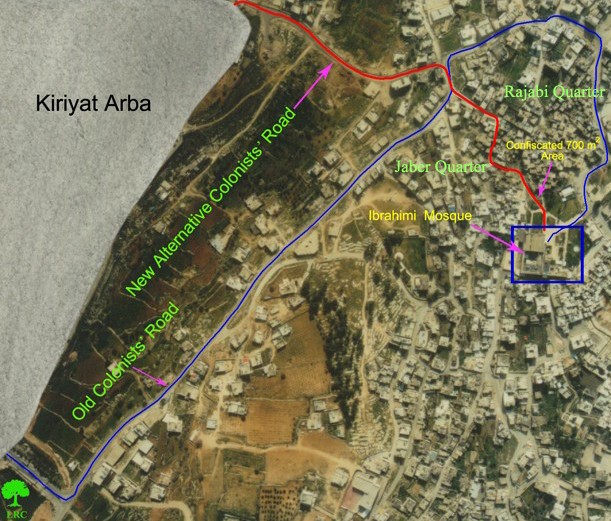
Such an effort has been focused on the construction of a new colonial road that shortens the distance from Kiriyat Arba' to Ibrahimi mosque from about 3 km to almost 700 meters. This road passes through the area of Wadi An Nasara and the ancient Jaber residential quarter. Once this road is finished, the Ibrahimi mosque will be within a walk able reach from Kiriayt Arba'. The road will be completely devoted to Israeli settlers commuting between the settlement of Kiriayt Arba' and the Ibrahimin mosque.
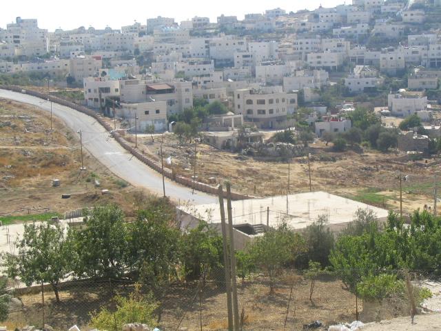
Actually, the first part of this road which is named by Israelis ' the prayers road ' has been finished last year at the length of 200 meters and width of 10 meters. This section of the road was built on four dunums of land confiscated from Mr. Mahmud AbdulHalim Jaber, 75 years old. It extends from the south western gate of Kiriayt Arba' down to the beginning of Jaber quarter and crosses the current road which goes down to the mosque through the Rajabi quarter. A wall was also constructed along the southern side of the road to separate Palestinians from their lands on the northern side of the road in the area of Biyar Al Mahawer. See Photo 1
The walled completed part of the road in Biyar Al Mahawer
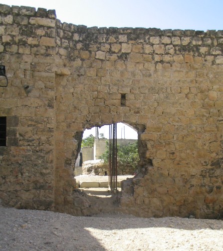
Currently, the Israeli occupation authorities are executing the second phase of this road which passes through Jaber quarter. This phase, which is about 500 meters long and 4 meters wide, is going to be more destructive than the first one since many old historical homes and stores from the Mamluk era – about 600 years ago- will be destroyed. It will, also, pass through an arch gate built under the residential compound of Jaber quarter.
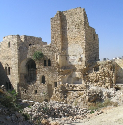
Earlier, two military orders were issued stipulating the destruction of 11 housing units all located in Jaber quarter. So far, 7 of these ancient structures have been demolished by bulldozers.
The second military order which was issued at the beginning of May, 2004, stipulated the confiscation of a 700 M2 piece of land located at the south eastern corner of the Ibrahimi mosque and owned by Islamic Waqf. This piece of land will be the starting point of the new alternative road being constructed (for related information, see case study titled' Under the Pretext of Security, Historic buildings are targeted in Hebron's Old city, May, 2004).
The current old road ( in blue) and the alternative new road ( in red).
The new alternative road passing through the ancient Jaber quarter
In an interview conducted by LRC field worker with Mr. Khalid Qawasma, site engineer of the Old City Renovation Committee, the following account was given: 'What is going on is another crime being committed by the Israeli occupation authorities against the history and architectural legacy of the Palestinian people in Hebron. I call upon concerned international organizations and bodies, practically UNESCO, to assume responsibilities and pressure Israel to halt its criminal acts against human culture and history in Hebron's old city'.
The arch gate under Jaber quarter compound where the new colonial road will pass under
A hole has been made in the wall of the compound to make a passage through the arch gate
Aancient destroyed houses and stores in Jaber quarter to make room for the construction of the road, Photos courtesy of LRC
Prepared by
The Land Research Center
LRC


