• About The Project
  • Palestine in Century
  • Selected Maps
  • Glossary
  • About ARIJ
  • About LRC
  • By Year
    • Case Studies By Year
    • Daily Report By Year
Tuesday, June 3, 2025
POICA
No Result
View All Result
  • Home
  • Settlements
    • New Israeli Settlements
    • Settlement Expansion
  • Israeli Violations
    • Agriculture
    • Confiscation
    • Demolition
    • Environment
    • Eviction of Palestinians
    • Settlers Attacks
  • Bypass Roads
  • Israeli Plans
  • Segregation
    • Checkpoints
    • Closure
    • Separation Plans
  • Military Orders
  • Reports
    • Daily Report
    • Monthly Report
    • Quarterly Report
No Result
View All Result
POICA
No Result
View All Result

The remaining lands of Attayba village threatened by the Segregation Wall constructions

July 5, 2004
in Separation Plans
The remaining lands of Attayba village threatened by the Segregation Wall constructions


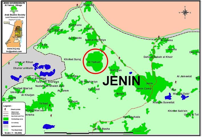
Location and population

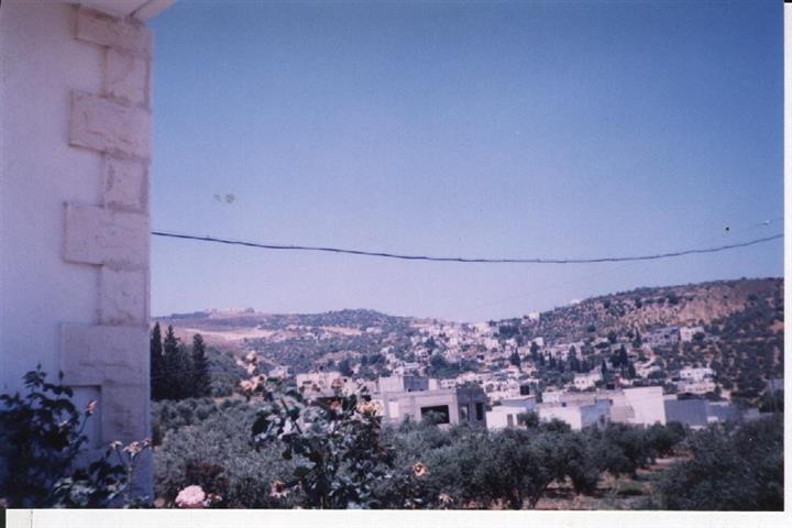
The border village of Attayba is located 16 km to the north west of Jenin city. In 1967, it had a population of 450 people. The latest census conducted in 2002 put the number of residents at 2100. Click to see Photo 1


A general view of Attayba village- Jenin. Photo courtesy of LRC 


Um Al Fahem town located at the western side of the green line is the mother town of Attayba as many people left it during the war of 1948 and settled in Attayba because of its fertile land.

Before the Israeli occupation of 1967, most of Attayba citizens depended on agriculture and animal breeding. Between 1967 and 2002, about 90% of the village citizens worked in agriculture and as laborers inside Israel, 6% worked in commerce and the remaining 4% in governmental jobs.  After the year 2002, 91% of work force became unemployed.

Village area

The total village area was estimated at 4200 dunum before the war of 1948. Today, the remaining area within the West Bank is only 2300 dunums of which 1000 dunums are designed as built up area. The Wall has separated about 700 dunum of the remaining land of Attayba ( almost one third of the remaining village lands).

The village and the Apartheid Segregation Wall

The Wall encircles the village of Attayba from its northern  and north western sides forcing most of local work force to become unemployed. In addition, the Wall will stop any further expansion in the built up area designated for Palestinians. The Wall was built at the distance of two km on lands belonging to Attayba citizens with a width ranging from 80-90 meter. The Wall is formed of barbed wires, trenches, early warning systems and patrol roads. It constitutes a second catastrophe in the history of Attayba after the one in 1948 in which more than one fourth of the village lands were confiscated and annexed into Israel. Click to see location Map


 The village of Attayba ( in red circle) with the Wall passing through its land


Impacts of the erection of the Wall on Palestinian citizens of Attayba village:-

A) Economic impact:-

1.     About 700 dunums of olive trees have been separated by the Wall, in addition to the uprooting of 570 olive trees to make room for the erection of the Wall path.

2.     91 % of the village workforce has become jobless mostly those working in agriculture and labor market in Israel.

3.     The erection of two gates: the first in the northern side of the village, and the second in the western side of the village. During the olive picking season, the Israeli military issues special passing permits for Palestinian farmers whose fields are located behind the newly established Wall. The gates were used to be opened every day at seven AM for the period of 30 minutes only.  At the end of the season, only very limited number of farmers (not exceeding 15) have been able to enter to and tend their fields behind the Wall. Click to see photo 2


The western Wall gate of Attayba which barely opens in the face of Palestinians, Photo courtesy of LRC 


A copy of an Israeli passing permit issued for a Palestinian farmer from Attayba village whose lands are located behind the Wall: it is valid from 13.11.2003 to 30.11.2003. Although it says that the bearer of this permit can stay in the closed military zone from 5 AM, the Wall gates are only opened at 7 AM for only 30 minutes.

B) Social impact:-

The set up of the Israeli Separation Wall has severed social relations between the citizens of Attayba and citizens of other border villages inside Israel such as the town of Umm Al Fahim . Click to see photo 3


Part of the Wall which separates between the village of Attayba and its agricultural lands, Photo courtesy of LRC


C) Psychological impact:- 

  1. Creating an atmosphere of terror and fear amongst Palestinian community of Attayba as a result of intermittent shooting of gun fire, flares and light bombs at the hands of the Israeli army patrolling the area.
  2. Instigating a sense of depression, frustration and melancholy amongst Palestinian criticizes of Attayba  because of the on going Israeli repressive actions, encompassing the prevention of free movement, denial of access to education, health.


LRC field worker visit to the village

During LRC's field worker visit to the village, he met a number of Wall victims, including Mr. Isma'il As'ad Shehada Mahamid, who mentioned that the Israeli occupation authorities had confiscated his 60 dunums of land leaving him with no source to live on. He stressed the fact that the Israeli military authorities refused to provide him with a passing permit to reach his agricultural land behind the Wall path.


Prepared by
 The Land Research Center
LRC


Recommended For You

إغلاق مداخل قرية دير نظام بالتزامن مع إقامة مقطع جديد من السياج الفاصل / محافظة رام الله

by arij
June 25, 2019
0
The Israeli occupation violates human rights in Deir Nitham / Ramallah governorate

  الانتهاك: إقامة مقطع جديد من السياج الفاصل وإغلاق مداخل القرية. الموقع: قرية دير نظام شمال مدينة رام الله. تاريخ الانتهاك: 13/02/2019. الجهة المعتدية: جيش الاحتلال الإسرائيلي. الجهة...

Read moreDetails

The Israeli occupation violates human rights in Deir Nitham / Ramallah governorate

by arij
June 25, 2019
0
The Israeli occupation violates human rights in Deir Nitham / Ramallah governorate

  Violation: closing the town’s entrance and establishing a new segment of the apartheid wall. Location: Deir Nitham village north Ramallah city. Date: 13/02/2019. Perpetrator:  The Israeli occupation...

Read moreDetails

Info-graph: Manipulating the Demography of Occupied East Jerusalem
“The Construction of the Israeli Segregation Wall in and around Jerusalem

by arij
January 16, 2019
0
Info-graph: Manipulating the Demography of Occupied East Jerusalem “The Construction of the Israeli Segregation Wall in and around Jerusalem

  When Israeli captured East Jerusalem along with other Arab-Palestinian territories during the 1967 war, it became an obsession of the successive Israeli governments to win the demographic...

Read moreDetails

جيش الاحتلال الاسرائيلي ينصب بوابة حديدية جديدة شمال مدينة سلفيت

by arij
July 3, 2018
0
جيش الاحتلال الاسرائيلي ينصب بوابة حديدية جديدة شمال مدينة سلفيت

  الانتهاك: نصب بوابة حديدية على مدخل طريق زراعي شمال سلفيت. الموقع: مدينة سلفيت.. تاريخ الانتهاك: 21 حزيران 2018م. الجهة المعتديه: جيش الاحتلال الإسرائيلي. الجهة المتضرره: المزارعون في...

Read moreDetails

Israel to build new segment of the apartheid wall around “Ma’ale Isreal”

by arij
December 10, 2018
0
Israel to build new segment of the apartheid wall around “Ma’ale Isreal”

violation: completing the construction of the apartheid wall Location: Sarta Ash-Sharqiya village/ Salfit Governorate. Date:  May 01 - 2018 Perpetrators: Israeli Occupation Forces Victims:  residents of Sarta Description:...

Read moreDetails
Next Post
Israeli army’s terror and Sabotage actions in Al Yamun town, Jenin District

Israeli army's terror and Sabotage actions in Al Yamun town, Jenin District

LATEST NEWS

77 عام  على النكبة الفلسطينية: حاضر مستمر لا تاريخ منتهي

77 عام  على النكبة الفلسطينية: حاضر مستمر لا تاريخ منتهي

by arij
June 2, 2025
0

........................................................

Expansion of Gilo Settlement: A Strategic Plan to Isolate Bethlehem and Undermine Palestinian Rights

Expansion of Gilo Settlement: A Strategic Plan to Isolate Bethlehem and Undermine Palestinian Rights

by arij
May 12, 2025
0

........................................................

الأراضي الفلسطينية بين الذرائع الأمنية والأطماع الاستيطانية – “الأمن، الآثار، والطبيعة كحجج لاقتلاع الفلسطينيين من أراضيهم”

by arij
April 15, 2025
0

........................................................

الطرق الالتفافية الاسرائيلية وأثرها على البيئة الفلسطينية

انتهاك للطبيعة والهوية في الأراضي الفلسطينية المحتلة

by arij
March 17, 2025
0

........................................................

flag_yellow_lowEU-PfP-Logo

This website has been produced with the assistance of the European Union. The contents of this publication are the sole responsibility of ARIJ & LRC and can in no way be taken to reflect the views of the European Union.

© 2025 Copyright ARIJ . All Rights reserved. .

No Result
View All Result
  • Home
  • Settlements
    • New Israeli Settlements
    • Settlement Expansion
  • Israeli Violations
    • Agriculture
    • Confiscation
    • Demolition
    • Environment
    • Eviction of Palestinians
    • Settlers Attacks
  • Bypass Roads
  • Israeli Plans
  • Segregation
    • Checkpoints
    • Closure
    • Separation Plans
  • Military Orders
  • Reports
    • Daily Report
    • Monthly Report
    • Quarterly Report

© 2025 Copyright ARIJ . All Rights reserved. .