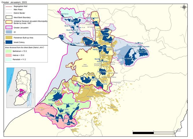
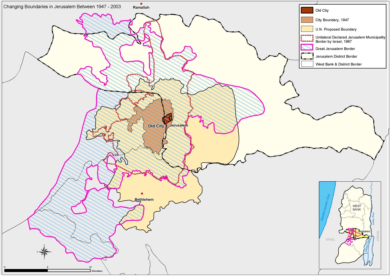
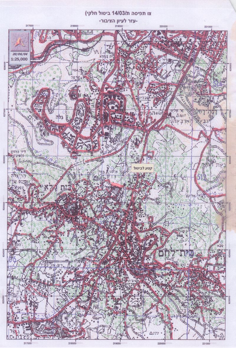
The northern entrance of Bethlehem district (8 Km south of Jerusalem) has always constituted an obstacle to the Israeli plans that aimed at sealing it and banning the Palestinian population from using it. Over decades of occupation, the Israeli Army carried out endless measures of intimidation in order to drive the residents living within the vicinity of Bethlehem northern entrance out of their homes: all of which failed. In June 2002, the time when the Israeli government initiated the construction of its infamous Segregation Wall throughout the West Bank, a significant part of the Segregation Wall intended to circulate Jerusalem city as a part of the so-called ''Jerusalem Envelope'' which incorporated the seal-off of the southern gateway of the city at the northern entrance of Bethlehem city. See map 1 & map 2 &

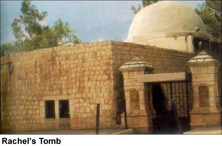
The Segregation Wall intends to engulf the pilgrimage religious site known as ''Rachel's Tomb'' located at the northern entrance of Bethlehem within (Area ''C'') as identified in the Oslo II Agreement signed in 1995. According to Oslo II, (Area ''C'') falls under Israeli security and civil control and the Palestinians retain the right to use the main road until the time that (Area ''C'') transfer to the Palestinian National Authority (PNA) control within 18 months of the inauguration of the Palestinian legislative council as conceded in the Oslo II Agreement. The Oslo II Accord also stated that none of the parties involved should adopt any measures aimed at changing the present status within the vicinity of the Tomb. Apparently, the government of Israel had a change of heart as it decided to include ''Rachel's Tomb'' within the Segregation Wall along with considerable parts of the land located in the vicinity.
What is Rachel's Tomb?
It is a religious memorial located at the northern entrance of Bethlehem city and regarded as a pilgrimage site for the monotheistic religions (Islam, Christianity &Jewish).
It signifies the memory of Jacob's wife; Rachel; who died during childbirth on the way to Hebron and buried in Bethlehem. The tomb stood in negligence for centuries until the crusaders decided to restore it. The Turks erected the structure, which now houses the tomb, in 1620 during the Ottoman period, which makes the location of the Tomb one of Bethlehem's historical sites and a part of the city's heritage. See Photo of Rachel's Tomb
Following the time the current Intifada broke out (September 2000) the Israeli Army denied Christian and Muslim access to the Tomb's site in an initial step to annex the location to Jerusalem; thus carve out a part of Bethlehem's long preserved heritage.
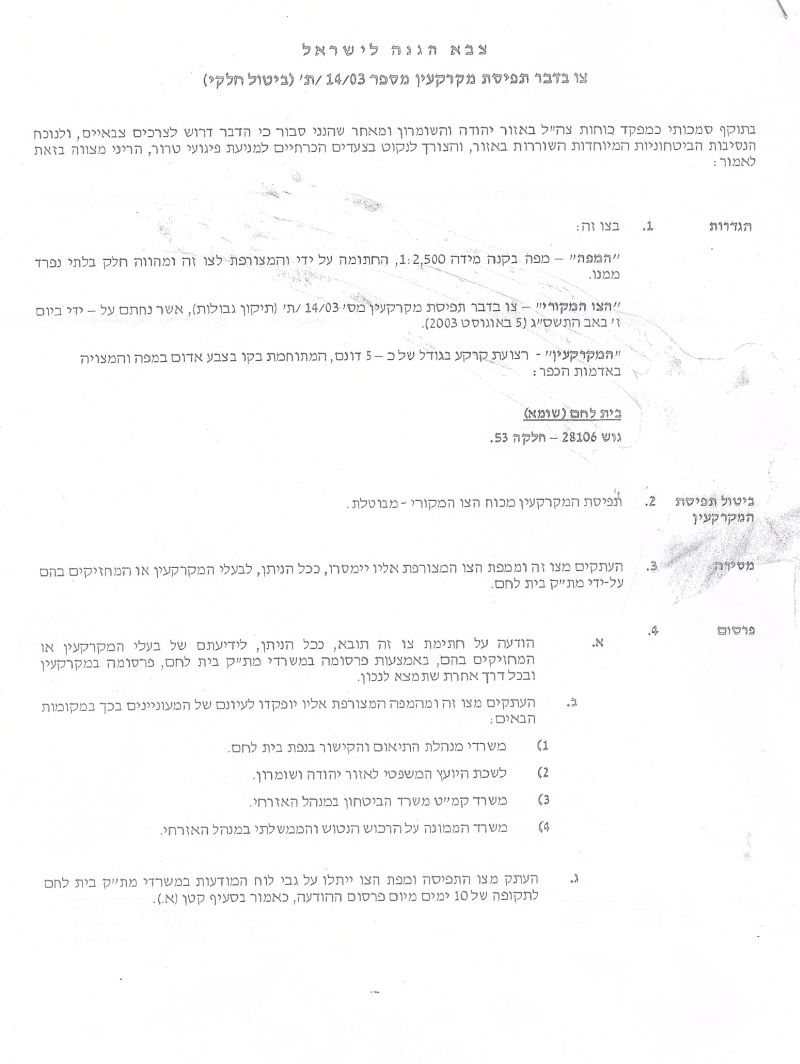
Military Order # 03/14/T
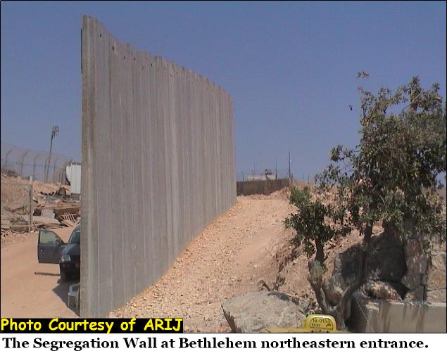
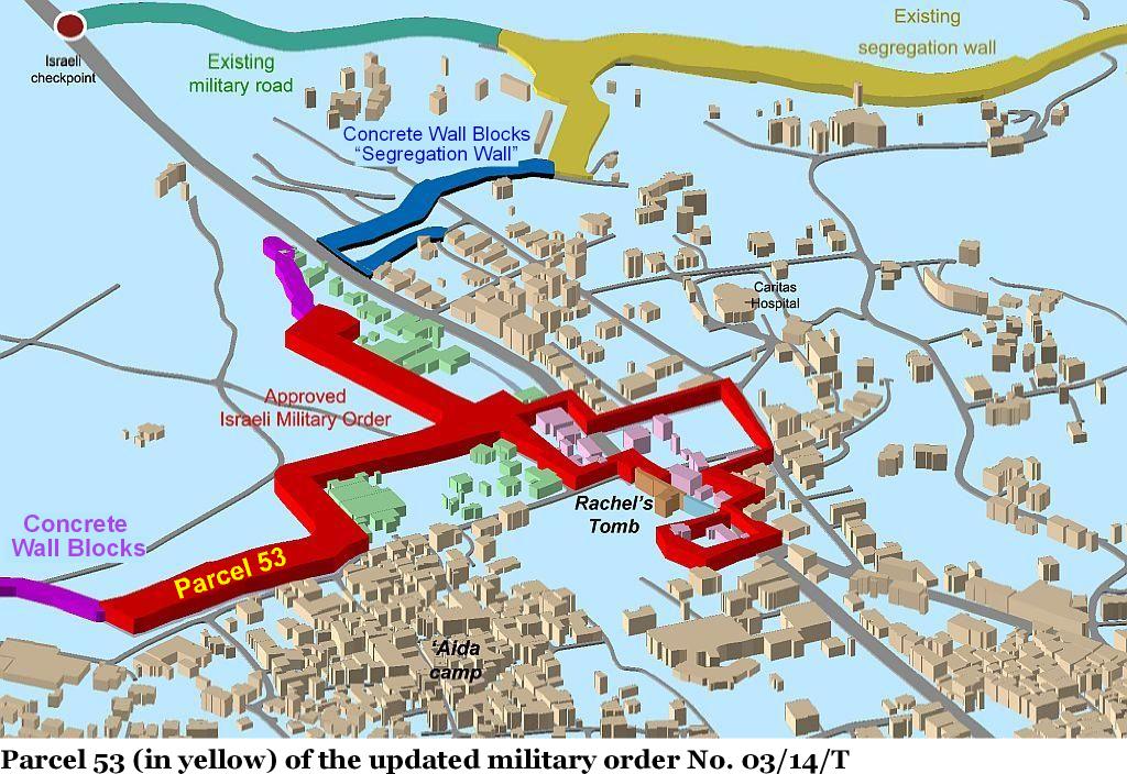
Following an intense debate over discussion of the Israeli security cabinet regarding Rachel's Tomb in the Israeli media in September 2002, Moshe Kaplenski, Chief Commander of the Israeli Occupation Forces in Judea & Samaria, issued a military order #03/14/T on February 9, 2003 to seize 18 Dunums of land in the vicinity of Rachel's Tomb. The military order partially comes to build the Segregation Wall and include the site within Jerusalem city's borders; a part of the Jerusalem Envelope plan. The segregation Wall set to encircle the location of the Tomb will in effect segregate some 3000 Dunums of the city's lands behind it. The area segregated represents enormous agricultural loss to the Palestinian residents in addition to the only territorial grounds available for expanding the city's urban area. See Photo of the Segregation Wall at Bethlehem northeastern entrance. at Bethlehem northeastern entrance.
The area segregated at the northern entrance of Bethlehem already inhabits nearly 500 Palestinians in addition to an industrial complex, 50+ commercial shops, 2 gas stations, 3 souvenir stores, 4 restaurants. Moreover, any person wishes to enter or exit the area will have to obtain an authorized permit from the Israeli civil administration; a part of a policy adopted by the Israelis to push the Palestinian residents to willingly leave the area.
Following a petition submitted by the residents of Bethlehem northern entrance, a new military order issued in August, 2003, under the same number of the original military order (03/14/T) with subtitle (Border Amendment). The new map displayed the final penetration path of the Segregation Wall, which shows 20 Palestinian building encircled within the Segregation Wall but still segregates 3000 Dunums from their original owners.
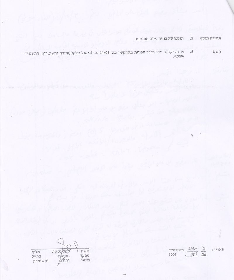
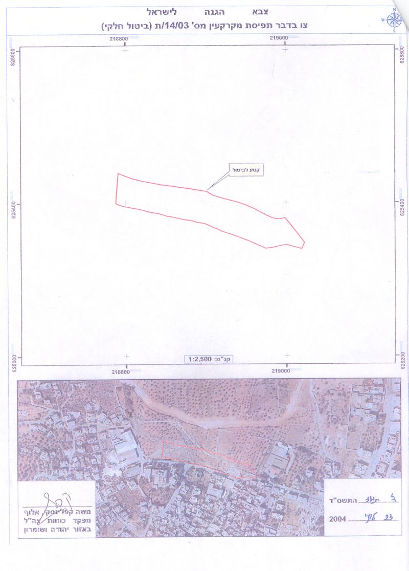
In June 23, 2004, Moshe Kaplenski, Chief Commander of the Israeli Occupation Forces in Judea & Samaria issued a new military order under the same number of the original military order for the area (03/14/T) with a new subtitle (Partial Annul) of one segment of the Segregation Wall in Block # 28106/ Parcel # 53 over an area of 5 Dunums. click to see copy of military order
 x
x
The order itself stands but the decision was to substitute three tracks of fence of a 100 meters width with 27 feet (height) concrete blocks instead to counterpart the under construction segments of the Segregation Wall at Bethlehem northeastern entrance toward Beit Sahour and the northwestern Wall toward Beit Jala. See copy of map order as provided by IOF.
as provided by IOF.
Once completed, the Segregation Wall will seal off the northern parts (east to west) of Bethlehem district where the only way out will be through an Israeli controlled checkpoints.
Prepared by:
The Applied Research Institute – Jerusalem