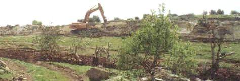

Wadi Shubash-Metulla- Jenin: Israeli large hammers and bulldozers leveling the land and uprooting trees for Wall construction purposes, Photo courtesy of LRC.
Location and population
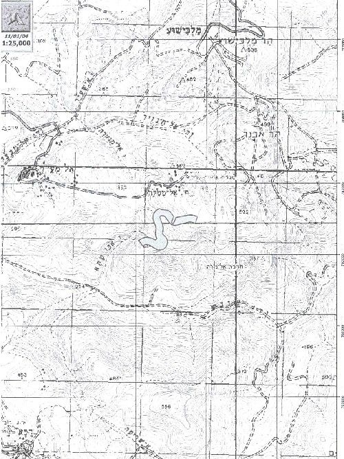
The small village of Metulla is located 14 km to the east of the city of Jenin. The village population is estimated at 300 people. The whole population is derived from the same extended family of Al Bazur. Most people in the village work as animal breeders and shepherds. Some work in agriculture and as laborers in Israel. The total number of sheep and goats in the village is estimated at 1000. There is a basic school, mosque and electricity network in the village. The village inhabitants live a very simple way of life. See map of location
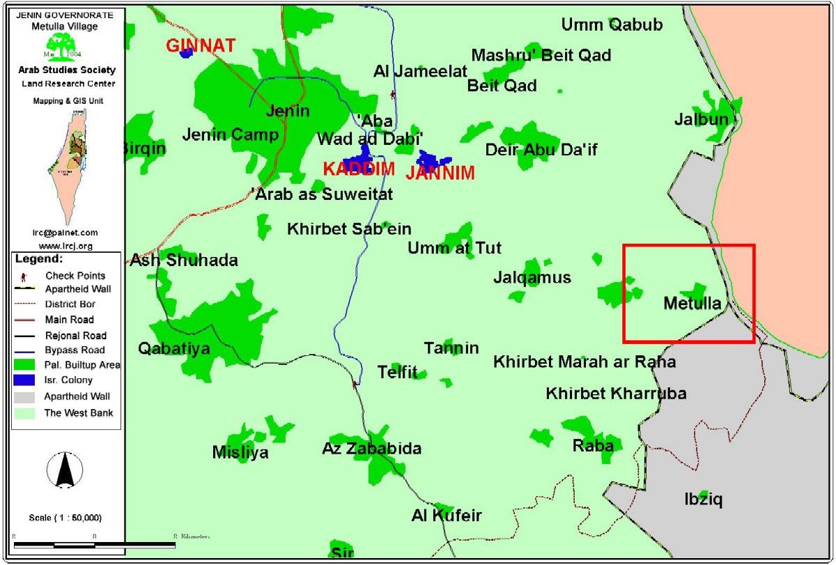
The village of Metulola ( in red quadrangle ) surrounded by Wall from three sides
Village land area
The village land area is about 2500 dunum, of which 500 dunum registered in Tabo and 2000 dunum registered as state land and used as range land. The village built- up area is composed of 50 houses.
The village and the Segregation Wall
The first construction phase of the Segregation Wall started in October, 2003 in the northern and eastern borders of the village, while the second and final phase started on February 28, 2004 and will encircle the village from the south. The path of the wall travels about three km over the land of Metulla. The following table provides the names of land owners affected by the Wall construction:
Land owners effected by the Construction of the Wall in Metulla village
|
No. |
Name of owner |
Area in Dunums |
Type of trees uprooted |
|||
|
|
|
|
Olive |
Grape |
Fig |
Almond |
|
1 |
Sulieman Daud Muneizel Bazur |
15 |
400 |
100 |
10 |
50 |
|
2 |
Naser Khaled Daud Bazur |
15 |
400 |
100 |
8 |
70 |
|
3 |
Husni Taher Muneizel Bazur |
45 |
500 |
100 |
9 |
100 |
|
4 |
Muhsin Taher Muneizel Bazur |
45 |
500 |
80 |
5 |
100 |
|
5 |
Lutfi Taher Muneizel Bazur |
45 |
500 |
60 |
11 |
100 |
|
6 |
Muneizel Ali Muniezel Bazur |
1 |
00 |
00 |
00 |
00 |
|
7 |
Nafi'e Ali Muneizel Bazur |
4 |
60 |
00 |
00 |
00 |
|
8 |
Sadeq Ali Muneizel Bazur |
6 |
70 |
40 |
2 |
80 |
|
9 |
Rafiq Daud Muneizel Bazur |
15 |
400 |
20 |
00 |
80 |
|
10 |
Basma Mohammed Faris Bazur |
11 |
20 |
00 |
00 |
80 |
|
|
Total |
202 |
2850 |
500 |
45 |
660 |
Area of confiscated or segregated land:
According to the table above, the area of the segregated land is estimated at 202 dunum registered and owned by the village people and more than 1200 dunum are classified as state land and range land. Most of the confiscated and segregated land is mountainous and hilly areas.
To the left: a copy of the land confiscation order No. T/04/04 issued by the commander of the Israeli army in the West Bank, General Moshe Kaplenski. According to the order, Block 11 ( parcels: 19,21,45,42,40,39,38,37,35) and Block 12 ( parcel 13 ) were confiscated for security needs'. Thee two Blocks are in the villages of Metulla and Al Mughaiyer in Jenin district.
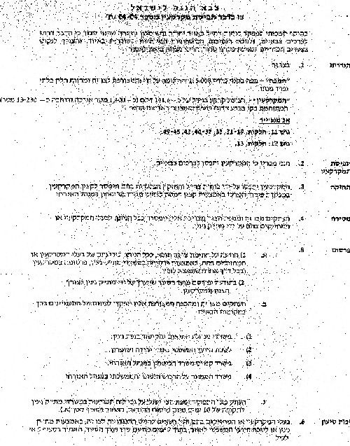
Military order and map attached to the military order showing the land targeted for confiscation.
Impacts of Wall on the village:
The destruction and the segregation of more than half the number of olive and almond trees in the village caused serious economic problems for farmers who are dependant on agriculture as main income.
The closure of large areas of range land created more economic burdens for animal breeders who will be forced from now on to buy fodder for their cattle at high prices, or sell them as some has already done.
The prevention of village laborers from working inside Israeli proper has also increased the level of un-employment and poverty.
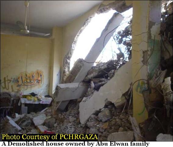
The proximity of the Wall path to the village houses causes constant tension and fear among village farmers, shepherds and school children due to the presence of Israeli military patrols and security personnel in the area. See photo 2
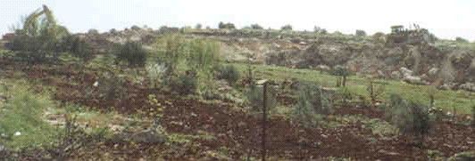
Wadi Shubash- Metulla- Jenin: uprooted and destroyed olive and almond trees as part of constructing the Segregation Wall, Photo courtesy of LRC.
Prepared by